All posts by echow

Emma Chow Final Paper: Recommendations for Creating a Recreation Hub in India Street Neighborhood

Emma Chow

Professor Gieseking

The Digital Image of the City

12/17/14


Recommendations for Creating a Recreation Hub at the Foot of India Street, Portland, Maine


Research Question


Once a bustling commercial hub of industry, Portland’s historic India Street Neighborhood has lost its neighborhood vitality and is now in need of revitalization. The India Street Sustainable Neighborhood Plan, published September 2014, is comprised of five goals, six vision statements, thirteen development principles, and twelve critical actions.[1] This paper focuses on Critical Action 11 – Create a Recreation Hub at the Foot of India Street, by giving recommendations for developing the Recreation Hub to best align with the plan’s vision. The recommendations aim to meet the following goals and visions: Goal 5: Enhanced Mixed-Use Nature of Neighborhood; Vision Statement 5: A Healthy, Connected, and Active Neighborhood; Vision Statement 6: A Neighborhood of Strong Identity.

Integrating a workout park, green space, solar lighting, public art, seating, and small local businesses will create an enjoyable destination space for people of all ages. India Street Neighborhood (ISN) has great potential to leverage the vacant space at the foot of India St. to create a recreation hub that will effectively energize both the ISN neighborhood and the entire City of Portland.


Approach to the Common Good for the City

A city can serve the common good by developing its public spaces in a manner that allows Setha Low’s five freedoms[2] — freedom of access, freedom of action, freedom to claim, freedom to change, and freedom to ownership – to be realized. Cities must take measures to ensure public space maintains civilian safety; is accessible by all groups regardless of race, gender, age, or socioeconomic status; only allots temporary private ownership (i.e. evening or weekend events); and relinquishes power to the people for further shaping the space. Portland may be tempted to supplement limited government funding for public space with private dollars; however, the City should be wary of fostering any public-private partnerships that will turn its parks and squares into permanent large-scale advertisements. This may be especially likely given Maine’s regulations against billboards. Ultimately, government decisions should always be made to maximize the common good of the public, rather than the private.

Approach to the Smart City

A Smart City is one that first realizes the way technology can expand people’s potential well-being, and then implements technological systems with the goal of actually reaching this potential. The Smart City creates policies that incorporate and leverage available technologies to further the city towards where it wants to go[3]. Technology does not dominate the Smart City, but simply enhances the quality of the essential features of a city: infrastructure, housing, and public space. The Smart City uses technology to address issues such as poverty, urban food deserts, climate change, reliable energy supply, global communication, and transportation[4]. The most successful Smart Cities carefully adopt technology to help alleviate their greatest issues while still keeping people at the forefront of their decision-making.

The Smart City not only uses technology to install smart meters, coordinate traffic lights according to congestion patterns, and display subway wait times in real time, but also uses technology to enhance public space. For instance, cities can install free Wi-Fi in public space to improve Internet access and provide outdoor workspace, where tasks can be completed while surrounded by nature. Technology can be integrated into public space and shape the way people use that space. Technology can also be used to create a virtual communication platform for engaging the future users of public space in the planning process. Residents are the everyday consumers of the city, therefore, their voices should be heard – online forums and email surveys may be a great way to ensure the most voices are heard. Finally, the Smart City makes its data available to the public so people can develop apps to meet their changing needs. Apps can be designed to maximize people’s usage of public space, making them aware of where these spaces are located and what they can do there.

Literature Review

Academic Literature:

Green areas in cities are essential for sustainable urban development. Here, the word sustainable is used to describe cities that simultaneously ensure sustainable environmental, social, and human health. Additionally, green infrastructure both directly and indirectly, generates a series of economic benefits that will be realized in the future.[5] Accessible public space in cities improves the quality of life for residents by “facilitating social contact between people of all ages, both informally and through participation in social and cultural events (local festivals, civic celebrations or doing some theater work, film, etc.)”[6] Recent research has expanded experts’ understanding of well-being, revealing humans are social animals that experience an increase in well-being from pro-social behavior.[7] Well-designed public space provides a permanent site for consistent social interactions, thus further developing social capital and building community.

Public space can be designed to host an array of recreation opportunities, such as workout parks, walking and biking paths, children’s play areas, soccer fields, and open space for yoga classes. Green public space and recreation space can bolster the identity of a neighborhood, consequently creating a higher quality community environment for residents and attracting tourists and private investment, as well. When green spaces are installed, property values tend to increase: “Numerous studies have shown that housing and land value, which are adjacent to green spaces, may increase by 8% to 20%.”[8] Therefore, issues of gentrification need to be carefully considered when implementing projects for creating green space in cities. Other economic benefits include: savings healthier residents experience due to improved physical health, the revenues earned by vendors at cultural events, reduced storm water management costs, and increased spending by tourists.[9]

Waterfront cities have an incredible opportunity to leverage the natural water amenity as a means for improving residents’ quality of life. By facilitating physical and emotional contact with water, public waterfront space can foster strong relationships between urban populations and water. As a result, residents’ well-being is heightened by the enjoyment they derive from waterfront activities. Residents also gain an appreciation for the water and are subsequently compelled to protect the essential resource by changing their behavior and/or supporting water conservation groups.[10]

The success of public space is largely determined by its ability to meet people’s needs; the only way for planners to know those needs is by including the public in the planning process. Traditional image-based survey methods involve showing often biased, manipulated photos to participants; therefore allowing planners to elicit intended opinions from the public. Being able to say they involved public participation in their planning is often more important to planners than actually generating meaningful input. In Participant Driven Planning (PDPE), participants provide photos and are able to engage in meaningful dialogue about what they like/do not like about the places they present. Bottom-up planning processes, as opposed to expert-driven top-down approaches, ensure public space is designed to meet the real needs of the community.[11] Additionally, as MIT’s Places in the Making whitepaper concludes, the placemaking process is just as important for empowering local communities as the physical outcome is.[12]

Media Literature:

There is a national movement to “push back on the hegemony of the automobile and make public spaces accessible to pedestrians.”[13] Cities are increasingly realizing that designing for cars attracts more cars, while designing for people attracts more people. Great public space pulls people outdoors and then gives them a reason to stay – whether it be something to do, places to socialize, or beautiful scenery to look at. Many formerly industrial cities were built along the water for easy access to transportation channels, and now those cities are transforming their waterfronts to be multi-use areas for people.

Open space can be transformed using technology and nature to create dynamic public space that attracts tourists and residents alike. Three key features that need to be kept in mind when creating public space that will develop community attachment, are: social offerings, openness, and beauty.[14] Important features in any public space include: seating, lighting, and grass, plants, and trees. Many American cities are taking steps to create public space that offers recreation opportunities. New York City installed its first adult playground (an outdoor workout park) at Macombs Dam Park in the Bronx in 2010, and plans to install as many as two-dozen similar parks by the end of 2014.[15] Miami-Dade County, Los Angeles, and Boston have all installed public adult fitness facilities, as well.[16] The size and cost of workout parks can range from the $40,000 (the average cost per site in Los Angeles) to more than $200,000 (the cost of New York City’s largest park).[17] New technologies are even making it possible to install workout parks that generate electrical energy from users’ exercise on the fitness equipment; however, these technologies are not yet widespread since they are more expensive than conventional workout parks.[18] Workout parks are not the only solution for creating recreation space for adults. Boston’s Lawn Street D, for instance, offers circular LED-lit swings that change color according to movement, bocce ball, beanbag toss, Adirondack chairs, and a sound stage for music.[19]

Lighting can be used to transform public space at night. One team at the 2012 Makeathon in San Francisco designed an affordable technology for adding digital light projections to buildings and brighten up dark alleyways.[20] Another team at the same tech event offered technology to create a portable light up stage for performances in public space.

Methods

The Portland Master Plan and India Street Neighborhood Master Plan documents were first reviewed to understand the goals for the city and this specific neighborhood. Next, the History of Portland’s India Street Neighborhood[21] was reviewed to gain familiarity about the history of the neighborhood and the important role the waterfront has, and continues to play, in developing Portland’s economic and physical landscape. An academic literature review was completed to provide insights into the economic, health, and environmental benefits of public space along the waterfront, as well as the importance of authentic public participation during the planning process. Media sources provided exposure into emerging technologies used for workout parks and lighting features in public space, as well as the value of placemaking for fostering community.

Conclusions about public space and opportunities to enjoy the waterfront were drawn from a series of data sets, including: consolidated data on the 97 mental maps collected by Digital Image of the City students and recommendations proposed by those 97 participants, as well as QGIS shape files provided by the City of Portland.

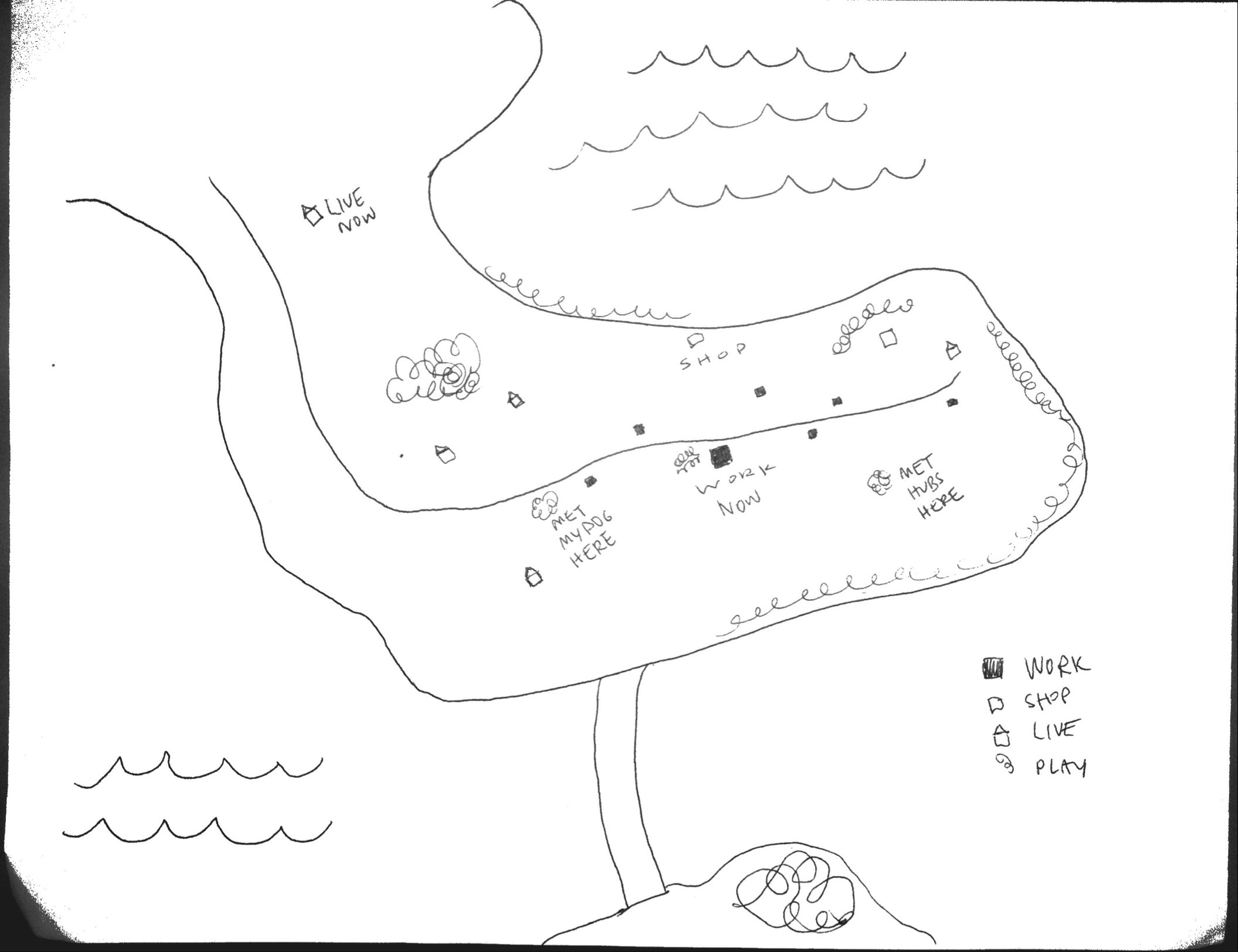
Maps were created to visualize the proposed area of development and guide planning recommendations. A map was first created to identify ISN and the future site of the Recreation Hub. Another map with a broader perspective reveals the extent and location of existing outdoor recreation space in the city, while contextualizing the Recreation Hub with respect to neighboring residential areas. The City of Portland provided data identifying the types of open space in Portland – areas identified as a trail, park, golf course, or playground were all grouped to map “recreation space”. Another map was created using data to illustrate the connection between different recreation spaces in the ISN area and the need for accessibility to the Recreation Hub. Bus route schedules were examined to understand the scope of accessibility.

Historical maps provided by the City of Portland were also referenced. These maps provided insights into how the city’s growth was fueled by the waterfront activity at the foot of India St and the commercial center of India St., Exchange St., and Middle St. Historic sources discuss the interplay between daily life in Portland and the waterfront; highlighting how it has changed from the eighteenth century to present day.


Findings

Historic maps and sources indicate that ISN’s identity as the city’s commercial center has changed over the years. Now, the neighborhood serves as a transitional area between the rapidly gentrifying neighborhood of Munjoy Hill and the tourist and commercial center of the Old Port and Commercial St. ISN lacks a sense of clear identity.


Fig 1. (Left) Portland in 1775 with India St. (King St. then) as a major artery to the waterfront. (Right) Portland in 1866 featuring the rail network along the waterfront centered at India St.[22]

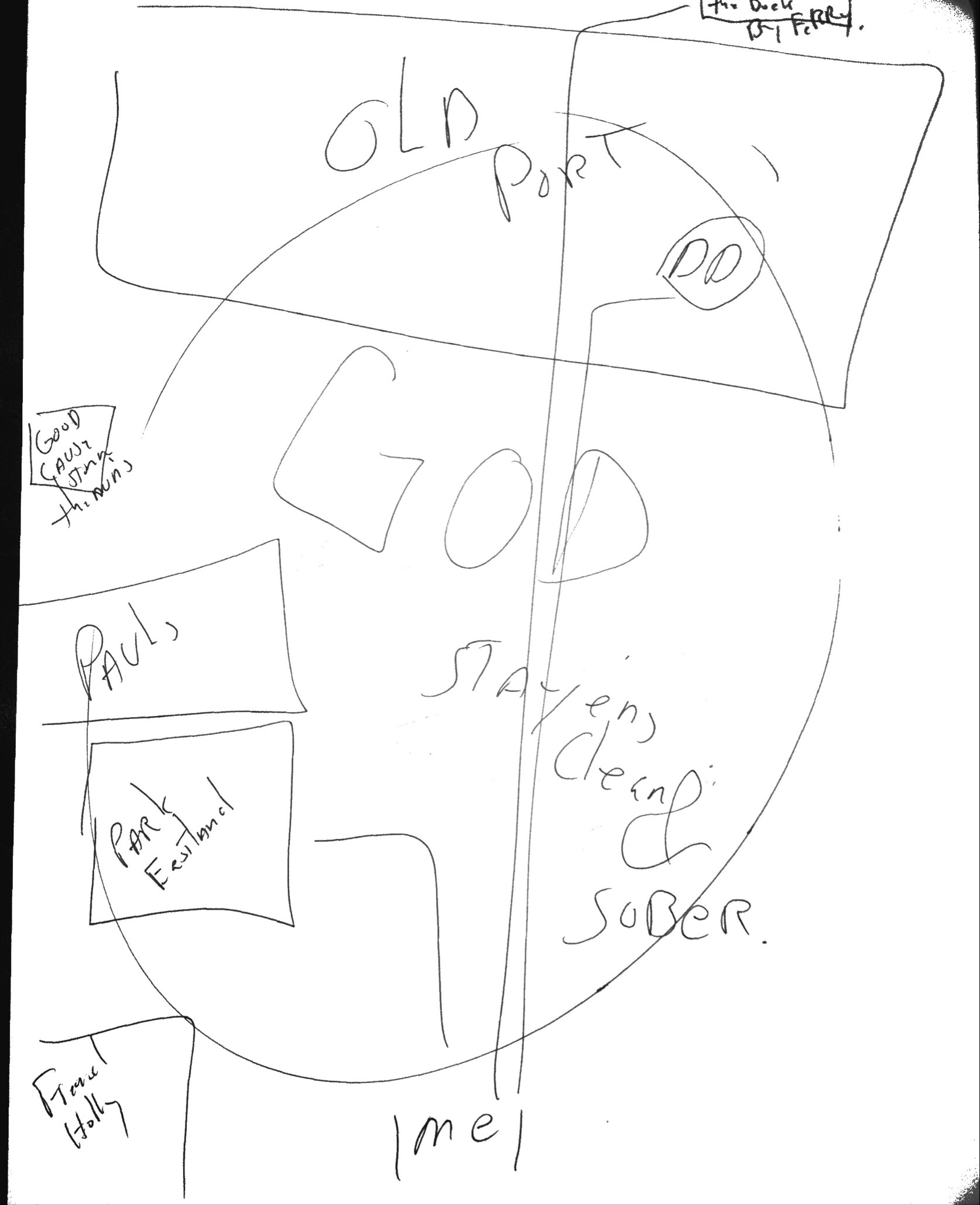
As Fig 3. Illustrates, recreation space is concentrated around the Eastern and Northern edges of the city with very little in the center or along the waterfront. Piers and tightly concentrated streets dominate the waterfront. ISN is situated on the Eastern part of the city near the waterfront.


Fig 3. Recreation space (trails, parks, playgrounds, golf courses) in Portland.

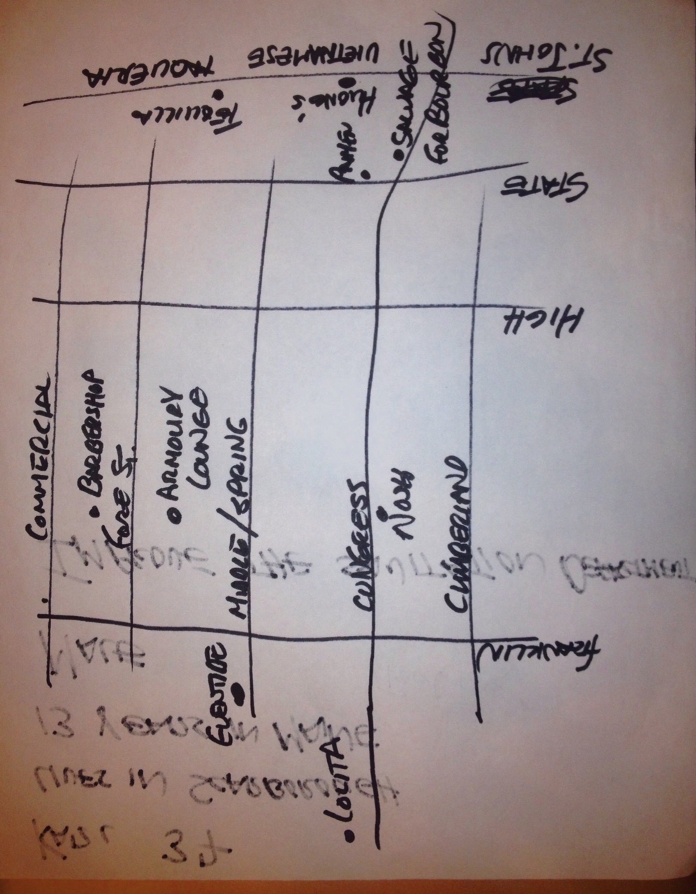
Fig 4. ISN and its major streets are highlighted, along with the site for the Recreation Hub.

ISN is dominated by open space that is not used for recreation and large buildings that consist of industrial buildings, parking garages, and hotels. There is no recreation space in ISN, there are only three recreation sites located just beyond the neighborhood boundaries. Residential neighborhoods border ISN, as indicated by the many small buildings to the Northeast and Northwest.
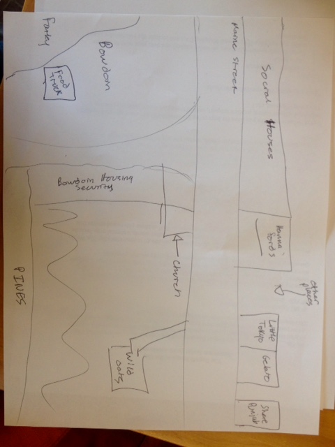
Fig 5. Bus routes, sidewalks, and streets connecting ISN to the rest of the city.

Bus route 8, which stops at Commercial St. and India St. provides access to the Recreation Hub. However, the bus only runs every 30 – 45 minutes on weekdays and 40 – 50 minutes on Saturdays, with no service on Sundays. Major streets in the area have sidewalks, but some are disconnected in and immediately around ISN.

Discussion

My recommendations have dual aims: (1) to offer feasible solutions for transforming the open space at the foot of India St. into a Recreation Hub, and (2) to suggest the optimal planning process for engaging public participation. I recommend installing an adult workout park, a play area for children, comfortable seating, lighting, and a storm-water collection pond. My recommendation for the planning process leverages technology and the web interface to provide a highly-accessibly and interactive platform for residents to voice their opinions.

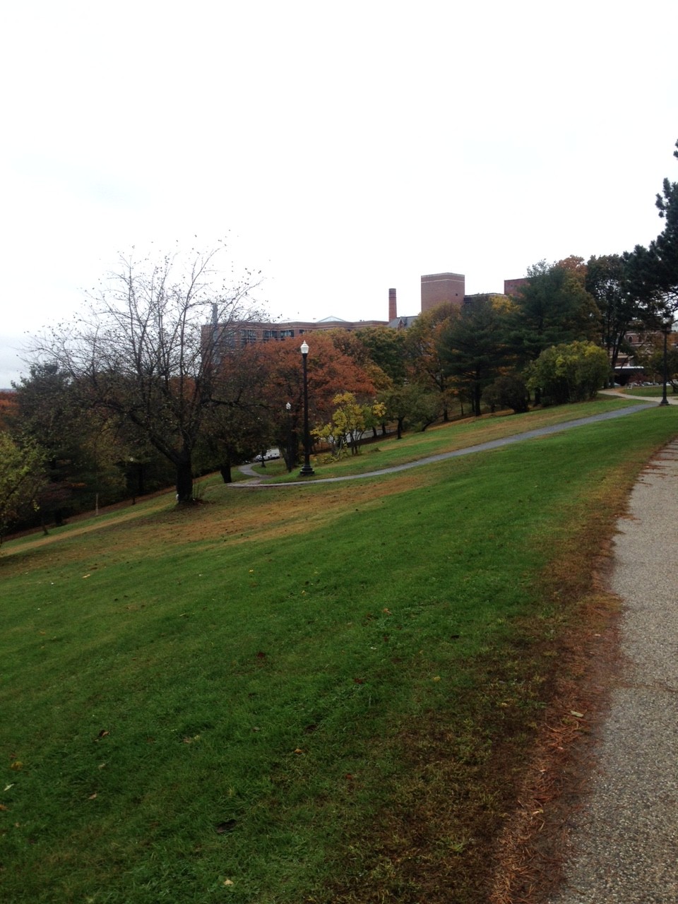
The Recreation Hub needs to be developed with the goal of maximum usership in mind. The area can establish itself as a destination that draws people to ISN and gives them a reason to stay. Currently, popular restaurants, such as Hugo’s, Duckfat, and Eventide Oyster Company located on Middle St., are the main attraction to the neighborhood. The success of these restaurants, as well as nearby shops and the popular Italian landmark, Micucci Grocery Store, has already initiated a revitalization process; however, public space is still lacking. Even more, Portland as a whole presents limited opportunities for its residents to enjoy the waterfront. The water is a valuable natural amenity whose ability to improve quality of life should be better taken advantage of. Not only can transforming the open space at the foot of India St. into a Recreation Hub provide opportunities for people to spend time near the water, but it will also provide much needed opportunities for recreation.

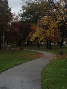
While Portland does have some recreation sites, they are primarily located along the North and Northeastern edges of the city. The new Recreation Hub should include a workout park for adults, consisting of stationary equipment and signage providing exercise information. The workout park should occupy no more than a quarter of the total space. A play area for children should occupy another quarter of the space. Depending on budget limitations and residents’ desires, the play area can be as simple as a paved section for chalk or a sandbox, or full on playground equipment. The children’s area should be surrounded by benches for parents to sit on while attending to their children. At least half of the space should be made of natural materials. This includes open grass patches for picnics, bushes to separate the Recreation Hub from the street, flowers, and trees to provide shade. If space permits, a pond that collects storm water and then uses it to irrigate the greenery should be installed. The pond would minimize run-off and save water, as well as create a feature that children can interact with. Seating should be positioned around the pond so people of all ages can sit and relax, enjoying the calming effects of the water.

Lighting is essential, especially given the dark days of Maine during the late fall and winter. The City of Portland should partner with students at MECA, University of Maine, Bowdoin College, and Bates College and challenge them to create public art installations in the form of solar-powered lights. Different lights can be installed each season, transforming the look and feel of the space and showcasing many different student-artists. These installations would be an ideal way to incorporate public art into the space while minimizing commissioning and electricity costs and ensuring visitors’ safety.

It is critical that the Recreation Hub is made accessible to the rest of the city, especially as the most densely populated residential areas are located beyond the boundaries of ISN. While Bus 8 stops right by the Recreation Hub site, the bus does not run frequently and does not run on Sundays. Since the Recreation Hub will be catering to all ages, family visitation rates are expected to be highest on weekends when parents have the most time to spend time with their children. It would be advisable to increase the frequency of Bus 8, and at the very least, provide service on Sundays. The surrounding sidewalk network appears to be sufficient, however, the Recreation Hub needs to meet cyclists’ needs by offering ample bike racks. The Recreation Hub should also be well connected to the preexisting recreation area of the Eastern Promenade. This lookout area attracts many visitors and the Recreation Hub could become a final destination for these people, especially runners and cyclists seeking an additional workout. Establishing this connection and then educating the public about it will be key to increasing usership.

Finally, the Recreation Hub should be multi-purpose, capable of serving as an event venue year-round. Events can integrate local private businesses, to take part in food festivals. Similar the Art Walk model, one evening each month, the Recreation Hub could invite a selection of Portland restaurants to sell a few menu items at a capped cost. Temporary seating could be set up so people could pick up food from restaurant booths and then sit and eat. Musicians could be invited to provide entertainment. The food offering could be tailored to the season – outdoor heaters and blankets, Duckfat poutine, a hot chocolate stand, and snow sculpting competitions in the winter; Nosh burgers, a lemonade stand, and popsicles in the summer. This would be a good way for ISN to engage local businesses in community-building events without giving them long-term ownership to the space.

Conclusion

The recommendations detailed in this paper provide a means for Portland to significantly revitalize ISN. GIS analysis indicates that Portland needs to expand its green space and provide increased opportunities for residents to enjoy the waterfront as a part of their daily lifestyles. If the Recreation Hub incorporates the recommended features – an adult workout park, children’s play area, seating, green space, public art solar lighting, and an irrigation pond – the space will become a prominent destination spot for both residents and tourists. What these features finally look like should be determined by public preferences. Portland can best listen to the public by establishing an online platform that anyone can easily access to voice their opinions. The platform would become a forum where people can vote on options (i.e. four options for a children’s play area), comment on proposed solutions, and even post photos of places in Portland or elsewhere explaining what they like or do not like about it. Essentially, an online “public space” should be created to develop the public space to ensure people’s needs are best met.

The design of the Recreation Hub is critical, but accessibility ultimately determines its public usage. Thus, Portland should increase its Route 8 service to the Recreation Hub, ensure sidewalks are well maintained, and create a well-marked connection to the Eastern Promenade. Public awareness about the space can be increased through newspaper articles, newscast features, and events sponsored by local businesses. The Recreation Hub can become an engaging dynamic place for people of all ages to enjoy the waterfront, play, socialize, relax, and engage with nature. In these ways, the Recreation Hub has great potential to improve people’s quality of life and well-being. The recommendations discussed in this paper ensure the Recreation Hub will ultimately Portland help further ISN towards the goals and visions outlined in the India Street Sustainable Neighborhood Plan.


Works Cited


Beatley, Timothy. Biophilic Cities. Washington, D.C.: Island Press. 2010.


Cicea, Claudiu and Corina Pîrlogea. “Green Spaces and Public Health in Urban Areas.” _____Theoretical and Empirical Researches in Urban Management 6, no. 1 (02, 2011): 83-92. _____http://ezproxy.bowdoin.edu/login?url=http://search.proquest.com/docview/858207241?acc_____ountid=9681.


City of Portland. India Street Sustainable Neighborhood Plan. September 2014. _____http://www.portlandmaine.gov/DocumentCenter/Home/View/6471.


Durgahee, Ayesha and Matthew Knight. “New Gym Turns Workout into Watts.” CNN. _____November, 27, 2011. http://www.cnn.com/2012/11/27/world/europe/gym-workout-watts-_____electricity/.


Hu, Winnie. “Mom, Dad, This Playground’s for You.” New York Times, June 29, 2012. _____http://www.nytimes.com/2012/07/01/nyregion/new-york-introduces-its-first-adult-_____playground.html?pagewanted=all&module=Search&mabReward=relbias%3As%2C%7B_____%222%22%3A%22RI%3A14%22%7D&_r=2&.


Hurst, Nathan. “Digitally Enhancing Public Spaces at the Urban Prototyping Makeathon.” _____Wired. November 6, 2012. http://www.wired.com/2012/10/up-makeathon/.


Larry, Julie and Gabrielle Daniello. History of Portland’s India Street Neighborhood. Accessed _____November 17, 2014. http://www.portlandmaine.gov/DocumentCenter/Home/View/4276.


Low, Setha M. “Spaces of Reflection, Recovery, and Resistance: Reimagining the Postindustrial _____Plaza.” in After the World Trade Center: Rethinking New York City, ed. Michael Sorkin _____and Sharon Zukin (New York: Routledge).163-172.


Perry, Tony. “San Diego’s Waterfront Makeover is Heavy on Public Space.” Los Angeles Times. _____December 8, 2014. http://www.latimes.com/local/california/la-me-san-diego-waterfront-_____20141209-story.html#page=1.


Petty, Raven. “Four Cities with Playgrounds for Adults.” Livability. November 17, 2014. _____http://livability.com/health-and-wellness/four-cities-playgrounds-adults.


Rutherford, Linda. “Why Public Places are Key for Transforming Our Communities.” Greenbiz, _____April 25, 2014. http://www.greenbiz.com/blog/2014/04/25/why-public-places-are-key-_____transforming-our-communities.


Sareen, Himanshu. “Smart Cities: A Brave New Digital World.” Wired, March 28, 2013. _____http://www.wired.com/2013/03/smart-cities-a-brave-new-digital-world/.


Schulkin, Jay. Adaptation and Well-being: Social Allostasis. Cambridge: Cambridge University _____Press, 2011.


Silberberg, Susan. Places in the Making: How Placemaking Builds Places and Communities. _____Massachusetts Institute of Technology (2013). _____http://dusp.mit.edu/cdd/project/placemaking.


Tomer, Adie and Rob Puentes. “Here’s the Right Way to Build the Futuristic Cities of Our _____Dreams.” Wired. April 23, 2014. http://www.wired.com/2014/04/heres-the-right-way-to-_____build-the-futuristic-cities-of-our-dreams/.


Van Auken, Paul, Shaun Golding, and James Brown. “Prompting with Pictures: Determinism _____and Democracy in Planning.” American Planning Association: Making Great _____Communities Happen. 2012.


[1] City of Portland, India Street Sustainable Neighborhood Plan, September 2014, http://www.portlandmaine.gov/DocumentCenter/Home/View/6471.

[2] Setha M. Low, “Spaces of Reflection, Recovery, and Resistance: Reimagining the Postindustrial Plaza,” in After the World Trade Center: Rethinking New York City, ed. Michael Sorkin and Sharon Zukin (New York: Routledge), 163-172.

[3] Adie Tomer and Rob Puentes, “Here’s the Right Way to Build the Futuristic Cities of Our Dreams,” Wired, April 23, 2014. http://www.wired.com/2014/04/heres-the-right-way-to-build-the-futuristic-cities-of-our-dreams/.


[4] Himanshu Sareen, “Smart Cities: A Brave New Digital World,” Wired, March 28, 2013, http://www.wired.com/2013/03/smart-cities-a-brave-new-digital-world/.

[5] Claudiu Cicea and Corina Pîrlogea, “Green Spaces and Public Health in Urban Areas,” Theoretical and Empirical Researches in Urban Management 6, no. 1 (02, 2011): 83-92, http://ezproxy.bowdoin.edu/login?url=http://search.proquest.com/docview/858207241?accountid=9681.

[6] Ibid.

[7] Jay Schulkin, Adaptation and Well-being: Social Allostasis (Cambridge: Cambridge University Press, 2011), 3.

[8] Claudiu Cicea and Corina Pîrlogea, “Green Spaces and Public Health in Urban Areas.”

[9] Ibid.

[10] Timothy Beatley, Biophilic Cities (Washington, D.C.: Island Press, 2010), 6.

[11] Paul Van Auken, Shaun Golding, and James Brown, “Promting with Pictures: Determinism and Democracy in Planning,” American Planning Association: Making Great Communities Happen (2012), 2.

[12] Susan Silberberg, Places in the Making: How Placemaking Builds Places and Communities,” Massachusetts Institute of Technology (2013), http://dusp.mit.edu/cdd/project/placemaking.

[13] Tony Perry, “San Diego’s Waterfront Makeover is Heavy on Public Space,” Los Angeles Times, December 8, 2014, http://www.latimes.com/local/california/la-me-san-diego-waterfront-20141209-story.html#page=1.

[14] Linda Rutherford, “Why Public Places are Key for Transforming Our Communities,” Greenbiz, April 25, 2014, http://www.greenbiz.com/blog/2014/04/25/why-public-places-are-key-transforming-our-communities.

[15] Winnie Hu, “Mom, Dad, This Playground’s for You,” New York Times, June 29, 2012, http://www.nytimes.com/2012/07/01/nyregion/new-york-introduces-its-first-adult-playground.html?pagewanted=all&module=Search&mabReward=relbias%3As%2C%7B%222%22%3A%22RI%3A14%22%7D&_r=2&.

[16] Raven Petty, “Four Cities with Playgrounds for Adults,” Livability, November 17, 2014, http://livability.com/health-and-wellness/four-cities-playgrounds-adults.

[17] Tony Perry, “San Diego’s Waterfront Makeover is Heavy on Public Space”.

[18] Ayesha Durgahee and Matthew Knight, “New Gym Turns Workout into Watts,” CNN, November, 27, 2011, http://www.cnn.com/2012/11/27/world/europe/gym-workout-watts-electricity/.

[19] Linda Rutherford, “Why Public Places are Key for Transforming Our Communities”.

[20] Nathan Hurst, “Digitally Enhancing Public Spaces at the Urban Prototyping Makeathon,” Wired, November, 6, 2012, http://www.wired.com/2012/10/up-makeathon/.

[21] Julie Larry and Gabrielle Daniello, History of Portland’s India Street Neighborhood, accessed November 17, 2014, http://www.portlandmaine.gov/DocumentCenter/Home/View/4276.

[22] Julie Larry and Gabrielle Daniello, History of Portland’s India Street Neighborhood

Searching for Public Seating in the West End – Emma Chow

I conducted a transect walk through the West End with fellow Public Space group members, Libby and Jackie. We decided to focus on public seating and learn from the William Whyte video to observe the state of usable public seating in Portland’s West End. Our observations indicate a need for more public seating facilities, but perhaps more importantly, better maintenance of current seating facilities. There is great potential for the two parks we visited to be improved; I would recommend the City dedicate their funds to first improving the Western Promenade and Deering Oaks park before setting plans to install any new parks. I also would recommend that public art installations be shaped around seating – either making the art the seat itself or creating art near pre-existing seating to make it more inviting.

Our walk began at Pine St. and State St. and we headed west to the Western Promenade. We could not find any public seating on our way to the Promenade, which was quite surprising to us since we perceived ourselves to be in one of Portland’s most wealthy residential neighborhoods. We spotted a tree stump early in our walk and given the lack of traditional seating (benches, ledges, etc.), we proclaimed that if they had cut the tree a little higher then the stump would be a wonderful seat! We thought about the potential for having a series of stumps that could be carved by local artists and then lacquered for longer wear.

IMG_0977

The tree stump that inspired our “nature” seating idea.

We spent quite some time exploring the Promenade, which had exactly six benches, all of which were very run-down and not aesthetically pleasing. The placement of the benches was rather unusual – they were awkwardly spaced and faced out toward some trees and shrubbery (some of which had been cut down) overlooking the water. A water view sounds appealing, however, the inlet is surrounded by industrial buildings, large storage tanks, and the airport – not exactly what I would like to look at for a long period of time. We struggled to understand why the park designers had placed the benches in such a manner. Would it not be more pleasing to have the benches turned the opposite way facing the lawn? And perhaps fill the lawn with some gardens and more trees? Or level a section of it out and make it a soccer field, play ground, or recreation area? We saw three people while we were at the Promenade, all had dogs. Why not make part of it into a dog park? They could easily install a dog tap for water along with some doggie bags, a physically fenced in area is not necessary. The paths did not make much sense to us either – three different materials were used and the path which housed all the benches was very broken and poses a safety risk to anyone walking or running along it. The lighting fixtures in the park were inconsistent, as well. The area mostly left us feeling confused, wondering who would come here and what they would do.

IMG_1007


The winding paths on the northern end of the park which were very confusing to us. They were very narrow and at a steep incline which would make it difficult for older residents to use.

IMG_0998


A view of the industrial area below.

IMG_0990

One of the three types of paths at the Western Promenade, looking old and grown in. 

IMG_0985

All of the benches looked like this one. Old, moldy, and not very comfortable looking (no arm rests even!). 

We headed North from the Promenade past Maine Medical Center. There was some seating outside the hospital entrance, however, it faced the side of the building rather than the street. The height of the seating was ideal, but it was rusting and old. It also did not appear as though it was very well-cared for.

IMG_1009

The blue rusted seating facing a brick wall.

IMG_1012

Here is our first example of some usable public seating outside the hospital. The ledge is a good height and depth, it is facing the street, and the flower bed can be planted with aesthetically-pleasing arrangements to attract people. 

IMG_1015

Across the street from the hospital is a parking lot with a stone wall that has so much potential for seating, but the railing is stuck right in the middle so seating is not even a possibility. It is such a shame that patients and hospital employees lack opportunities to sit outside for lunch or an afternoon break. 

IMG_1018

A seating area at the corner of Deering St. and Congress Ave. where two of the three benches sit side-by-side with a garbage bin – not exactly the most inviting space for people to want to sit for an extended period of time. The third bench (not pictured) is looking away from the others, isolated all on its own. 

IMG_1021

We made our way north to Deering Oaks park, which was definitely the most encouraging public space we visited, particularly for seating. There was a string of benches bordering one of the winding paths. We did spotted one lone picnic bench; however, it was placed in a random location. We noticed the lighting fixtures were, like the Western Promenade, inconsistent – some were black lanterns while others were grey and ugly. The pond is a great feature, but there are no paths built along it and no seating nearby. How are people supposed to be able to enjoy the fountain and watch the ducks if there is limited access and no facilities to sit? Furthermore, the park needs a physical or psychological barrier to separate it from the traffic driving by. I know I would be much more likely to want to spend time there if the visual and audio effect of the cars did not disrupt the peace of being immersed in nature.

Coordinates:

Low stone pillars: 43o39’02.15″N; 70o16’09.10″W
Promenade bench 1: 43o38’58.52″N; 70o16’34.65″W
bench 2: 43o38’57.33″N; 70o16’34.62″W
bench 3: 43o38’56.53″N; 70o16’34.73″W
bench 5 (think we’re missing one): 43o38’54.50″N; 70o16’34.15″W
bench 6: 43o39’04.52″N; 70o16’34.98″W
Blue hospital benches: 43o39’07.83″N; 70o16’31.52″W
Stone hospital benches: 43o39’08.62″N; 70o16’29.70″W
Hospital bus stop: 43o39’08.95″N; 70o16’30.14″W
Congress St bench 1: 43o39’14.78″N; 70o16’21.44″W
Congress St bench 2: 43o39’14.44″N; 70o16’21.02″W
Congress St bench 3: 43o39’15.00″N; 70o16’21.27″W
Deering Oaks Park bench 1: 43o39’25.03″N; 70o16’20.17″W
DOP 2: 43o39’25.32″N; 70o16’19.84″W
DOP 4: 43o39’26.10″N; 70o16’15.64″W
DOP 5: 43o39’26.22″N; 70o16’14.57″W
DOP 6: 43p39’26.48″N; 70o16’12.78″W
DOP 7: 43o39’26.84″N; 70o16’11.52″W
DOP 8: 43o39’27.22″N; 70o16’10.67″W

Portland Residents Highlight Big Room for Improvement for Public Space and Park Space – Emma Chow

This data provided me with some valuable insights into ways public space can be improved. The cafe ethnography demonstrated that people in Portland do like to sit with friends and chat, read alone, and meet up with family at a coffee shop, in addition to doing work on laptops. The cafe had the atmosphere of what I would love to see in public space, however, the cafe is not a public space because people are obligated to make a purchase in order to spend time there. It made me think about the potential for indoor public space. I thought about how incredible it would be to make such a space as Bard cafe accessible to everyone, not just those who can afford a $5 beverage.

The mental maps highlighted the public spaces participants use. Two of the maps feature park space. One, from a Portland resident, and one from a Yarmouth commuter. The Yarmouth commuter highlighted Deering Oaks Park, where a farmers’ market is held in the warmer months. The Portland resident lives near the West End, but utilizes recreation areas on the eastern promenade and the Back Cove. When we did our transect walk in the West End, we notice how underutilized public space is and how dreary the one park we visited was. It is no wonder this resident ventures across the city to “play”. That same resident recommended that smoking be banned from Congress St. I had not thought about the role in public space in Portland before and must admit that besides outside the hospital, we did not come across any “no smoking” signs during our transect walk. Banning smoking in public spaces, particularly parks or seating areas would definitely help improve the comfort of places and encourage people to use them more.

4:20 pm 10/3/14

  •  3 middle-aged people, two women and a man are chatting at a table; the table behind them sits empty but there’s a green water bottle on top of it – where did the people go? Did they forget their bottle? A man with very cool glasses sits in a suit and skinny purple tie, entrenched in his phone. Another man settles into a table and chair by the window looking onto the street, sun streaming in. In the back corner a woman and a man sit doing work on their corporate laptops; they’re sitting on couches that are deep and comfy. Another businessman sits in a wicker chair doing work with his feet up on another chair. Four people, two who know each other, are sitting at the stools by the café bar.
  • A man wearing Dr. Marten type shoes with the Union Jack on is standing in a vest at the cash register. Three women, all blonde in their late 20s and early 40s are standing chatting as they wait for their drinks along the wooden countertop. Another man has joined the people on the couch. The man in the vest just left as he took a call. A woman sits at a bench table fiddling with her large purse, sitting sideways draped over the chair as she speaks to a friend on the phone.
  • A woman is wearing gloves, why is she wearing gloves? It’s 70 degrees out! Oh she’s taking them off. An older gentleman walked in and ordered a drink and a delicious looking pastry. The three blond women have their drinks and have sat down; they look to be in quite a serious conversation. The woman with the gloves is in her late twenties; she’s sitting across from a man who looks like he could be her dad. The bar stools are empty except for two women at their laptops. They sit alone.
  • The man with the cool glasses and purple tie sits, eyes still glued to his iPhone, A mom and two kids just walked in – one boy and one girl. The boy is pouring himself a cup of water and the girl is staring at the pastries through the transparent display case. Mom says she can’t have one – too close to dinner. The girl has taken claim to a stool in the corner; she’s twirling around, mom smiles at her from across the counter. The man sitting in the wicker chair has stood up and put his coat on to leave, grabbing his laptop on the way out.
  • A woman with a wrap around her head and a cobalt blue cozy sweater has sat down across from the man with the glasses. The three blond women are departing. A man with sunglasses on his head, in work boots just walked in. He looks as though he just wrapped up the day at a construction site. Two girls in their late teens or early twenties are waiting for the bathroom, the woman on the couch advises them of the café’s policy – they need to ask for a key to get in. The woman with the head wrap is ordering a drink.
  • A man with a camera strapped around his neck carries a brownie and hot drink to the bar and sits on a stool; He sits with his giant backpack on his back. Perhaps a tourist? Or maybe media photographer. It’s hard to tell for sure. Man with glasses and cobalt blue pants sat down beside the woman with the head wrap and across form the man with the cool glasses. The man and the woman on the couch sit in silence, clicking away at their keys.
  • A mom with two kids, another boy and a girl walking in and are standing in line, except they’re standing in the line to received drinks rather than order. They just realized and moved over to the cash. Lots of people in suits are walking past the café windows outside; it’s the end of the work week. The man on the couch has left, but his bag is still there, maybe he’s in the bathroom.
  • The mom with the two kids (with the daughter who sat at the stool) is now joined by their dad in the corner at a square table. A couple with a stroller carrying their young daughter are waiting for their order. The mom pushes the stroller back and forth; the daughter is calm and quiet, sitting peacefully. The man who was on the couch has left.
  • The corner by the window sits empty, the families have left. The two baristas are noting to one another that tonight is the art walk. The guy with the cool glasses and the two other people are enjoying lively conversation. While the man with the glasses is no longer staring at his phone, he always needs to have contact with it, playing with it and tapping it against the table. Oh, now he’s looking at it while speaking to them.
  • Two women in their middle ages just walked in. An older man just ordered an apple. He asked for a knife too, to cut the apple. One of the women is getting a class of water, now she’s refilling the cup. That same woman is wearing scrubs, it’s hard to tell since she’s wearing a sweater, but the white ties are coming out the bottom. Two men with their bags on chairs sit at the tables by the front windows, one on an ipad, and the other on a laptop.
  • The man with the glasses and his two friends are heading out. A woman with curly hair, a green backpack, and glasses is peering at the menu, but she has already ordered. A woman in a pink blazer and black work dress just walked in. She has opened a compact to retrieve a credit card. A man with a ponytail just ordered with a card and signed the ipad that acts as the cash register. He’s sitting at a stool next to a rugged looking friend with a large beard.
  • A man with arm tattoos and even tattoos on his sideburns is sitting with the woman with the pink blazer. He has a file folder filled with tons of paperwork. Maybe she is his accountant or doing his taxes? He’s writing down numbers on a sheet of paper on a clipboard. A young couple is standing in line debating what they want to order. A woman sits in the corner, looking out onto the street as she reads her book. An older woman in an orange vest is standing outside the window.
  • An older man is standing at a laptop at the counter; he’s staring so closely at the screen. I’m not sure what he’s doing. A man just got the key for the bathroom; it’s on a kitchen whisk haha! A family just walked in. They’re all very funkily dressed. One woman has blue booties on and a bright yellow fall scarf. The woman with the blazer is now speaking to the man with the tattoos, all the papers have been cleared off the table
  • A man in work boots just spilled some tea on the ground and his boots; he just went to grab some napkins to mop up the spill. The café is very quiet. The funky family has claimed the couches as their territory. Four people sit at the stools. The woman by the window is still reading her book peacefully and the two men are doing work still at the tables in isolation.
  • A man and wife sit across from us at the bench table in silence, the husband is peering over his glasses at a newspaper while the wife stares at her phone He just mumbled something to himself – are they having a conversation with no eye contact? Oh, they just engaged in conversation. The woman reading the book in the corner just stood up and put on a black wool beanie. She’s walking to put away her cup and plate and heading out the exit doors, book in hand. The two rugged looking men are sitting and conversing at the bar still.

Mental Maps:

IMG_1024

Age 34, female, graphic designer, lived in Portland for 12 years, lives in Libbytown, would like to see smoking banned from Congress St. Would like more info about study results: [email protected]

IMG_1025


Age 37, male, food truck chef, lives in Scarborough, has lived in Maine for 13 years, would like to see improvements in the sanitation department.

IMG_1026

Age 50, male, veteran, recovered drug addict, has lived in Portland for 6.5 years, would like to see cops be less corrupt.

IMG_1027


Age 26, female, has lived in Yarmouth for three years, admissions representative at MECA, would like to see better street labeling and striping.


Accessible Low Energy Transportation for Portland – Emma Chow

Infrastructure is most useful in the smart city when is meets the ever-changing needs imposed by urbanization. As Simone writes, urbanization increases the complexity of cities by increasing the density of heterogeneous elements. [1] As more people move from rural to urban environments, cities need to increase their infrastructure’s capacity to accommodate the needs of growing populations. This means establishing hospitals, police stations, fire departments, and schools in specific locations to meet the needs of incoming residents. Infrastructure in the smart city is useful when it employs technology to provide residents open access to information about the city. With open data, residents gain an interactive experience with their city and realize their right to produce infrastructure. [2] For instance, a single individual, when given open access to data about bike share hub locations, can create an app for everyone to use. Technology can be leveraged to create solutions that improve infrastructure’s usage and efficiency. Open data, such as the plans featured in Jimenez for building shelter/seating structures and bike accessories [2], allow people to share information at no cost and realize the infrastructure they want to see in their city.

Infrastructure for the common good ensures access to healthcare, protection from environmental damages (curbs for water run off, etc.), and public safety. Infrastructure for walking, biking, and public transportation not only reduce emissions and damaging environmental and human health impacts, but also increases opportunities for low-cost methods of transportation throughout the city. As Sorkin highlights, prioritizing pedestrians over cars develops infrastructure that encourages people to walk and engage in “low energy travel”. [3] Being able to walk and bike places enables low-income people to experience the city in a more robust way and better access infrastructure such as hospitals, schools, and libraries.

Portland should further develop its infrastructure by improving its transportation network. The city is small, so people should be able to safely bike and walk as means of transport. This requires building and maintaining sidewalks, installing streetlights so people feel safe at night, shoveling the sidewalks during the winter, and installing bike lanes along busy traffic streets. Planting trees along roads with lots of pedestrian and bike traffic would help slow traffic and improve safety, as well. [3] Portland should increase its bus routes and frequency of services. Closing down certain streets to be pedestrian-only for certain nights, such as First Friday Art Walk, would help the city become more pedestrian friendly. The city also needs to address flooding issues in the Old Port by building a drainage system to cope with heavy summer downpour. Portland should also build infrastructure to meet its changing demographics by providing the social services and English language development services its immigrant population needs. Immigrants and refugees need basic care and English skills to secure economic opportunities and also to engage in the social infrastructure. [1]

[1] Michael Sorkin, “Traffic in Democracy,” in The People and Space Reader, ed. Jen Jack Gieseking, et al (New York: Routledge), 2014, 411-415.

[2] Alberto Cosin Jimenez, “The Right to Infrastructure: a Prototype for Open Source Urbanism,” Environment and Planning D: Society and Space 32 (2): 342-62, 2014.

[3] Abdul Maliq Simone, “People as Infrastructure: Intersecting Fragments in Johannesburg,” in People and Space Reader, ed. Jen Jack Gieseking, et al (New York: Routledge), 2014 (2004), 241-246.


Centralized, Energy Efficient Housing for Portland – Emma Chow

Housing is most useful in the smart city when it employs technology to increase the structural energy efficiency and is well-integrated with the city’s other systems. Crowley [1] discusses the possibilities of using Twitter as a means for directing people’s actions to be more energy efficient, but a system of systems does not necessarily need to be established in order to best leverage the power of technology. For instance, installing systems that allow residents to control their home’s temperature remotely using a smartphone app helps residents waste less electricity. Housing should not be planned according to low-density suburb design. By creating high-density residential areas, it makes it easier to design more accessible public transportation networks.

Ensuring housing is built within the city, instead of outside the city, brings people closer together and helps cultivate community. Smith [2] discusses the issue of gentrification in New York’s Lower East Side. He explains how developers promoted the Lower East Side’s new housing by convincing potential buyers they could conquer the “Frontier”, and in doing so, would capture the American Dream. Higher income residents gentrify a neighborhood by moving in, driving up housing prices, and often claiming it as their own by re-naming the area. “Village”, “Heights”, “Hill”, “Green”, “Gardens” – these are all common names assigned to neighborhoods to give them a more “sophisticated” image and sense of place. Housing for the common good is accessible. The financialization of the housing market over the past few decades has made housing in cities increasingly inaccessible. [3] Financialization has increased inequality and worsened housing conditions in cities by making it harder for low-income residents to move to better housing. [3] Housing for the common good may include co-op buildings where residents own shares and share the responsibility of maintaining the building. Housing should also be built using eco-friendly or recycled materials, in a manner that maximizes energy efficiency (i.e. weatherizing, high-efficiency appliances), to minimize negative environmental impacts.

Portland can take several steps to better develop its housing. The city should implement building height restrictions to ensure residential condo buildings do not concentrate people in too small of an area. A sudden influx of many residents can have unplanned negative impacts on a community. Portland should carefully manage areas that are attracting the “Creative Class”, to ensure they do not become too gentrified and exaggerate the divide between the poor and wealthy neighborhoods. Additionally, neighborhoods should be restricted from being renamed to sound more “sophisticated”. Housing developments should be integrated in the city as much as possible, while subdivisions or condos outside the city should be avoided. Distancing housing from the city’s core increases the need for car commuting, and makes it difficult to foster a sense of community. The city can also implement a housing weatherization project to ensure homes are more energy efficient; this will cut residents’ electricity costs and reduce climate-change-inducing emissions.

[1] David Crowley et al, “Leveraging Social Media and IoT to Bootstrap Smart Environments,” in Big Data and Internet of Things: A Roadmap for Smart Environments, ed. Nik Bessis and Ciprian Dobre (Springer), 379-99.

[2] Neil Smith, “’Class Struggle on Avenue B’: The Lower East Side as the Wild Wild West,” in The People, Place and Space Reader, ed. Jen Jack Gieseking, et al, (New York: Routledge, 2014), 314-319.

[3] Desiree Fields and Sabina Uffer, “The Finacialisation of Rental Housing: A Comparative Analysis of New York City and Berlin,” Urban Studies, July.

Avoiding Privatization and Militarization in Portland’s Public Space – Emma Chow

In order for public space in smart cities to be most useful, they need to be safe. People – women, children, the elderly – all people, need to feel as though they can frequent public space without fear of being attacked or harassed by a stranger. Since the September 11, 2001 terrorist attacks, citizens have lived their lives with a sense of uneasiness and fear. (1) Fear is leading to the fall of public space. (2) The American government has responded to the threat of future terrorist attacks with militarization. Armed troops in uniform now stand in “key terrorist threat sites”, such as Grand Central Station in New York City. Their presence may make some citizens feel safer, but they may also make many other citizens feel as though they do not have a right to the space. In reality, everyone should feel like they have the right to public space. Public space in smart cities is  made safe and enjoyable through good lighting, a constant flow of visitors, and the provision of shared experiences, not by intimidating men standing with machine guns. By sharing experiences with strangers in public spaces – whether strolling in Central Park, eating lunch on the Bryant Park lawn, or conversing on a street corner – people become more trusting of others, thus further developing social capital. This common trust encourages people to look out for each other, decreasing the likelihood of crimes taking place. Technology (surveillance systems) and militarization is not the answer for creating safe public space because who really wants to spend their leisure time under the “Big Brother” eye of a camera or soldier?

Public space best serves the common good when it provides the five freedoms Low argues for: freedom of access, freedom of action, freedom to claim, freedom to change, freedom of ownership. (2) Good public space allows people to assert their right to inhabit the city. (1) Occupy Wall Street demonstrations in Zucotti Square in NYC serve as a good example of people exercising their right to assembly – Zucotti Square provided thousands of people the freedom to protest and have their voices heard. Public space for the common good should allow people to exercise their right to assembly, provide opportunities to play and exercise, immerse them in nature, and enrich their lives. Ultimately, public space should help the city meet the human “need for creative activity…for information, symbolism, the imaginary and play.” (1) Public space that serves the common good includes places, such as Central Park. As discussed in class, Central Park was masterfully designed by Olmstead to transform a mundane plot of land into a wilderness wonderland where people of all ages can come and recreate and get lost.

Portland should think carefully about how it aims to make its public space safer; camera surveillance and “Big Brother” tactics (2) should be avoided. Public space should be designed and managed as to ensure Low’s five freedoms are maximized. This means careful consideration of privatization of public space, which acts as a mechanism for blocking these freedoms. (2) Temporary privatization of space (i.e. weekend farmers’ markets and food trucks) can attract more people to visit public space; however, longer-term privatization (i.e. Nikon-sponsored Fashion Week in Bryant Park) can block public access to Low’s five freedoms for an extended period of time. That being said, privatization can be a great way to secure funding for revitalizing public space and attracting visitors. Portland may be tempted to supplement government funding with private dollars and accept corporate sponsorships; however, the City should be wary of turning its parks and squares into permanent large-scale advertisements – especially given Maine’s regulations against billboards. After all, government decisions should always be made to maximize the common good of the public, not the private.

(1) Don Mitchell, “To Go Again to Hyde Park: Public Space, Rights, and Social Justice,” in The People, Place and Space Reader, ed. Jen Jack Gieseking, et al. (New York: Routledge, 2014), 192-196.

(2) Setha M. Low, “Spaces of Reflection, Recovery, and Resistance: Reimagining the Postindustrial Plaza,” in After the World Trace Center: Rethinking New York City, ed. Michael Sorkin and Sharon Zukin (New York: Routledge), 163-172.

Smart Solutions for Public Spaces in Portland – Emma Chow

1. Create an app for tourists with walking tour routes that feature historic sites/buildings, parks, and public events that day/week

2. Install free wifi in public parks/squares and track the number of people who use each place

3. Place tracking devices on furniture in public spaces so it does not need to be locked up or removed every day

4. Create an app that features outdoor events/festivals and highlights places with outdoor dining options

5. Commission college art students to create modern solar powered light-art installations that automatically turn on when it becomes dark

The top smart initiatives to improve Portland’s public spaces from this initial list are: installing free Wi-Fi in public parks/squares, creating an app for outdoor events and dining options, and installing illuminated public art powered by solar. By making Wi-Fi accessible in public spaces, it attracts people to the place and gives people the freedom of performing activities normally done indoors, outside. When Wi-Fi is combined with good seating options, people have the ability to bring their laptop and do work outside, have meetings, or watch a TV show. The majority of people have smartphones that are set to automatically connect to open Wi-Fi networks. Wi-Fi can also be leveraged as a means for tracking the usage of public spaces by recording how many people are connected to the Wi-Fi and how long they stay. Portland is home to many start-ups, and people in creative industries often have the freedom to work remotely at home or in cafes — why not use Wi-Fi to bring these people outdoors and enjoy their public spaces?

Portland hosts a monthly art walk as well as several outdoor festivals during the summer months, but it needs to increase the frequency of events/festivals, and transform its streets and parks from an occasional tourist attraction to a place for regular enjoyment for locals. Events can include street food festivals, outdoor movie screenings in the park, or free art for kids on the weekend in a square. Once events are planned, they need to be publicized. The best way to do this is through an app that will inform Portland residents, as well as visitors, of upcoming outdoor events/festivals. These should be year-round. The app can also feature outdoor dining options, which are a growing trend in Portland, as indicated by the multiple applications for outdoor dining licenses in July (1). Another example of an event is closing down streets on certain evenings throughout the warmer months and setting out tables so all the diners can eat outdoors as pedestrians wander through.

Finally, public spaces will be much better utilized if there is better lighting. Well-lit places not only create a more inviting atmosphere at night, but also improves safety since people cannot hide amongst the shadows. Lighting is especially important in places in Maine where the sun sets very early during the fall and winter months. Portland has such great potential for commissioning MECA, Bowdoin, Bates, Colby, and U Maine students to create great public art installations in the form of lighting. These art installations can inject places with interest and culture during the day and then illuminate automatically once the sun goes down, thanks to solar-powered technologies. The installations can change according to the season and illumination can even be displayed in various colors. If passed by the Portland City Council, $63,000 of future bond funds will be dedicated to public art (1) — lighting initiatives would be a great way of allocating of funds.

Unlike Smart Cities like Songdo (2), Portland is not starting from scratch. Therefore, it needs to integrate technology with current systems and the history of its place in a way that best benefits people’s daily lives. Portland has so much potential to create dynamic public spaces that will energize its city life. Technology should be infused into the development of these places so they  not only function well for people, but also informs people about them via  apps, etc..

(1) The Portland City Council, “Agenda: Regular City Council Meeting July 21, 2014,” City of Portland, July 21, 2014, http://portlandmaine.gov/AgendaCenter/ViewFile/Agenda/07212014-479

(2) Adam Greenfield, “Against the Smart City,” Do Projects, 1.3 Edition, October 1, 2013.


Investigating Public Space in Portland — Emma Chow

I would like to be in the public space research group to investigate the role public space has in people’s lives in Portland, and the ways public space has shaped and evolved in recent years. I believer public spaces can be designed in ways that improve human well-being. I grew up in Toronto, a city with accessible public parks, playgrounds, wading pools, and beaches. These spaces, both organically-created and human-designed, have and continue to play an instrumental role in my daily life. Public spaces give people opportunity to exercise and become healthier, to gain exposure to nature and reap the psychological rewards, and cultivate strong social ties that help build social capital.

The Hayden chapters made me think about the social history of place and the ways places evolve overtime according to the current cultural landscape. It made me think about the accessibility of public places and how public life studies are important to show who uses these spaces, and equally as important, who does not. It also made me want to learn more about the production of public spaces in Portland, especially concerning converting working land to places for people.

As an Environmental Studies-Economics major, I am very interested in creating systems to improve environmental sustainability. Creating cities for people is a powerful means for propelling society on a path towards sustainability. While studying abroad in Sweden last fall, I conducted a research project on bikeable cities for my Comparative Healthcare class. This research, along with my experiences traveling to other European cities, made me realize how public spaces and walking/biking facilities can improve people’s lives through a range of mechanisms. For example, bikeable cities increase exercise rates, improve people’s physical health, decrease congestion and air pollution (which in turn further enhances physical health), increase exposure to nature, and increases social interactions. As a result, the population receives physical and psychological benefits.

I am fascinated with Jan Gehl’s work and the study of public life. I am a strong believer that creating dynamic public spaces helps shift people’s consumption from material goods to experiences. Material goods provide a temporary increase in happiness, while experiences and human relationships fulfill the highest human needs for love, belonging, and sense of purpose. I am intrigued by the notion that we can design public spaces and leverage them to create a more sustainable consumption culture.