Category Archives: Post #7: Individual Analysis of Transect Walk

Transect Walk – Countless Empty Benches: Exploring the Intersectionality of Urban and Nature

Having done the transect walk, I am more confident in my original ideas, which was already supported by my cafe ethnography.

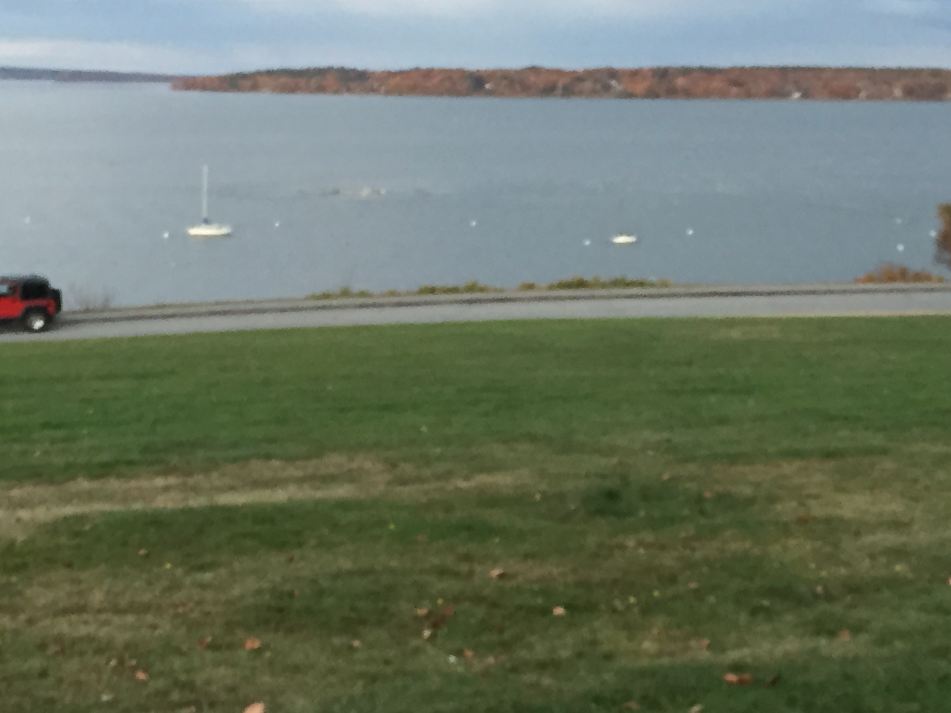
  1. Portland has amazing natural beauty, that could be better utilized, appreciated by more people, and to a certain extent, capitalized.
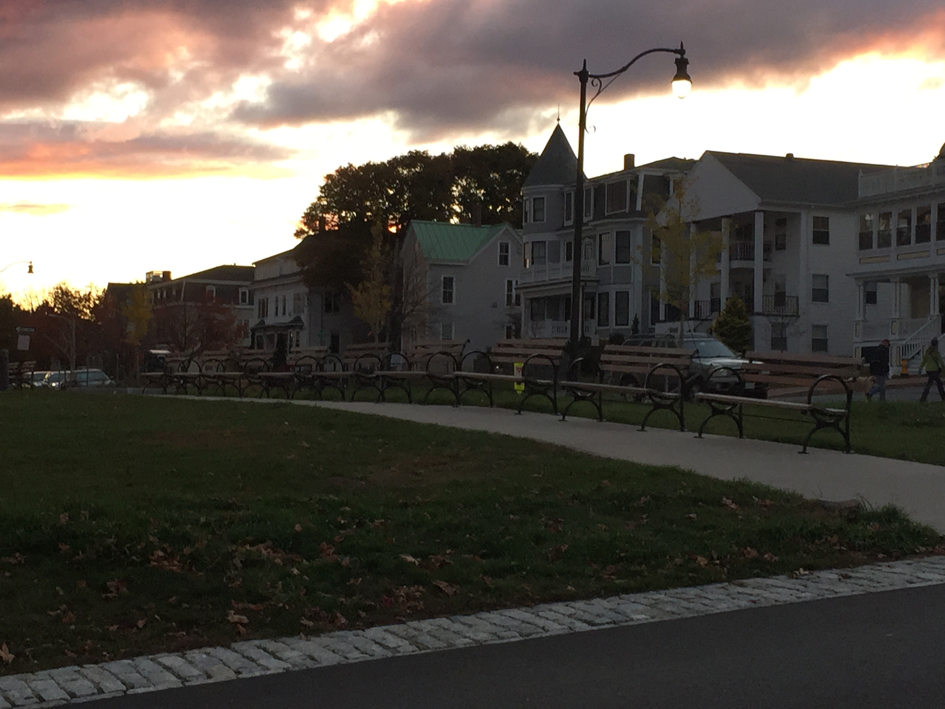
  2. Amazing and gorgeous views, but few people get to enjoy it, which is pretty evident from all the empty benches. There is definitely more potential for higher utilization rates — even the designers of the park would agree!
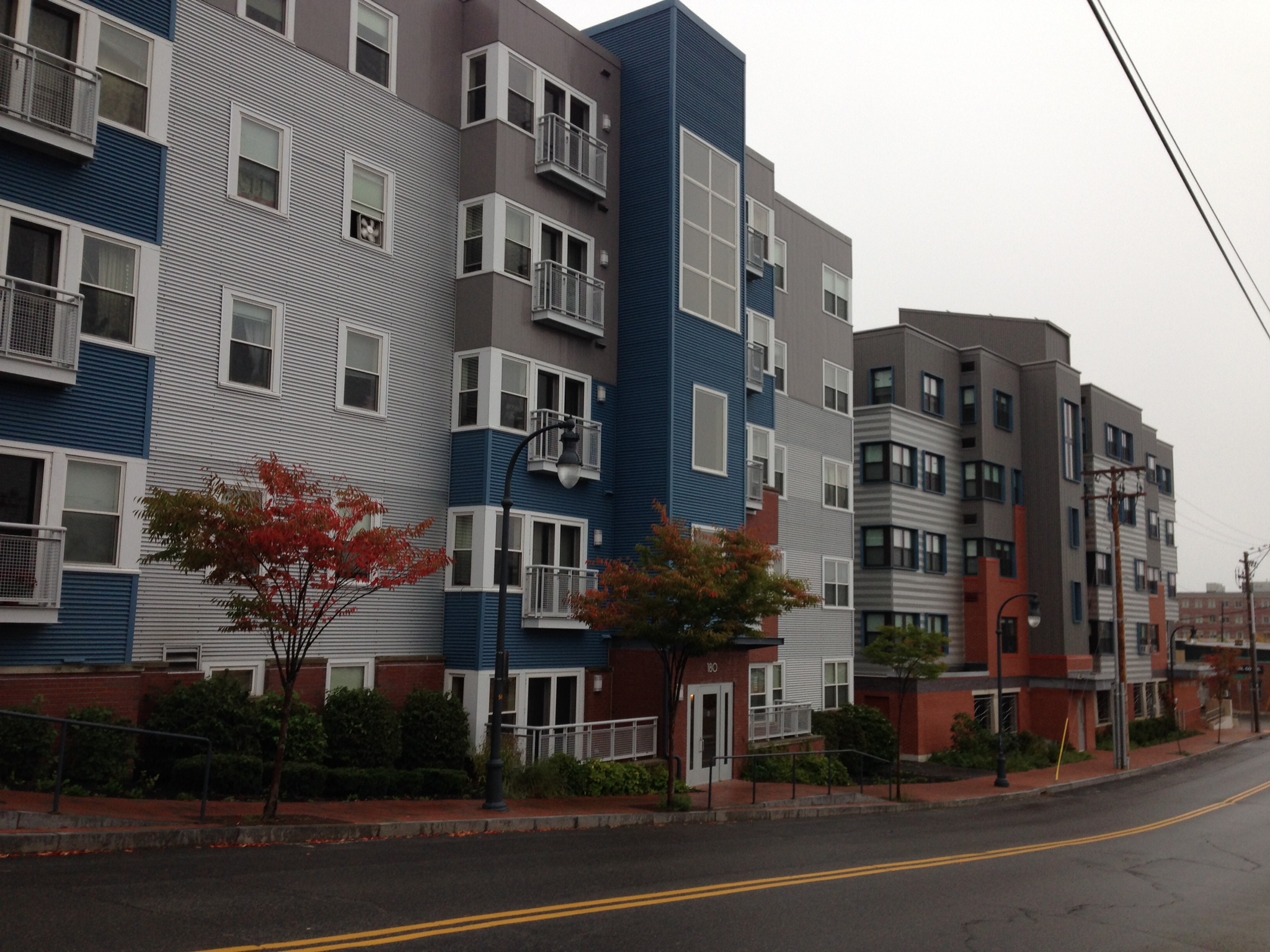
  3. Infrastructure could be designed near the Waterfront in ways that complements and preserves Maine’s natural beauty, which would attract a greater population to the area.
  4. I have been told that during Canadian Thanksgiving, Canadians take ships to Portland and dock at Old Port. However, constructing a pier/casino complex in the East End would be perfect. It is the closest spot in Portland City to the ocean. Visitors can visit the complex and cash can flow into the city without disrupting other parts of the City.
  5. 295 is really close to many residential neighborhoods, and noise pollution can become troublesome.

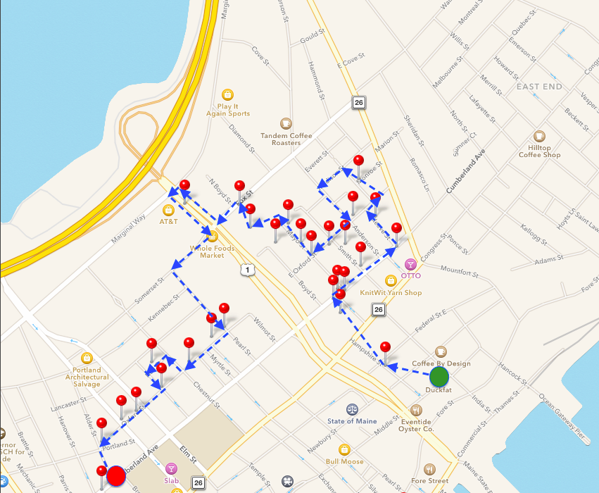
Transect Walk: Eastern Promenade

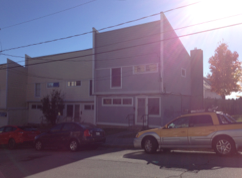
  • The neighborhoods on my way to the East End looked nicer than when I was on the West Side. In fact, I was pretty impressed by the entirety of Fore Street — very commercial and lively.
  • Toward the south side I see some people and a lot of dogs. Though through out my entire walk there seems to be a lack of dogs waste disposal facilities.
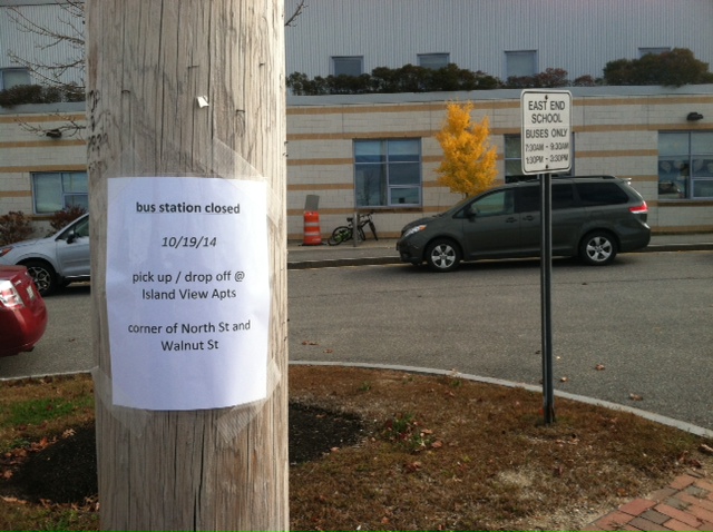
  • No public transportation seen near the East End, although there a lot of road access approaching the waterfront.
  • Benches every 7 yards but there all empty, as can be seen from the photos below. All benches have different name plates on them, which is kinda cool.
  • Pretty nice park, breathtaking scenery, as you can probably see from the pictures. No fences surrounding the park area. No homeless people seen. Just no living things around me.
  • Do not really see many light posts in the park, not really designed for recreation after dark, eh?
  • Huge parking lots. All empty.
  • There is a playground with no children.
  • A jogger just passed me!!!
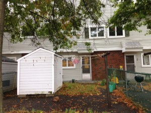
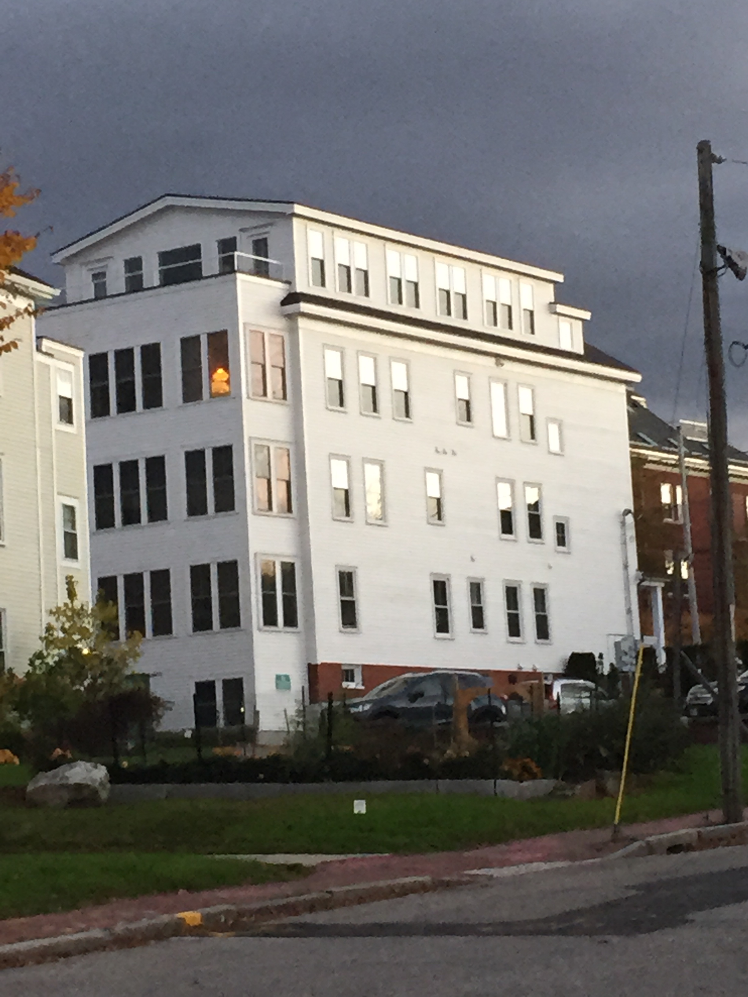
  • Many multi family houses. So there should be a sizable population in the community, which does not make sense considering I have been seeing nobody outside. The houses do not seem entirely occupied.
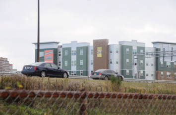
  • I can hear sounds of the highway (295) throughout the walk. Having the 295 so close by and above ground creates serious noise pollution, which definitely impacts the values of adjacent properties.


IMG_1657

IMG_1658 IMG_1667 IMG_1670 IMG_1672 IMG_1675


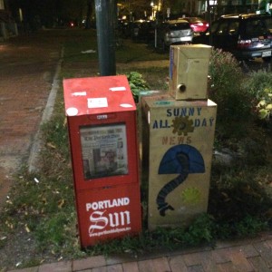
Empty signs?? Infrastructure not well serviced around here I see.


IMG_1677


IMG_1678


Coordinates:

  • Lat: 43.6655; Long: -70.2415
  • Lat: 43.6651; Long: -70.2401
  • Lat: 43.6667; Long: -70.2411
  • Lat: 43.6674; Long: -70.2419
  • Lat: 43.6678; Long: -70.2423
  • Lat: 43.6683; Long: -70.2432
  • Lat: 43.6695; Long: -70.2451
  • Lat: 43.6697; Long: -70.2457

Portland’s Lifestyle Juxtapositions

In my walk through Portland, I was most struck by stark juxtapositions within the city in regards to standards of living. I noticed the construction of condos and apartments near blocks and blocks of identical low-income housing. I noticed the existence of a Planet Dog – a store exclusively for the accessories, beds, toys, and food receptacles of Portland’s canines – next to homeless people begging with signs on the street. I noticed the irony of an upscale antique store and a home entertainment store just down the road from the Preble Street Resource Center and Salvation Army.

These observations highlighted what I believe to be Portland’s (and many other cities’) central tension between the rise of the city as a popular, ‘hip’ tourist destination and the prevailing difficulty of life for the city’s lower class, ‘at-risk’ population. This tension manifested itself toward the end of my transect walk in Congress Square Park. With an interest sparked by our guided tour and conversation with Caitlin Cameron, I took a brief walk around the park and took a couple pictures. I walked up the steps to leave and was followed by a woman for several blocks, slurring and screaming obscenities at me such as “Fuck the White House, bitch.” Upon reflection, this exchange was representative of this central tension – an ostensibly well-to-do white girl wielding a large SLR camera, entering a space of day-to-day struggle for local citizens, which for me is just a space of temporary and lighthearted exploration. Going forward, I will continue to reflect upon and consider these juxtapositions and tensions.

Transect Walk

      Congress Street

-Development of 118 on Munjoy Hill, “new boutique condo” deemed controversial by the Bangor Daily News. The developers are recording the construction process and advertising time-lapse videos on the web:  http://118onmunjoyhill.com/time-lapse/
(43.66594, -70.247428)

Screen Shot 2014-10-28 at 9.53.58 PM

Kellogg Street

-Homogeneous housing…potentially public housing? Public ordinance sign: “No drinking of alcoholic beverages”

Screen Shot 2014-10-28 at 9.53.05 PM

Washington Avenue

-More racial and linguistic diversity than I’ve seen yet, compared to Congress Street in particular
-Prominent police presence

Montgomery Street

-Two adult black males, staggering and slurring their words, bounce a basketball with a boy approximately 10 years old, while firemen break into a home a few houses down

Anderson Street

-Cars on the street significantly nicer than the houses
-Racial diversity
-Same homogenous housing from Kellogg Street

Franklin Street

-Homeless people hold up signs at a busy intersection, adjacent to Planet Dog
Intersection: (43.665364, -70.260148) Planet Dog: (43.664990, -70.260019)

Screen Shot 2014-10-28 at 10.00.54 PM

Back Cove Park

-Environmental concerns with rising sea level
-Development of apartments: (43.6630577, -70.2639535)

Screen Shot 2014-10-28 at 10.02.01 PM

Screen Shot 2014-10-28 at 10.06.22 PM

Google Images

Preble Street

-Skillful Home Recreation: (43.660955, -70.263761) & Portland Architectural Salvage (antique store): (43.660684, -70.263517) on the same street as Preble Street Resource Center: (43.6587404, -70.2618871) and Salvation Army: (43.659377, -70.2625879) – ironic juxtaposition

Congress Square Park

Screen Shot 2014-10-28 at 10.07.19 PM
-Interaction with the lady who followed me: (43.6542343, -70.2632788)

Transect Walk: Varied Low-income Lifestyles in East Bayside

Ever since our class group visited the soup kitchen at Preble Street, I have been curious about poverty, homelessness, and refugee life in Portland. My initial surprise upon discovering the locus of Portland’s poverty problem was twofold: proximity and invisibility. More specifically, I was shocked to hear that Portland’s poorest neighborhood was only two blocks away from the shops and restaurants of Congress Street, and confused by the relative lack of dilapidation and other obvious poverty signifiers in Bayside.

For my transect walk, I focused on housing as a means of investigating living conditions in East Bayside. There were, of course, limitations to judging housing conditions entirely by the homes’ exteriors. Nevertheless, my transect walk through East Bayside was eye-opening in that it showed the many forms and signifiers that low-income living can assume.

On East Oxford Street, for example, housing seemed to alternate between run-down (well built) multi-family homes, renovated houses with back yards, and shiny new condominiums.

IMG_0025_2IMG_0017_2IMG_0038_2

Down Mayo Street, however, stood a low-income development that I could only describe as “Maine-style projects.” These apartments were all one story in a row, and reminded me a lot of some off campus dormitory housing at Bowdoin. The only difference is that these homes are supposed to fit whole families. There are a lot of different living situations that fall under the category of “low-income housing.”

IMG_0045_2IMG_0049_2

My walk eventually took me past Whole Foods on Franklin Avenue, a sight which accentuated the undercurrent of gentrification that I felt upon seeing certain renovated exteriors in East Bayside. Ultimately, I walked the western portion of Oxford Street. Though not technically a part of East Bayside, this street is home to several homeless shelters and resource centers. I encountered more human activity, including sporadic gatherings of refugee families and shelter clients each block, and ultimately ended up at Preble Street. There I noted that the location of low-income resources is not residentially as underprivileged as East Bayside.

Colorful new affordable units buildings by Avesta Housing line Oxford Street. This, in my opinion, is the kind of the development needed in East Bayside. There are already proposals to displace low-income residents in order to build market-rate housing in East Bayside. Hopefully, financial interests will not trump the need for new housing I saw in parts of East Bayside.

IMG_0055_2 IMG_0062_2

Map of Transect Walk:

Screen Shot 2014-10-27 at 10.41.52 AM

Transect Walk

My transect walk took me on a sort of figure-eight route through Portland, using Congress street as the central “scaffolding” route and branching out in broad loops in opposing directions at its intersection with State Street. The focus of my walk was on the streets themselves. I then divided my focus in to a few groups: overall condition of the roads, width of street, existence of sidewalks plus quality and condition, and free street parking. **NOTE** I did not distinguish between no parking and paid parking (i.e. spots with parking meters), so as to draw attention to the distinct lack of free parking.

My walk started with a straight shot from one end of Congress street to the other, starting in Munjoy Hill past the cemetery and ending in the West End before Maine Medical Center. What I noticed along this stretch was an interesting dichotomy. At the center of my walk was Portland’s City hall. At this point, the street was at its widest—four lanes, two in each direction—with sidewalks paved in brick and/or large concrete slabs. There were no free parking spots, despite the numerous empty lots advertising parking (for a fee), but other than that the quality of the streets were in superb condition.

Outward from here, in either direction, these street roles began to reverse. Street conditions alone began to deteriorate, especially at the furthest points from the center along my walk. At my turn-off onto Park Street, there was even a pot hole large and deep enough to expose the original cobblestone pavement that was otherwise covered in asphalt. The width of the street became constricted, allowing only one lane for each lane of traffic. The sidewalks also constricted in overall width, and as the red-brick inlay was replaced by solid-black asphalt a few blocks in either direction from City Hall, the condition of the sidewalks worsened as well.

At the same point of transition (Franklin Street to the north, State Street to the south) came an influx of free parking spots along the street. On Munjoy Hill, free parking was available on either side of the street, with little to no time restriction. However, despite a marked improvement over no parking whatsoever, the spaces were still limited considering the number of potential users, i.e. people living in street side apartments, restauranteurs, etc.

Upon turning onto Weymouth Street, the street conditions along Congress Street have reached the furthest negative extent of the aforementioned street condition dichotomy. At either end of Weymouth Street are Maine Medical Center and the Exposition Center (aka Seadog Stadium). As a result of these landmarks, the streets beyond these points see an improvement in width and condition(with little improvement in free parking or sidewalks). Moving north once again along Park Avenue, these conditions are maintained through the turn-off onto State Street. At this point, the conditions once again change—this time unexpectedly. The street sidewalks improve in width and condition, showing the return of brick-inlay pavement, and free parking shows up on one or both sides of the street. Turning onto Spring Street introduced the return of wide, multi-lane streets (although traversing it is made difficult by a high median running along the area with the highest pedestrian and vehicular traffic) and the disappearance of free parking. As Spring Street enters the Old Port, the streets narrow once again (just after the Union Street intersection) at which point Spring Street becomes Middle Street. The trend of narrowed streets, minimal free parking, and brick sidewalks continues until India Street. At this point, I turned upwards and returned to my starting point on Congress Street.

As a side note, I also took note of the existence of bike racks along the street—which was easily done, because the only one I saw was at the Cumberland County Civic Center on Spring Street. There were many bikes locked along the side of the street, but these were often locked to trees or nearby stoop fences (especially along State Street).

Congress Street: A Walk Through

My chosen area of focus is technology and education, but for my transect walk I chose to track how public messages were published and shared (a kind of public education). To study this, I walked along Congress St. from the Gulf Express Mart on Neal St. to the Eastern Promenade on the ocean side of Munjoy hill.

The difference in messaging was striking. While store fronts downtown were often densely populated with  signs and posters, Munjoy hills’ stores (mostly at the bottom towards downtown) tended to have only store hours and sale items in a display. There were also far fewer stray posters. The posters that there were appeared to be restricted to neighborhood issues, like a lost cat and an upcoming play.

Public signage/postering is far less important today than it once was, but still connects social events and activities to spaces.  While someone from Munjoy hill is very likely to see posters downtown, the exclusivity of presence of those posters suggests that the intended audience for the event is those immediately local to them. One idea for information access equality would be to simply install more poster boards like the one that I saw by Congress Square Park (shown further below).


State St Intersection by Longfellow Monument
The first media distribution hub that I encountered were these newspaper dispensers. Lots of stickers and markings on them.

2014-10-26 18.34.09

Optimal Self Community Health & Wellness Center Window (between State and Park St.)
A collection of small posters for wellness workshops and classes. Includes such offerings as children’s yoga and polarity healing. This falls into a class that I call Window-based Self-Promotion (WSP).

2014-10-26 18.30.50

More concert/event posters on the side of a building under construction.

2014-10-26 18.27.02

High St Intersection by Congress Square Park
This is what I’m talking about! These are all live music events and parties happening in the next month or so in Portland. The exception is the “Coming Home After Lockup” poster, which is advertising a theater production and community discussion put on by the social justice organization Maine Inside Out. Interesting to note that this is a dedicated public poster board.

2014-10-26 18.46.06

Empire (corner of Forest Ave. and Congress St.)
Another piece of WSP, this one a list of upcoming shows on the door of Empire.

EmpireList

The famous temperature and time sign is a very unusual and interesting example of public information publication/distribution.

2014-10-26 18.11.53

Center St. and Congress
This poster collection had nearly all of the same posters that I saw at the High St. Intersection, this time stuck to a lamp post rather than a poster board.

2014-10-26 18.13.53

There were quite a few window signs and “for rent” signs between Monument Way and Munjoy Hill that I did not photograph because they were not of particular interest.

St. Lawrence Arts & Community Center
The enclosed poster board outside by the door of the center had posters for two plays, a lecture on the life and art of Bernard Langlais, and a fundraiser.

2014-10-26 19.02.56

Vesper St. Intersection
This poster-splattered lamp post stood in stark contrast to the one downtown. The only poster that was legible was for a missing cat, but all were black and white and very worn.

2014-10-26 19.04.00


Transect Walk and Public Transportation

Transect Walk

Munjoy Hill Area

October 19, 2014

Screen shot 2014-10-27 at 2.48.34 PM

Started at Eastern Promenade and Congress Street. Walked up Congress Street.

Almost every block along Congress Street had at least three bicycles outside houses or on the street. The bicycles locked on the sidewalk were usually locked to sign posts or trees. There were almost no bike racks and the bike racks that existed had room for at most two bikes. There were no bus stations along this section of Congress Street despite it being both a residential and commercial area (there were a lot of cafes). Though there were bus stops along Congress, no buses were seen.

need bike racks

Right on Washington Avenue.

Despite having many restaurants with good food and a surprisingly diverse food selection, the actual street looked dilapidated, largely due to the run down roads and unkempt sidewalks. There were no bike lanes and the shoulders were not particularly accessible because of the parked cars. The roads were not in good condition.


Right on Walnut Street.

The street is much more residential than Washington Ave., but the roads were still rather run down. There were still plenty of bikes outside houses but no bike lanes.

Left on Eastern Promenade.

There is some sort of bicycle road race for adults and another course for children. It looks like the race is almost over. It was pretty crowded and there were a few food trucks. Further down the Eastern Promenade is deserted probably because the road is closed for the race. There is a school which we stopped by to find some mental maps. A few families with small children and someone walking their dog. The school playground was relatively deserted.

Left on North Street.

We walked by a bus stop with seating and a rain cover. There was a large map and schedule for bus routes. However, there was a paper flyer stating that the stop was closed. The stop was by a church and a school and a few blocks from a residential area. There were a lot of cars parked at the intersection of North and Eastern Promenade and there seemed to be a lot of people in the church. There was a family packing/unpacking family bikes into a car.

bus map

bus stop closed

Left on Melbourne Street.

Melbourne Street took us back into a residential neighborhood. Again, I did not notice the bus stops and there were no bike lanes but still a few bikes outside. The roads were a little nicer than those along Washington Avenue.

Right on Merrill Street.

Still a rather residential area. I did not see any bus stops or buses along the road.

Right on Congress Street.

Went to Hilltop Cafe. The few blocks had to the cafe had already been walked.


The transect walk confirmed what was said about the public transportation system in Portland. There were few bike lanes or bike racks despite every block having a number of bikes locked outside houses or to street signs. The easier suggestion would be to increase the number of bike racks to make the city more aesthetically pleasant and to encourage biking around the city. Since biking on the sidewalk is usually dangerous for pedestrians and bikers, it would be nice if there were more bike lanes or at least larger shoulders for the streets. The only bike lane I noted was along parts of Congress Street. However, the city does seem to be encouraging bikers as the day I visited Portland part of the Eastern Promenade had been closed for road races for adults and children. There are also nice trails along the water by the Eastern Promenade.

The more accessible and perhaps useful alternative form of transportation is the bus system that, based on my transect walk, is severely lacking. I saw very few active busses and could only find one schedule of routes and stops. The schedule attached to the bus stop did not have hours for Sunday. Instead there was a note at the bottom that stated, “Limited holiday, weekend, evening and Sunday Service,” suggesting the unreliability and inaccessibility of the transportation system. There was then a paper note stating that the bus stop was not running that day although that might have been for the aforementioned road race. Though the map showed that a few bus lines went into neighboring areas such as Westbrook and Falmouth, there were hardly any actual bus stops on these routes making the bus system seem largely ineffective. Though it would be a large investment to increase the number of routes, stops, and hours, three out of my four mental map people mentioned that the public transportation system was lacking, and one emphasized especially for senior citizens.

Transect Walk (Parking) – 10/13/14

For my transect walk, I decided to focus on the parking spaces available to tourists and residents in Portland. I started on Temple Street, walked through Bayside, and ended my walk in Old Port. The sheer amount of free parking in Bayside astonished me, since I have heard countless people talk about how little parking there is in Portland. While parking options in Old Port were certainly more limited (and almost always paid), there was an abundance of parking space in Bayside. Seeing such a stark difference between parking in Old Port and parking in Bayside reinforced what I had already seen during my café ethnography and what I learned from my mental mapping discussions with Portland residents: there is incredible class-based separation in the city.

Truthfully, I am not completely sure how the parking situation in Portland should be addressed. One idea that initially came to my mind would be to somehow encourage people who would normally park in Old Port to instead use the existing space in Bayside, perhaps through the use of shuttles between Bayside and Old Port. This idea seems problematic, however, for a number of reasons. First of all, encouraging people to park in Bayside would likely displace many of the people living there or, at the very least, disrupt their ways of life. I’m worried that encouraging “Old Port people” to park in Bayside would in a sense gentrify the area and drive away the lower-income population currently living there. Furthermore, if people were to start parking in Bayside for free, it would likely only be a matter of time until lots started charging people to park there, thus compounding and expanding the problem of limited free parking in the city. In a way, I feel that the best way to solve the parking problem while also not displacing current Bayside residents would be to first address the problem of homelessness in that part of the city (easier said than done, I know). Once the people in Bayside have been helped out of poverty (which will not happen for a long time and may never happen completely), implementing some sort of parking-shuttle service between Bayside and Old Port will be much more feasible and will not drive people out of the area. The key point here is that I do not believe Bayside should be gentrified in the sense we have discussed in class: Instead of forcing the homeless population out of Bayside, the city should take measures to help those people climb out of poverty. Once this has been done, the parking situation in the city can be improved for everyone, as can other aspects of the city in general.


Transect Walk Notes (Parking):

  • The Temple Street Parking Garage near Nickelodeon Cinemas charges hourly.
  • There is free 15-minute parking on Federal Street West.
  • On Congress Street, there is two-hour paid public parking.
  • At Two Monument Square, there is a parking garage for tenants only.
  • Elm Street Parking Facility – public, $1.75 per hour with a $21 daily maximum.
  • At the Portland Public Library, there is parking in the back for staff only.
  • Portland Public Market Parking Garage – $21 per day, $110 per month.
  • TD Bank (481 Congress Street) has a parking garage for customers.
  • Salvation Army Adult Rehab Center (88 Preble Street Extension) has free parking.
  • There are many free parking lots on Preble Street.
  • In Bayside, there is a lot more parking than in Old Port. All of the parking structures and lots I’ve seen here are free.
  • Despite the abundance of spaces to park in Bayside, there are very few cars in most of the lots.
  • There are signs in the parking lots for Planet Fitness and Walgreens (both on Marginal Way) that say “video recording in progress.”
  • The Salvation Army Thrift Store on Alder Street has a lot for staff parking only.
  • Custom House Square Parking Garage (25 Pearl Street) – paid parking at an hourly rate.
  • On Commercial Street, there is a lot of paid 2-hour parking.
  • There are several parking lots on piers on Commercial Street in Old Port. These are all paid, I believe.
  • Fore Street – 15-minute street parking.
  • Market Street – 2-hour paid parking.
  • Many of the roads that intersect with Commercial Street and Fore Street have no parking on the street.

Transect Walk. The Way People Use Their Streets

My transect walk focused on the way residents used their space. That is to say, what the street life was like and how people seemed to interact with their surroundings. I think the weakness of this topic is that it is completely dependent upon time of day. That is to say, when I walked was a confounding variable. Instead of examining different spaces, I saw a few locations in totally different circumstances. I started the transect walk at around 5pm on a saturday night and by the end, I was walking through a residential neighbourhood where it makes sense that there would not be any kind of substantial nightlife at 7pm.

So I started my walk at Monument Square Park in Old Port. Just as it was when we went on our class walk around Portland, the area was busy. It was saturday afternoon and it was still fairly warm so dozens of people were out and about. A few people were in the restaurants in the area, but by and large people seemed to be moving from place to place and not stopping in this part of the city.

From there I walked walked down Congress St. towards the southwest. Almost everyone I passed was moving. In this more built up part of the city, almost no one was standing and talking to people. They just kept moving from place to place. There were groups. None were stationary. Couples and small packs of people slid past one another without connecting or taking much time to notice one another. The most surprising thing to me was that no one seemed to enter the buildings on either side. I am not sure if they were tourists or if they simply hailed from another part of the city within walking distance.

As I moved away from the densest part of the city I went North slightly to get into a more residential neighborhood that Google Earth calls Parkside. Here there were fewer people on the street who moved less. Unlike the people in the shopping neighborhood to the South, the people here mostly would stand around on the corner. There were also more dogs.

As I approached Cumberland Ave, I realized that I was headed too far North to reach my eventual destination of the West End so I resumed my Southwesterly course. The environment remained much the same. Over time, it became clear I was entering a richer part of the city. Houses became larger, Yards too became larger. Really, they started to exist. I was surprised to find that as the buildings became more spread out and there was more green space, I saw fewer people. This remained true until I got to the Western Promenade. It had a number of walkers and even a few people rollerblading in it.

I returned back towards the Old Port Area along Bowdoin St and finally took Spring St all the way in to town. The walk back I noticed the same trends I saw on the way out. A zone of empty, then a zone of people mostly standing around though not nearly as large of one and finally people bustling about on some business.

On top of this, I did the walk in Mid-October so I do not think this experience will hold for other times of the year. Summer would have more tourists. Winter would have many fewer people. Professor Gieseking said that this should be a snapshot, and I think that I did that. It is a moment in time, but I do not know if this moment in time can be used to extrapolate anything about the city as a whole. Events were random and the sample size small.


I have a map with the locations marked where I went. I am working on posting it.

Transect Walk from Hilltop Cafe

The walk on Congress Street from Hilltop Café to the cemetery on Mountfort Street is a nice street to walk down. I noticed the very few sitting areas on that short walk. There is definitely a lack of benches along the street. The few seats that exist are owned by private firms meant to seat their customers. For example, Donatelli’s Tailor Shop has a couple of seats outside of their shop. I must say that even though I knew the seating was private it did not feel hostile to seat without being a customer. It felt welcoming using their seats, but I believe that the main reason for this is that they are local shops owned by local residents. There were two benches in front of a Portland Fire Department office, which is public.

Another important quality I saw were the wide sidewalks that are not typical for Portland. These sidewalks are wide due to the traffic of Congress St. There is a considerable amount of foot traffic, but definitely not as much traffic as there is in the Art District/Old Port. I saw many people with grocery bags, so I guess a good amount of people choose to walk to their local store. I also thought I would see more bikes. It was also a chilly day, maybe that affected the number of people outside. I also thought about the amount of snow that falls every year in Portland, and wondered why not on top of adding energy-creating sidewalks add a top layer that is heated to melt the snow on public walk spaces. This way it would create a greater incentive for people to walk outside and use the pathways at the same time create energy. There also needs to be a better access for bicycles. I asked an individual that seem to be a bike-owner on the importance of cycling in Portland, and she told me (she also drew a mental map for me) that Portland is mall enough to have an efficient bike system where people could get from one end to the other in 20 minutes max. She brings up a good point, because it is highly inefficient to have cars in Portland. It is not easy to park, so why does the city not create a bigger incentive to bike?

On my way to the cemetery, I passed on a developing housing project called 118 on Munjoy Hill, and I actually met the developers this summer, but I did not get a chance to see the building until today. (I can not paste pictures from the 118 project website for some unknown reason, but here is the link http://118onmunjoyhill.com/residences/views-2/) These new condos being build are not cheap; in fact, it is more of a luxury home. The condos have a bunch of really cool features and perks. It is kind of the bridge between condos and smart condos. I asked another person about the housing in Portland (she did not have time to draw a mental map), but she said, “Portland needs more affordable housing, not more low-income housing.” Which is something we have not really discussed yet. There seems to be some low-income housing options, but what about the people who are trying to buy a nice home? Is there a big gap between cool, new, expensive housing like 118 on Munjoy Hill and low-income housing? It seemed that there was according to this person.

Who Uses Portland’s Public Space?

The clear indication from my transect walk was that Portland’s smart city solutions must include some help for the homeless in Portland. I walked down Preble Street to the western section of East Bayside, and my walk I looked out for how people were interacting with public space. This included the various forms of use and disuse of public space, as well as use of unintended public space. I found that use of public space turned from casual to necessary use as I passed from the business and tourist district into a more depressed area of Portland. There was a very distinct change, approximately located along Congress Street as an edge. In terms of my smart city recommendations, I think they must incorporate solutions that provide housing, jobs, and support for the city’s homeless. How this factors into parking is something I am still pondering.

Each green link in this section will open to the map location in a new window. The walk was as follows: I began at the small public space at the intersection of Middle Street with Market and Exchange. Eight fairly rough looking people of a few different races were occupying most of the space, skateboarding and chatting with one another. They had two pit bull terriers with them. Across Exchange Street, right outside Bard Coffee, three people were using a smaller grassy area with benches as the backdrop for a photo shoot. A pair of young women and one lone young woman sat drinking coffee, on benches facing the street. At the corner of Middle Street and Temple Street, in the large plaza centered on The Lobsterman statue outside Nickelodeon Cinemas, three older-looking Caucasian men sat on three benches. One was looking at his phone, one was reading a book, and one watched the people and plaza around him.

Outside the Post Office on Temple Street, there was a large and abandoned plaza. It was filled with low walls to sit on, and contained a fair amount of greenery. This was an example of a possible public space that lay totally unutilized by anyone. On Congress Street near the corner of Congress and Temple, the small open garden of the First Parish Church was also unused. While this space is technically private, I included it, as there was a sign on the door inviting the public to respectfully use the space.

Walking down ­Elm Street, I saw several homeless-looking people using the overhang of the Public Library as a place to lounge comfortably in the shade. They may have been waiting for some form of transportation, as the building is right across from the bus depot. Further down and one street west, thirteen people were sitting on benches outside Preble Street Resource Center. Farther down Preble Street, a Caucasian man and a woman sat on the step outside the veteran housing building, speaking to each other. Another block down, two middle-aged men of color sat eating cake on the step at the entrance of a small green public-looking space.

At the corner of Elm and Somerset, nine people sat along the edge of a large, sort of grassy, vacant space. Behind them was the parking lot to Trader Joe’s and Walgreens. I walked around the large space towards the Walgreens, and passed a lone African American man sitting on a bench. He appeared homeless, and got up to sit in the Walgreens parking lot after I passed him.

At this point, I turned around and went back up the hill, up Alder Street. At the intersection of Alder and Oxford Street, I passed four young people standing around a streetlight at the corner of an empty lot. They were talking and laughing and I had the sense that they lived in the surrounding houses. For some reason (Apple Maps), my last two data points did not map correctly and I am not sure where they were geographically. The last things I passed were some unused benches, and then a nice bench on some cobblestones, where one man was sitting.