All posts by rbarnes

Rachel Barnes Final Paper – Flood Response App for Portland, Maine

Apologies for the lack of figures and weird format – the website wouldn’t let me upload my fine because it was too large


Rachel Barnes

Professor Gieseking – Digital Image of the City Final Research Paper, Due 12/17/2014 at 5pm


Portland Flood Response App, Website, and Road Signage

Research Question:

With industrial and technological development booming since the end of the 19th century, greenhouse gases in the atmosphere have risen and continue to rise at an increasing rate. The increasing greenhouse gas content within the atmosphere causes an increase in the warming Greenhouse Effect that produces an increase in global temperatures. Increases in global temperatures result in melting polar ice caps and land ice reservoirs, both contributing to sea-level rise over the past century, and an expansion of the oceans in a process called thermal expansion, further contributing to sea-level rise. The rising sea-level particularly affects populations and infrastructure on coastlines as they reside in areas that are most at risk of experiencing large storm surges or flooding events. As a result of these changes in global climate, Portland, Maine has experienced roughly 1.9 mm/year in sea-level rise along its coasts over the past century (Urban Land Institute, 2014). Sea-level has risen more than half a foot over the past 90 years according to a NOAA Tidal Gauge in Portland and many scientists project another 2-3 foot increase in sea-level by 2100 (Maine Geological Survey, 2007).

The sea-level rise coupled with the heightened energy in the weather and climate systems has the capacity to create larger, more powerful, and more frequent storms that damage Maine’s beautiful coastline and the industry that these regions bring the state (Urban Land Institute, 2014). I propose a policy recommendation to create a flood preparation and evacuation plan specifically tailored for Portland in the form of a smart-phone app and physical road signage detailing evacuation routes, emergency information, and weather updates. As described by Graham et al. (2012), “everyday life in urban places is increasingly experienced in conjunction with, and produced by, digital and coded information” (2). Because of this shift towards digital and coded information, I think that it would be most beneficial if Portland were to create this flood evacuation plan in the form of an electronic app and website so that it can be used and adapted to changing technology for many decades to come.

Furthermore, I propose that in order to help mitigate the damage of a serious flooding event, Portland should create a policy for limiting how close developers and industries can build to the changing coastline. I think that this is important because Portland infrastructure potentially should be sustainable and though it may not be affected by the expected 2-3 ft sea-level (Urban Land Institute, 2014) rise over the coming decades, it will likely be affected later in the century. Additionally, I suggest that Portland, Maine continue to take precaution against protecting the coastlines with more natural buffers against erosion like coastal bluffs or wetland conservation programs in an effort to avoid coastal land loss or wetland transgression inland.

Approach to the common good for the city:

As cities are ever changing and incredibly diverse, I propose that a policy recommendation with the intent of improving ‘the common good’ of the city has to have both a spatial and a temporal component. I propose that a smart city recommendation for improving the common good in Portland is something that benefits the most people possible and furthermore benefits them well into the future. I do believe that the Portland City Council is greatly concerned with the common good with regards to sea-level rise and flood preparedness as they have requested and conducted multiple different studies to gauge the timeline, likelihood, and potential damages that are associated with these incumbent flooding events. That being said, the next step in helping the common good is to create a reaction plan and to educate the City’s residents on the potential dangers of the their changing coastlines in the coming decades.

With regards to infrastructure, I proposed that this Flood Response App will be incredibly beneficial to the common good as it creates a service that initially directly improves residents’ quality of life as it allows them a certain piece of mine through educating them of the potential risks and providing them information as to how to minimize their potential losses. Furthermore, in the case of a natural disaster or flood episode, the City will have created accessible and visible evacuation plans and services to help all different demographics, specifically ages, of residents at risk. This smart city policy recommendation allows for long-term benefits to the common good and is easily executable. Outside creating the application, all the app requires is educating Portland’s residents on their evacuation route options in a flooding emergency. Though the risk of serious flooding or flood damage is not presently high, it is important that the City of Portland take action now so that they can mitigate and avoid potential problems in the future. As described by Fields and Uffer, City Councils “need to find a way to forge critical urban politics of finance focused on common welfare rather than short-term objectives of growth and competition” (13) and that the Portland City Council takes the time now and prepare the city for the impacts of future climate change.

Although substantial sea-level rise (2-3 ft) will likely not affect Portland until 2100, many commuters and residents alike complained about the lack of flood preparedness and parking during rain events this past summer. Bernie, a 21-year-old commuter from Brunswick, Maine, described the flooding and parking problems that regularly plagued the city as he commuted to work this past summer. While he was creating a mental map for this study, he suggested that the City have better planning for diverting traffic and more available alternative parking for those areas and residents affected by flooding episodes.

Approach to the smart city:

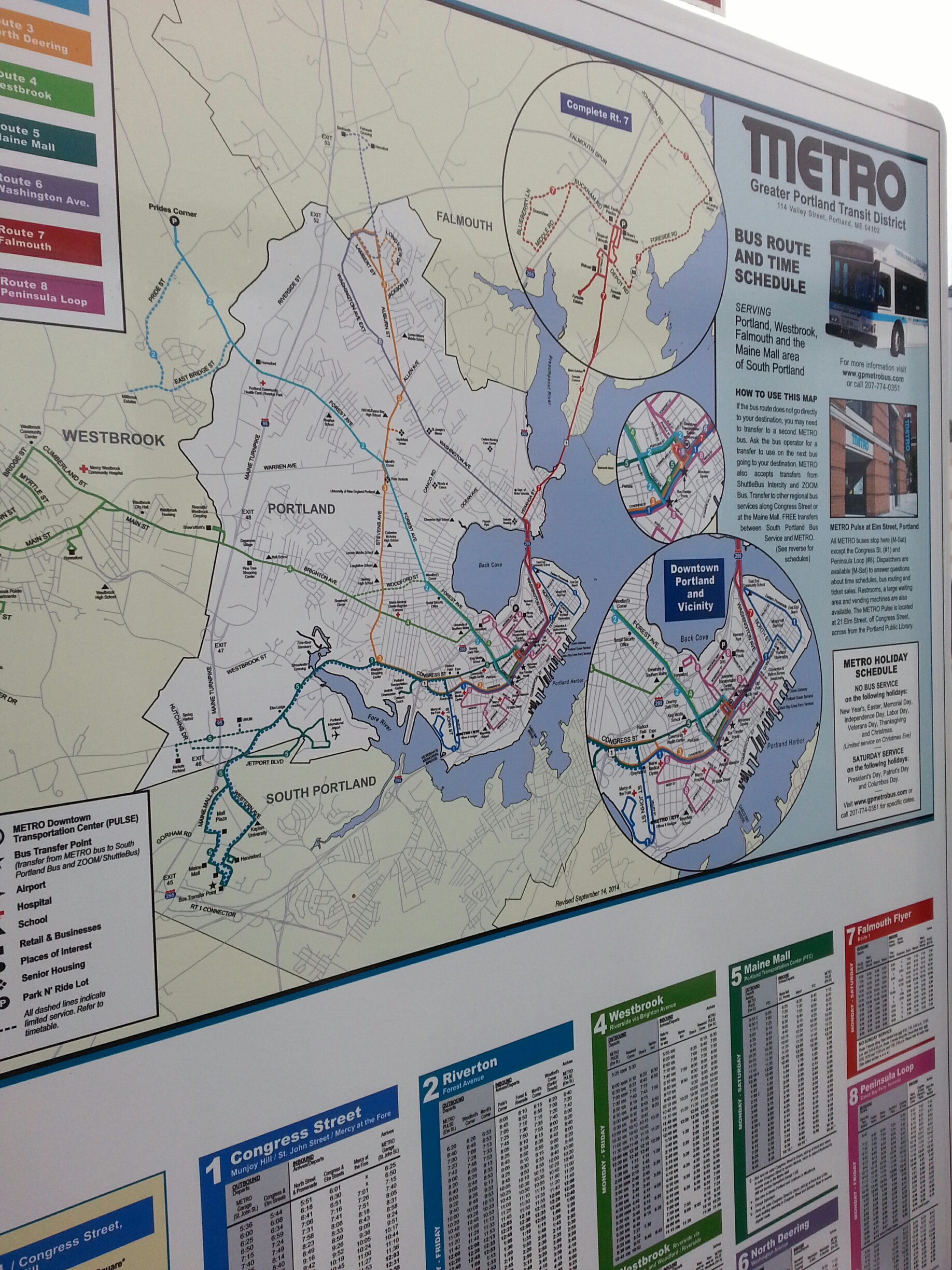
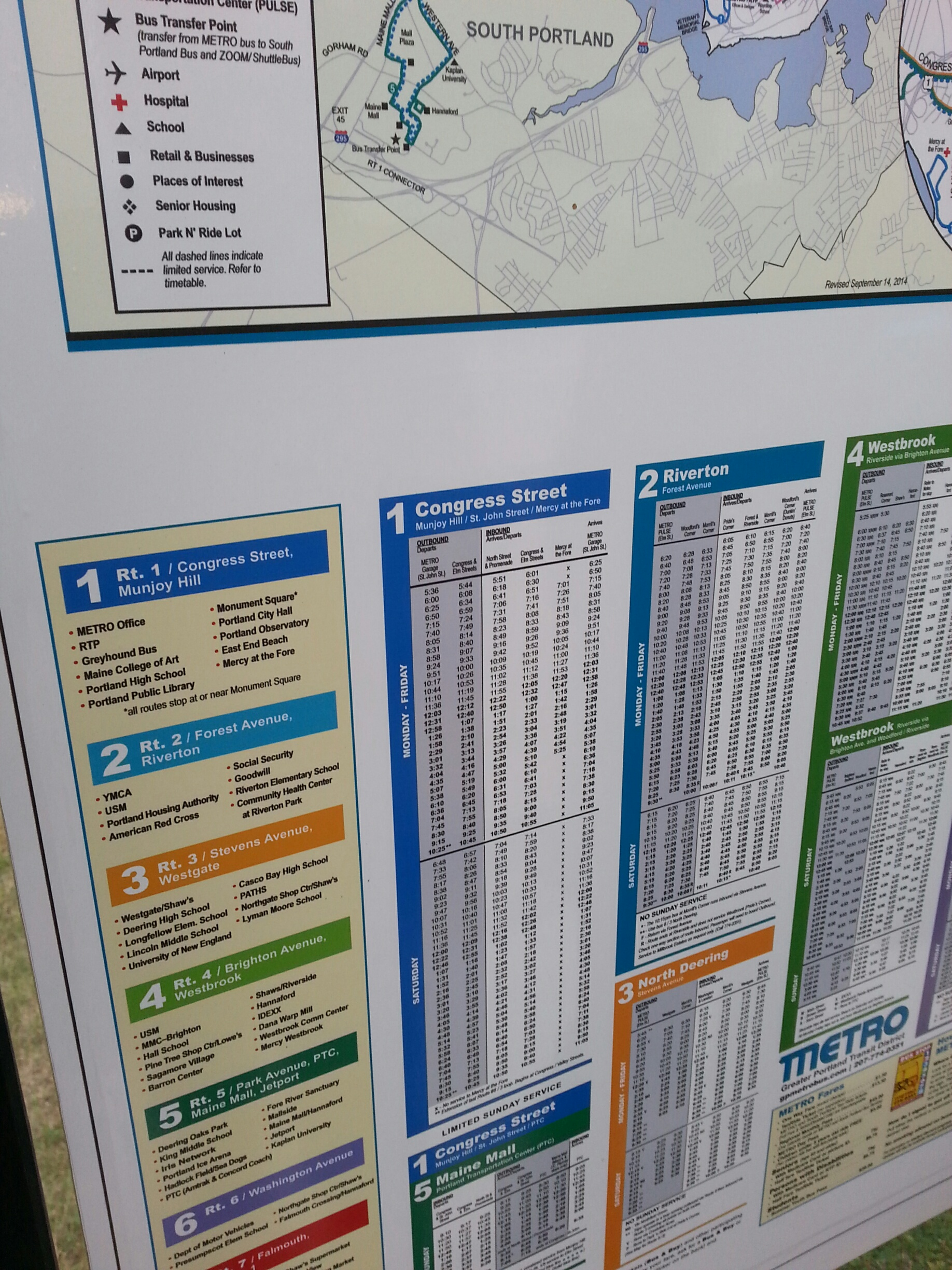
A phone application and coupled website designed to inform Portland residents of the flood warnings or storm surge events that could potentially occur in the city involves combining many different types of streaming data (weather data, emergency contact information, live updates on areas at risk, etc.) into one, smooth application and website. That being said, the application would have an offline component which would allow Portland residents to still examine the flood zones (of varying intensity based on the storm surge), emergency contact information, and areas of higher elevation within the city on their phones for times when electricity or cell phone service may be down. In addition to the application’s offline component, there should also be incredibly visible signage all across the city showing the same topography, flood zone, emergency contact information, and evacuation plans, so that those residents or tourists without access to the internet can also move to safety in the event of a flood in Portland. An ideal place for these signs and information would be at every bus stop.

The application would also be used as a way to connect emergency services and flood victims. The application could be used to either request emergency help or to let the emergency services know that specific residents are safe and healthy – this service would be especially important for the elderly and minor population as they may require more assistance in natural disasters. Additionally, this last component of this flood response application could serve for a way for more long distance family members to check up on the status of their family or request information as to whether they have been located by emergency services. As the emergency services personnel rescue or help individual residents, they could also use the app as an online message board or database for all individuals that have been found or are missing.


Literature review:

There have been many inquiries by the Portland City Council to obtain as much information as possible about which areas and infrastructures are most at risk from the incumbent sea-level rise. After a 1995 Environmental Protection Agency (EPA) report titled Anticipatory Planning for Sea-Level Rise Along the Coast of Maine, the City became more aware of the threats to their coastlines. The report compiled information from the Intergovernmental Panel on Climate Change (IPCC) from 1992 that stated that the international science community projects an accelerated rate of sea-level rise as a result of global climate change associated with the greenhouse effect. Similarly, the IPCC projects that there will be a global rise in sea-level in the range of 33-110 cm (1.08 – 3.61 ft) by the year 2100. The EPA report argues that the United States IPCC recommends that coastal zone managers, i.e. the Portland City Council, evaluate impacts on sea-level rise based on considerations of at least a 1.0 meter rise scenario for 2100 (EPA, 2014). Gordon Hamilton of University of Maine’s Climate Change Institute further supports the IPCC prediction of a 1m rise in sea-level by 2100 is supported by (Maine’s Coastline Program, 2007).

The EPA report also urges coastal communities in Maine to address the issue of flooding and sea-level rise now as there is a projected gradual onset of the issue, and there is time to make changes and an opportunity to avoid adverse impacts by acting now (EPA, 2014). The EPA moreover urges Maine’s coastal communities to seek “no regrets” strategies; no regret strategies are defined as strategies that the State will not regret implementing even if there is no acceleration in the rate of sea-level rise and strategies that recognize that sea-level rise is just one factor affecting coastal land loss (EPA, 2014). The report concludes by recommending that “the state should protect and strengthen the ability of natural systems to adjust to change in shoreline position” (11) and that “the state should prevent new development which is likely to interfere with the ability of natural systems to adjust to changes in shoreline position” (11).

There exist many other reports stemming from this initial EPA report (Anticipating Rising Seas from the Maine Coastal Program (2007) and the Waterfronts of Portland and South Portland Maine from the Urban Land Institute (2014)) and it is clear that the City Council is making the appropriate moves to prepare for sea-level rise in the future. Unfortunately, the council has yet to create any publically available response or evacuation plans.

The Maine Coastal Program report reiterates the same information as the EPA report did in 1995, but is more accessible and easily understandable, suggesting that its target audience was less scientific or political and more of a residential audience. The report emphasized the evidence of an increase in global temperatures and its contribution to more energy to the climate system in general. The report describes the stronger winds, larger waves, larger storm surges, and more erosion associated with a higher energy system. The report also warns residents of the economic impacts of such a shift in sea-level and its associated impacts in terms of the clamming and lobster industries along the coast of Maine (Maine Coastal Program, 2007).

As described by Stephen Dickson of the Maine Geological Survey, the increased energy within the weather system resulting from increasing global temperatures has a drastic effect on the intensity of weather events in coastal regions. He states that “storm surge from more intense weather systems could compound the damaging effects of sea-level rise” (1) and that coastal Maine is largely affected by Nor’easters, in which rapid changes in wind direction and currents combine to pile water along the coast and cause hefty erosion and flooding damage to coastal areas. According to Dickson, during such storm events, water levels could increase an additional 1 to 3 feet on top of the already rising sea-levels (Maine Coastal Program, 2007). Dickson and Peter Slovinsky, also of the Maine Geological Survey, argue that the densest population in Maine (York and Cumberland Counties) coincides with the most vulnerable coastal geology (sandy beaches, estuaries, and mud and cobble bluffs). The coastal regions of York and Cumberland County could experience potentially major economic such as declines in tourism and loss of taxable revenue after the loss or submersion of expensive waterfront homes (Maine Coastal Program, 2007). Dickson suggests that towns should adopt new measures that anticipate sea-level rise such as planning boards revising floodplain ordinances to raise the minimum height for building 3 feet over the existing 1-foot freeboard (Maine Coastal Program, 2007).

In their Resolution Supporting the Development of a Sea-Level Rise Adaptation Plan (2011), Portland City Council agreed to accept a 3-6 feet sea-level rise over the next 100 years which may cause permanent flooding in certain low elevation areas of the City. The council agreed that potential permanent flooding represents an economic, cultural, ecological, and public infrastructure loss to the City and that the Portland City Council supports the development of a sea-level rise adaptation plan (Portland City Council, 2011). That being said, I urge the City Council to explore the many different ways that a cell phone application and website can aid residents and their families during natural disasters.

There are many other instances of natural disasters where social media and technology have been used to aid or search for missing persons. More specifically, Twitter was arguable the most reliable source for live news updates and information for New York City, NY during Hurricane Sandy in 2012. Luckily, in New York, although millions of people lost power during the storm, individuals were still able to access the Internet on their mobile devices. Multiple different large media groups like Huffington Post and the news aggregator BuzzFeed experienced failing servers and therefore turned to Twitter and other social media to deliver information and reports about the storm. According to Twitter, people tweeted more that 20 million times about Hurricane Sandy from October 27th to November 1st and the most popular conversation on Twitter was about news and information, followed by photos and videos, then hopes and prayers for safety (Pew Research Journalism Project, 2012).

Additionally, after the earthquake in Turkey in 2011, Google launched a Person Finder app designed to help victims find missing loved ones. This project was first developed in response to the earthquake in Haiti in 2010 and has been deployed in several other disaster zones like Japan after their tsunami in 2011 since. The application was very simple and was created within a number of hours; users could either enter information on the person they were looking for or add information about people who are not already accounted for (Toor, 2014). It is this kind of combination between online, live news outlets (similar to Twitter during Hurricane Sandy in 2012) and a Person Finder app (similar to Google’s app during the earthquake in Turkey in 2011) that I think would be most beneficial for the City of Portland to develop for flood response.

In a 2013 article from the Bangor Daily News, titled Sea-level rise will wash away $46.4 million worth of Portland’s Commercial Street Properties by 2100, architects say, Seth Koenig describes the potential economic impacts of rising sea-levels and larger storm surges on Portland’s Commercial Street. He writes that nearly $33 million in flood damage will occur along Portland’s low-lying and high-traffic Commercial Street area by 2050 due to sea-level rise. According to the report released by local group, Portland Society for Architecture and analysis done by the consulting firm, Scarborough-based Catalysis Adaptation Partners, losses will actually amount to $111 million by 2100 resulting from sea-level rise. The $46.4 million dollar loss represents the specific land parcels that will be inundated by water on a daily basis resulting from high tides if no changes are made. These estimates are made specifically for Portland’s waterfront Commercial Street and Old Port, and do not take into account Back Cove or the city’s Bayside neighborhood which are also considered at high risk for sea-level rise and associated storm surges (Bangor Daily News, 2013).

Methods:

In order to understand the types of smart city solutions that Portland would most benefit from, I researched various smart city solutions that would benefit both already existing non-smart cities that are taking steps to become more ‘smart’ (i.e Portland, Maine or New York, New York) and already existing smart cities (i.e Songdo, South Korea). After this research, I executed a transect walk through Munjoy Hill in Portland, a Café Ethnography in Speckled Ax Café, and collected four mental maps from three residents and once commuter in Portland. After determining that a Flood Response application was most beneficial to Portland, I collected various sets of Portland age distribution data from U.S Census data off Social Explorer. I focused mainly on the elderly population (65+) and the minor population (18-) as they are both potentially the most at risk to both present flood risks and future flood risks as sea-levels are expected to rise over the next 85 years. I combined the U.S census data with multiple data layers such as elevation (topography), flood zones, and locations of hospitals and fire stations from the City of Portland in an effort to assess the riskiest locations in terms of flood risk over the next 85 years . The following maps are the maps created from these various data sources with the program QGIS.


As seen in figure 1, there are various areas that are particularly at risk to flooding in Portland. The areas that are especially at risk are the East Bayside and West End neighborhoods and the areas surrounding the Fore River, just south of the City. Furthermore, there are more areas in central Cumberland County, outside of the city of Portland, that also lay in flood zones. Additionally, the contours in figure 2 addresses the fact that other areas in and around Portland are also at risk as they sit at or below sea-level. The other areas that are of high risk to flooding are Back Cove and the area between Libbytown and West End. As seen in figure 3 (following page), the largest populations of elderly people exist in the more northern parts of Cumberland County and in Back Cove. As seen in figure 2 and 1, back cove is in a very low-lying area and therefore has a very high risk of flooding.


As seen in figure 4 (following page), there are fewer minors living in the coastal regions and there are higher minor populations living in the Northern regions of Cumberland County. Additionally, is a relatively large population of minors in East Bayside and Back Cove, both regions that are at a high risk of flooding within the coming decades.


As seen in the map in figure 5, the areas that are most heavily populated with elderly residents (Back Cove and the region just north of Back Cove) are also the same regions that lay below sea-level. Additionally, in figure 6 (below), the largest population of minors, in the more northern parts of Cumberland county, also coincide with the regions of the county that are most at risk for flooding and sea-level rise in the coming decades. In a hypothetical situation, if these current minors were to grow up and live their entire lives in these neighborhoods in Portland and Cumberland county, they theoretically would be part of the elderly population that is seriously at risk by the time climate change and sea-level rise sets in later in the century.

Reflections/Discussion:

As seen in the maps above, a large portion of Portland’s land sits at an elevation below sea-level. These low-lying areas have a current high flooding risk, even before sea-level rises. That being said, the flood zone areas that the City of Portland outlined in 2009 do not necessarily cover these regions. This could be for many different reasons – potentially the bedrock in these areas is impervious and therefore when inundated with water, the water quickly runs off to other regions of low elevation. That being said, I would suggest that the areas of elevation in Cumberland County that are below sea-level should be added to the flood zones. Additionally, there are fire stations that sit in the middle of low-elevation and flood zone regions. These locations are both potentially great and potentially horrendous ideas. On the one hand, the emergency services would be close to those residents in, but on the other hand, the stations and all of their equipment would also be flooded, making it difficult for the emergency services to do aid flood victims.

Moreover, there are large areas in Portland and the greater Cumberland County that run a high risk of flooding as they have such shallow topography and that also have large elderly populations, specifically Back Cove and the region just north of there. It is incredibly important that there are clear and visible signs in this region for evacuation routes and flood plans to regions of higher elevation and that there are easily accessible roadways for emergency services to aid these regions as well as hospitals. Perhaps large amounts of road signage may be considered extreme or expensive and therefore not worth it. I would argue that it will be worth it in the long run and I would further suggest that the City of Portland encouraging elderly residents to avoid living in the Back Cove, West End, or Fore River areas in an effort to avoid potential flood risks and hazards in the future.


Conclusion:

Though these plans seem premature as there is a relatively small risk of flooding in the next few years, having plans in place now will simply mean that the City of Portland is prepared in the coming decades when sea-level rise when flooding may become a problem. Additionally, one may argue that making such large policy changes to building distributions along the coast is detrimental to the current flow of the city and the city’s coastal economic activity, I would respond with an idea from Sorkin (1999) about the reciprocity within cities – “Cities are reciprocal, open and flexible ensembles and can continuously remold themselves through repeated social interactions”. If the City of Portland were to commit to this flood response plan and policy recommendation now, it would adapt and become a stronger, more prepared, and smarter city in the future.


Works Cited:


Fields, Desiree., Uffer, Sabina. “The Financialisation of Rental Housing: A Comparative Analysis of New York City and Berlin.” Urban Studies July 2014 (2014).


Graham, Mark. “Augmented Reality in Urban Places: Contested Content and the Duplicity of Code.” Transactions of the Insitute of British Geographers (2012).


Guskin, Emily., (2012) “Hurricane Sandy and Twitter.” In Pew Research Journalism Project: PEJ New Media Index.


Koenig, Seth. “Sea-Level Rise Will Wash Away $46.4 Million Worth of Portland’s Commercial Street Properties by 2100, Architects Say.” Bangor Daily News October 24th (2012).


City of Portland., GIS Data, 2014.


Coyne, J. R., Anton, J. M., Richards Waxman, D., Duson, J. C., (2011). Resolution Supporting the Development of a Sea-Level Rise Adaptation Plan. Portland City Council, July 18th.


Maine Coastal Program. “Anticipating Rising Seas.” Maine Coastline Winter (2007).


Simone, AbdouMaliq. “People as Infrastructure: Intersecting Fragments in Johannesburg.” The People, Place, and Space Reader (2004): 240-46.

Slovinsky, Peter. “Preparing Portland for the Potential Impacts of Sea Level Rise.” Maine Geological Survey (2011).


Sorkin, Michael. “Introduction: Traffic in Democracy “. The People, Place, and Space Reader (1999): 411-15.

Toor, Amar. (2011). “Google Launches Person Finder App Following Earthquake in Turkey.” www.engadget.com.

United States Environmental Protection Agency (EPA), (1995). Anticipatory Planning for Sea-Level Rise Along the Coast of Maine. In EPA (Ed.), Policy, Planning, and Evaluation.


Urban Land Institute. “Waterfronts of Portland and South Portland Maine.” In A ULA Advisory Services Panel Report, edited by James A. Mulligan. Washington, DC: Urban Land Institute, 2014.


U.S Census., Data, 2014


Route #1 Bus Stops in Portland, Maine

The data that I collected on the transect walk complimented the most beneficial smart city recommendation of a Transportation App that I found from the café ethnography and the 4 mental maps. Throughout the entire walk along the Route #1 Bus Line in Portland, Alex, Karl, and I only saw 2 route #1 busses. This suggests to me that the busses do not stick to schedule particularly well and that there is no simple or quick way to tell whether a bus will show up or not. In addition, the bus stops are just small yellow signs and it was particularly hard to tell where they were sometimes. Furthermore, when looking at the Portland Bus Routes map, there is no information about where the stops actually are, so unless the passenger already knows where the stops are near their desired location, it is kind of a guessing game that makes using public transportation particularly hard for visiting tourists. Oddly enough, Google Maps contains the information about bus route stops but the public maps in Portland do not. That being said, I think that it would be incredibly beneficial for Portland to firstly create more obvious bus stops and provide more information about where they are located. Secondly, I think that Portland should provide more information about the scheduling and wait times for the buses on each route, as they are often unreliable and late. As discussed in some previous posts, this information could all be incorporated into a public transportation application that residents could check on their computers or phones to see as to what the bus schedules are, how long the delays are for, and where the specific stops are.

20141019_161210_resized
Pictures of the only information available on the #1 Bus route available at one stop on the route

20141019_161213_resized

Portland City Metro Map of Bus Route #1

Screen Shot 2014-10-26 at 6.34.40 PM

Google Map of Portland City Bus Route #1 – does not show exact route but shows where the stops are (if you hover your mouse over the bus stop symbols then a window pops up describing which Metro Routes stop there)

Screen Shot 2014-10-26 at 6.37.47 PM


Transect Walk along public bus Route #1 – took account of the locations of all bus stops and Route #1 busses that we saw

  1. 206 Congress Street
  2. Congress & Kellog
  3. Congress & North
  4. Congress & Lafayette
  5. Atlantic and Monument
  6. 27 on Atlantic Street
  7. Vesper & Eastern Promenade
  8. 126 Eastern Promenade
  9. 182 Eastern Promenade
  10. Turner & Eastern Promenade
  11. 304 Eastern Promenade
  12. East End Community School & North Street
  13. 143 North Street
  14. North Street & Quebec Street
  15. Cumberland & North Street

Speckled Ax Cafe Ethnography & Mental Maps

From hearing about the lives and policy recommendations from these four Portland residents, I definitely have a different opinion about what the ideal smart city recommendations would be to improve the quality of life and economic sustainability of Portland. I think I was more focused on the larger picture earlier in the semester; I was thinking more about large scale, complicated technological improvements to the city whereas the residents definitely suggested more small-scale improvements such as improvements in public transportation, flood management, and educational opportunities. This disconnect likely results from the fact that we are, as individual researchers living outside the city, dealing with a small pool of samples and have inherently different ideas about the efficiency of the city than local Portland residents do.

This disconnect further brings into light the question as to whether one can make policy or smart city recommendations to Portland while not actually living in Portland – do we understand and know enough about the way that the city ecosystem works to create thoughtful, personalized recommendations for that specific city or are we more qualified to simply talk about and create smart city recommendations for a city in general? Because of this disengagement, I do think that it is very important for us as removed participants to take into consideration more of what the residents recommend than what we ourselves believe. That being said, perhaps it takes a certain amount of distance away from the city in order to fully see its moving parts and the different aspects that can be improved. As one of my participants mentioned, it is difficult to think and move outside of the status quo – it is hard to remove yourself from the whole city and its moving parts to really think about what can be done for the city.

After speaking with these residents, the transect walk, and executing the café ethnography, I would likely say that improvements in public transportation is the most beneficial and feasible smart city solution to most Portland residents and the city as a whole because it is very simple, and therefore easily executed, and would benefit the most people. If Portland could develop a transportation app for mobile devices and computers, residents and would be more likely to use and rely the public transportation system because they would be more educated about what it has to offer and the types of delays that would occur while they are trying to use it – in turn improving their quality of life. Moreover, a transportation app would help the city in terms of being more ecofriendly and economic stability because more residents would choose to use the bus as opposed to drive their own cars around.

20141026_164906

  1.  Ayriel – Woman, 24, [email protected]
  • Worked at a corner convenience store – “School is not a priority”
  • She focused more on the social aspects of the city when drawing her mental map – food, bars, work etc.
  • Talked a little about the gentrification of Munjoy Hill and how it was affecting the locals – not necessarily as a good or bad thing, just different than what she remembers from before.
  • She had lived in Portland for two years – was originally from Boston but came to Portland when she was 22.
  • She gave 2 policy recommendations – firstly, she said that it would be incredibly helpful if there was a phone application that told residents transport schedules/delays and social events that were going on in the city. The second recommendation was that there should be a ‘buffer zone’ for Planned Parenthood – she mentioned that there were religions groups protesting daily outside the clinic and that it made accessing the location and services, and feeling good about accessing the services, really difficult.

20141026_165300

  1. Woman, 22, from Canada but moved to Portland 2 years ago after living in Massachusetts, New Hampshire, and California throughout her life.
  • Worked in a Laundromat
  • She said that she enjoyed South Portland, or “SoPo”, but that the local changes in building and gentrification were making her a little sad. She mentioned that one of her favorite buildings had just been demolished and turned into a parking lot.
  • She attended Southern Maine Community College while working at the Laundromat
  • Her recommendation for Portland was that there needed to be better help for the homeless and more education for Portland’s youth through public campaigns and rallies.

20141026_163729

  1. Woman, 50 years old, very wise
  • Has worked at Portland Whole Foods and Lived in Portland since 1995, previously lived all over the east coast – mentioned New Hampshire, Massachusetts, and New York City.
  • When I asked her about her opinion of living in Portland, she told me that she and her husband, along with two children, one with autism and one with Asperger’s syndrome, actively moved around and researched the best places to live on the east coast. They decided Portland because of the small size, Portland’s great schooling system and the city’s very local and organic way of life.
  • She complained about a lot of things – but she was just this type of lady – specifically, that there was incredibly bad high speed interned. She also mentioned that the perception of what the city of Portland does for their residents is not up to par – that she knows and understands that Portland does SO much for their residents in terms of quality of life and schooling, but that residents need to complain less and to be more appreciative of what the city does for them. She said that she had hoped that people in the city would stop just following the status quo – that they need to break out from just going through the motions of living and be more appreciated (I think this may have been because she has been through a lot and was pretty stressed out about her children). She said that she thinks the city would benefit from a more educational campaign that enlightened Portland’s residents about what the city offers and the services that they may not know about already.
  • She said that her husband was a musician and that they were mostly self-sustaining and local in terms of what they eat and do at home. I asked her if she liked to go to restaurants or any specific shops and she said that they did not really go out much because money was tight. She also said that she has been a florist all her life, that she had started when she was a teenager, and that Whole Foods knew how good she was and they tried to recruit her to work for them a long time before the family moved to Portland. She said that she finally caved and started working for them after finishing two years of homeschooling her kids in the 90s. Now they are both in main stream schools in Portland and doing really well. We talked about boarding schools because she was asking me about my life and she said that her husband and his family came from a lot of money and that he went to boarding school and Boston College and that their family owns a lot of vacation homes at Cape Elizabeth, ME but that they did not own one.
  • She was an incredibly interesting woman.

20141026_232019_resized

  1. Bernie, male, 21
  • Commutes to Portland from Brunswick, has lived in Brunswick since 2011 but has worked in Portland since May 2014
  • Originally from Florida
  • Recommendations: Bernie loved the hills in Portland – he said that he would love to see more hills and differences in heights of the buildings in Portland to add more of a city feel.  He also suggested more parking and better flood management.  I assume he recommended improvements in parking and flood management because he commutes to Portland for work, as opposed to living in the city full time.


Speckled Ax

5468605
I sat on the bench side of the table closest to the bar

1:13pm:

  • Everyone seems to be working really hard – there are some conversations going on but it is really hard to tell what people are saying
  • The room sort of smells like coffee – but it is a very acidic non-coffee smell.
  • When I asked them for a large coffee they asked me whether I had a preference as to which coffee I wanted. Obviously I had no idea. They chose well.
  • Beatles are playing in the background
  • A really stylish family just walked in and was semi irritated that there was no available table to sit at while they enjoyed their iced coffees.
  • A creepy guy just walked in with red Red Sox sweatpants
  • Constant sounds of typing.
food_ax_main
http://portland.thephoenix.com/food/143736-purists-push-coffee-to-its-limits/


1:23 pm:

  • A whole load of people just walked in and met up with friends that were already sitting inside
  • It just got a lot louder in here and everyone else is kind of annoyed that they are being disturbed
  • I do not think these guys are from Portland
    • They are part of a show – something memoirs.
  • These people take their jobs very seriously
  • There is a mix of people that are clearly just here for the day to do work and groups of people that are in the middle of doing things and are just swinging by for coffee.
  • There is an adorable older couple sitting across from me holding hands from across the table and just watching everything that is going on around them while giggling to each other about their own conversation. They are drinking lattes – old people always drink lattes!

1:33 pm:

  • There is a really long line but somehow the café is still relatively calm and quiet
  • I am beginning to think that I have already drank too much coffee and I have only been here for 20 minutes
  • It is really sunny outside
  • There is a ton of clanking and bashing going on from behind the counter
  • A band of teenagers just walked in wearing beanies and skinny jeans
    • I bet they are all art students
    • I think they are all judging me for buying and drinking out of a plastic Poland springs water bottle – I am killing the planet obviously.
  • One of the employees dropped something on the floor – this is the second time he has done this in the past twenty minutes.
speckled-axe-coffee-shop
tripadvisor.com

1:43 pm:

  • I definitely have drunk way too much coffee.
  • A lady just walked in and sat down without buying a drink – she must be meeting someone.
  • Everyone’s shoes are making very squeaky sounds as they walk on the hard wood flooring
  • There is a dude behind the counter with longer hair than me and it looks awesome.
  • My legs have gone numb from sitting in the same place for half an hour
  • The music has changed to classic rock and the baristas are having a very vibrant conversation about scheduling hours for the following week.


coffee-if-you-re-not-shaking-you-need-another-cup-funny-poster

1:53 pm:

  • The same couple as before that were drinking lattes and holding hands are now hotly debating something and using huge hand gestures.
  • The other lady still has not ordered a drink and is just sitting there on her phone. Unless she has the wifi password from a previous visit, she must just be taking repeated selfies.
  • Various sounds of coffee machines on repeat in the background
  • Some girl doing work in the corner booth starts complaining about being a first year teacher.
  • One of the baristas is talking about what he did on Friday night.
  • There are loads of cars parked in the street outside – it is a busy day.


2:03 pm:

  • There is a small line in the shop and some people have left from before and their seats are immediately filled with new customers.
  • Everyone seems to be ordering cappuccinos – I wonder if the cappuccinos here are amazing….speckledax
  • So many hipsters – ordering Ethiopian coffee…
    • There are a lot of nose rings.
  • I feel like I am in a city – I did not feel like it before but I definitely do now. Why do hipsters do this to me?
hipster-humor-580x870
some hipster humor courtesy of streetloop.com


2:13 pm:

  • A girl literally walked in a saw that there were no seats available and walked straight back out again haha
  • It seems quieter in here now that it was an hour ago – more people though
  • There is a man drawing pictures on graph paper next to me – when the barista brought him his drink he refereed to her by name which makes me think that he comes here frequently
  • That lady on her phone without any wifi still has not bought a coffee which just makes me think that she just does not want to be outside in the cold or wants to nap on the Speckled Ax’s wooden tables.
  • There is a new couple sitting in the same seats as where the older couple were sitting earlier – this couple are having a pretty vibrant conversation but their faces are like six inches away from each other. She is leaning over the entire table and is practically on his side of the table and he leans in too. So adorable. They are probably late thirties.
  • I cannot tell if anyone has realized that I am just watching them all and have been for the past hour…..

2:23 pm:

  • Someone left the door open when they went outside and now it is freezing in here
  • We can hear the sounds from outside now – lots of cars and sounds of wind.
  • A guy who was sitting down before we even arrived just got up and left
  • Another creepy guy with his hood up and huge headphones on sat down immediately in his place
  • This chick on her phone is still on her phone and still has not ordered anything to drink. I can see a dunkin doughnuts cup in her purse – what is going on?
  • The room smells a little like pizza now that the door is open.


2:33 pm:

  • A new younger couple sad down in the old and older couple’s table. They are definitely students and are obsessed with each other. It is adorable. I will now be referring to that table as the love nest.
  • The room now smells like cigarettes because the door is still open. Thank god the owner just closed it! Twas getting very cold in here.
  • The love nest is getting rowdy.
  • Lady on her phone still has not looked up apart from a barista asked her if she had ordered a coffee he was meant to deliver to a different customer. She said no.
  • The music is a little louder than before.
  • The guy sitting next to me is still drawing on graph paper.

2:43 pm:

  • Say you love me by Jessie ware is the best song ever
  • The café seems relatively quiet now
  • The lovers nest is now empty
  • The weird lady is still on her phone doing nothing
  • I am seriously starting to worry as to whether anyone in here knows that there are three students stalking them for two and a half hours this afternoon


2:53 pm:

  • A new pair of people walked in and walked straight back out again because the seating that was available clearly was not good enough for them
  • The weird lady is still on her cell phone and has only looked up once in the past hour
  • The music is a little more mellow than it was earlier
  • Everyone seems to be busy doing work
  • A lady just walked in with a push chair and a child who seems like they are on the verge of tears… maybe they do not dig the music.
  • A man is still drawing maps on graph paper in the booth next to me
  • The baby is now crying and she is walking him outside of the café

3:03 pm:

  • The weird lady is still here and still has not ordered anything – I cant tell if she was napping or if she is still waiting for someone
    • OMG she just got up – and she sat down again. Perhaps she was just stretching.
  • There are really loud banging noises coming from behind the counter again
  • The café is mostly filled with individuals doing work – there is only one pair of people, likely a couple, sitting and actually talking to each other
  • One of my favorite songs just came on the radio – Semi-Charmed Kind of Life J


3:13 pm:

  • The people working behind the counter are having a very vivacious conversation about something – lots of laughs
  • The weird lady is still sitting and on her phone – she just left. After sitting here for two hours and not ordering anything.
  • The man next to me is still drawing on graphing paper
  • This playlist is killing it – they are now playing Jumper by third eye blind. So angsty.
  • The baristas are talking about how expensive bowing shoes are
  • I just realized that they only have one bathroom which kind of freaks me out
  • I really like the lighting in the room – the ambiance is stellar.
  • The baristas are now talking about how bowling balls fit on your fingers with one customer sitting at the bar. It is a little strange. Now talking about local candlepin bowling leagues.
  • The map man next to me finally finishes his definitely cold cappuccino after an hour and a half.
  • I start to ponder what would happen if we all get Ebola?
  • Some hipster just walked in with a skateboard and skinny jeans.


3:23 pm:

  • Two girls just walked in – they are in their mid twenties and are very loud/happy
  • A couple just left the booth at the end
  • Baristas are flirting with the two girls that walked in
    • Maybe they already know each other

Concrete Jungles

“It is neither a right to infrastructure, nor an infrastructure made right. Rather, the right to infrastructure allows us to escape the human-nonhuman and epistemology-ontology dichotomies altogether by opening up the agential work of infrastructures as a source or possibilities in their own right.” (Jiminez, 343)

Infrastructure subtly dictates all aspects of individuals’ or vehicles’ movement within a city. Not only does infrastructure physically organize the city in a way that forces traffic to flow in a specific pattern, infrastructure has the capacity to completely command the way that people think about their own movement within a city. This idea of a city’s infrastructure defining the way that we live connects to the broader idea in Jiminez that we, as a city, have the right to produce infrastructure and that infrastructure has the right to produce us by altering the decisions we make.[1]

In fueling life within the city, the local electrical is potentially one of the most important parts of a City’s infrastructure as it invisibly connects everyone. In smart cities, the electrical grid, and ones open-access to the grid, create opportunities for residents to be engaged and interacting with its many powerful components. I think the type of infrastructure that would be most useful in a smart city would be an interactive, multi-dimensional electrical grid that uses not only typical sources of power like coal or gas, but also more green energy options like wind turbines, solar energy, or hydropower. In addition, I think it would be incredibly beneficial and efficient if homeowners had all-day access to information about the type and amount of energy their homes and navigation around the city uses from the central grid. By incorporating green into the smart city’s central grid, the city would reduce its harmful impacts by reducing carbon emissions into the atmosphere but also would potentially reduce its energy consumption if residents knew the ramifications of their immediate actions. Having green initiatives would also make transitioning from fossil fuels to other forms of renewable energy easier in the future.

In order for the green energy to have the largest effect on reducing a city’s energy consumption, there would need to be a very individualized and open approach to how data is transported back to the consumer. This open approach should not be a problem in smart cities – everyone is connected to technology and the grid at all times through mobile devices or mainstream computer systems, and therefore this concept of remotely controlling one’s consumption is definitely conceivable within a smart city. Residents would indeed be a part of the infrastructure (similar to ideas described in Simone) as they would be able to control the heating and electricity within their homes from a remote location and in addition, residents could use this Grid App on their phones or computers to request maintenance or help at any time. Some countries like England are already hopping on the remote controlled home heating bandwagon – http://www.britishgas.co.uk/products-and-services/hive-active-heating.html . This type of green innovations would benefit the common good most as they reduce our long-term impacts on the environment and force homeowners to be more conscientious of their (sometimes unnecessary) energy consumption.

Though I think that Portland would seriously benefit from having this hi-tech and efficient energy grid system, I do not think that it would be the most beneficial thing for the city as a whole because Portland residents may not yet have access to smart technology in order to fully utilize the system (because Portland is not yet a fully smart city). I think that the most beneficial infrastructure change for Portland would be taller buildings within the center of the city. I really liked the ideas we discussed about Times Square in New York City from Sorkin. According to Sorkin and our class discussion, the height of architecture can seriously change the way that people think about and navigate a city.[2] If Portland added some taller buildings, it would make the city seem larger, and therefore easier to get lost or be fully immersed in.

In addition to taller buildings, having one street that was closed down (or closed down on one night each week like they do in Hamilton, Bermuda every wednesday night http://www.bermuda.com/media/5360795/choc-harbnitefullpgadrg2014.pdf ) would likely have an exciting effect on the nightlife and the use of public space within Portland. This type of area would be great for tourists and local businesses and it would probably not have that large of an effect on traffic and flow patterns because Portland is a relatively small city. Even if it did affect the flow of the city, as described in Sorkin, cities are reciprocal, open and flexible ensembles and can continuously remold themselves through repeated social interactions.[3] This all being said, if the city were to commit to this much open space, they would have to stick to their current ground hierarchy of pedestrians, bikes, busses, then cars as opposed to the opposite experienced in New York City.[2]

[1] Jiminez, Alberto Corsin. “The Right to Infrastructure: A Prototype for Open Source Urbanism.” Environmental Planning D: Society and Space 32 (2014): 342-62.

[2] Sorkin, Michael. “Introduction: Traffic in Democracy “. The People, Place, and Space Reader (1999): 411-15.

[3] Simone, AbdouMaliq. “People as Infrastructure: Intersecting Fragments in Johannesburg.” The People, Place, and Space Reader (2004): 240-46.

Potential Opportunities for Financialisation in New Smart Cities

In the present day, a smart city is inherently exclusive. In order to take advantage of all of the opportunities and services that the smart city offers, one needs to have a certain (high) level of personal technological capital and a very specific, technologically driven thought process behind one’s everyday decisions. Moreover the types of financialisation described in Desiree Fields & Sabina Uffer’s article The financialisation of rental housing: A comparative analysis of New York City and Berlin further paints a picture of an exclusive city as only very specific socioeconomic groups can thrive after financialisation[1]. As Fields and Uffer describe, once large, global financial institutions take over large housing complexes within a city, the companies, acting as risk-oriented entrepreneurs/investors (not landlords), strive for an incredibly selfish level of profit-driven efficiency.  Global corporations do this through reducing maintenance and housing upkeep (and therefore expenses), driving residents out of their homes, using government-issued vacancy bonuses to implement major capital improvements (thereby repositioning under-market units within the economy), and consequently releasing untapped value and profits[1]. Though financialisation and urban pioneering are detrimental to a city’s social diversity and culture, it is very efficient in the economic and technological sense while being used “as a preemptive justification for a new urban future.”[2]

One potential way to make the smart city more inclusive to people of all socioeconomic backgrounds would be to implement a technology like that described in Crowley et al. (2014). A smart city filled with sensors that monitor energy usage could be an incredibly cost-effective way of monitoring costs in a building and therefore theoretically, could make the smart city more accessible to people of all socioeconomic backgrounds.[3] The only problem with this logic is that it likely requires the technology and more cost effective living to be established first and then for low-income families to more in after.

Because smart cities are more focused on efficiency, perhaps financialisation could actually benefit smart cities.  As we have discussed in class, smart cities can be build on any location from scratch and therefore the financialisation of a new smart city could have less negative externalities. Financialisation occurring in a new smart city would reduce the negative externalities (compared to financialisation of a normal city) because there are no residents to displace with red-lining, there is no existing city culture to destroy, and the social dynamic does not even exist yet. Financialisation would simply amplify the smart city’s exclusivity (which could potentially be what some smart city residents and governments are striving for).

That being said, financialisation is likely not the correct technique for creating housing that most benefits the common good. In order to maximize the public benefit or public good of city housing, the city’s government cannot give up control over the city’s public housing as the government will no longer be capable of improving social welfare or supporting domestic business through housing policies and pricing.[1] Governments cannot simply be focused on increasing their income; they have to focus on keeping their residents happy and the city running smoothly. The city’s government must focus on the physical needs, safety, security, social needs, esteem, and self-actualization of its residents. As described in Fields and Uffer (2014), city governments “need to find a way to forge critical urban politics of finance focused on common welfare rather than short-term objectives of growth and competition” (13)[1].

With this in mind, I think that the ideal housing situation to most benefit the common good would be a wide variety of different types of housing all mixed together in one city, while still keeping already existing neighborhoods alive. As described earlier, it is incredibly important to keep enough government-regulated housing to ensure all socioeconomic groups and cultures can afford to live within the city.   With enough government rent-regulated housing, the idea of a New Frontier and Urban Pioneering as “idyllic yet also dangerous, romantic but also ruthless” (Smith) begins to change. Cities reduce the risk of forcing large groups and social diversity out of the city and avoid failing to cope with its homeless (New York City as described in Smith) while still gaining the positive sides of gentrification such as improvements in infrastructure, public space, and quality of life.

I think the best types of housing for Portland would be a combination of coops, larger apartment buildings, and government regulated housing.   I think coops would benefit Portland because coops encourage all residents to invest in the continued quality of their own buildings, therefore avoiding the infrastructure problems described previously with financialisation and furthermore nurturing a mini-community that can potentially contribute to Portland’s culture as a whole. That being said, specific individuals living in a coop could potentially be less likely to take care of their own apartment’s infrastructure because they know the cost will be spread across the entire building for large maintenance repairs. Because coops have the potential to create these perverse incentives, I think it is really important to have regular (local land lord owned, not financialised) apartment buildings and government regulated housing as well.


[1] Fields, Desiree., Uffer, Sabina. “The Financialisation of Rental Housing: A Comparative Analysis of New York City and Berlin.” Urban Studies July 2014 (2014).

[2] Smith, Neil. “Class Struggle on Avenue B: Lower East Side as Wild Wild West.” The People, Place, ad Space Reader (1996).

[3] Crowley, David N., Curry, Edward., Breslin, John G. “Leveraging Social Media and Iot to Bootstrap Smart Environments.” Studies in Computational Intelligence (2014).

Parks and Recreation

As mentioned in class earlier this week, the privatization of public spaces within cities can work wonders for a space’s infrastructure, and therefore  popularity. Corporations invest large sums of their capital in public space projects in an effort to either improve or reaffirm their positive company image while the public is given the opportunity to enjoy the new space that they create. Moreover, if residents see that a well-respected and influential corporation sponsors a large-city large public space, they are likely to assume that it is monitored and more secure than a non-privatized public space in a large city, and therefore residents may be even more likely to utilize the public space. That being said, having the corporation’s logos all over a park or pavilion in the center of Portland, Maine may not be the best addition to a small-city for residents to benefit most from their somewhat limited public space. Because Portland’s atmosphere may not be able to cope with that much aggressive advertising, I think finding a way to make a place not only safe, but also feel safe, is arguably the most important priority for Portland in terms of creating Public Space. “The city is the place where difference lives” (Mitchell, 193)[1] and in turn it is inherently more difficult for larger cities to create this kind of safe public space simply because there are more ‘differences’ to account for than there are in a smaller city like Portland.

“Such an association of public space with anarchy is, of course, not new; it is not just a feature of the contemporary city, of the current media-encouraged, overweening concern about crime, homelessness, and random terrorism that makes public space seem such an undesirable attribute of the contemporary American city” (Mitchell, 192) [1]. I definitely agree with the points that Mitchell describes about the contemporary city and fear of anarchy – that being said, a smart city is not necessarily the ‘contemporary city’ quite yet as very few cities are currently deemed ‘smart’. A smart city is the most ideal, efficient, and technologically driven city – a city where people trust technology enough to know that they will not be mugged in the middle of a park on the way home because everywhere is under constant surveillance.  I think the types of public spaces that would be most useful in a smart city would be large, green, flowing parks filled with trees, hills, and free Wi-Fi where the city’s residents can enter the park and get lost for an afternoon (similar to Central Park, NY) while knowing they are safe.

The types of public spaces that I would recommend most for Portland would be a large open park, with elements that make the area entertaining to a wide range of ages and socioeconomic backgrounds. In order for the public space to contribute to the public good, I think that it would have to contain different aspects of Portland’s culture and past like local art or a central historical monument. The park would have a large area of movable seating (with cushions!), free Wi-Fi, food trucks, large lamp posts, a playground area for children, tall bushy trees, various different forms of public art, large winding paths for athletes, areas of shade, message boards with city announcements and event advertising, a public garden, and more importantly, a pavilion with multiple different levels (creating seating and more private areas for smaller groups of people). The park could even have an ice rink in the winter to make it more of a year round public space.

The ideal public space would feel very private, as if its visitors are obviously safe because they can see what is going on in the entire park while still being separated from all of the park’s moving parts. This type of public space would cover the majority of Low’s 5 qualities of public space – freedom of access, freedom of action, freedom of claim, freedom of change, and freedom of ownership – while avoiding the fear typically associated with public spaces [2]. In addition, I think it would be beneficial to have one or two subtle security cameras within the park just so that the visitors have the reaffirmation that they are indeed safe.


Works Cited:

  1. Mitchell, Don. “To Go Again to Hyde Park: Public Space, Rights, and Social Justice.” The People, Place, ad Space Reader (2003).
  2. Low, Setha. M. “Spaces of Reflection, Recovery, and Resistance: Reimagining the Postindustrial Plaza.” After the World Trade Center – Rethinking New York (2002).

Free public WiFi and its Widespread Effects

  1. Free Public Wifi
  2. Public festivals (i.e food or music)/events/markets) all organized into a social app with information about each event. This could be connected to advertisement on social media and would likely help with community involvement in said events. It seems as if an incredible amount of effort goes into planning and acquiring the right permissions/permits for these types of large public events (especially if they require part of the city to shut down for the day like the annual Marathon or the Veteran’s Day Parade) from what I read in the minutes of the city council meeting from September 15th, 2014[1], therefore it also seems only fair if the public events are also well advertised and the most people are aware and able to participate. A social event app would also improve community integration an involvement.
  3. Improvements in Public Transportation – an application that shows schedules and updates on delays or changes due to weather. Moreover, for improvements to summertime transportation/new innovative ways to explore the city could be explored by installing public rental bicycles (i.e like they did in Washington, DC and many other cities – (http://www.capitalbikeshare.com/how-it-works )). These programs also create very large data sets about where people travel by showing where people pick up and drop off bikes, and therefore the program data would be pretty interesting and relevant for improving tourism and other aspects of infrastructure and public space in Portland. Moreover, we all definitely found the geographical divides within the city quite surprising and relevant because the divides definitely affect each resident’s sense of place. If it were easier to navigate the city with improved transportation, then residents and tourists would likely be more aware of the different divides and possibly make more of an effort to transport them (while stimulating the economy and having a fantastic time on a bike!).
  4. Improved public seating/awareness for the homeless – this website (http://www.fastcoexist.com/3032631/these-park-benches-welcome-the-homeless-instead-of-rejecting-them) is really cool and has information on a bench that can transform into a shelter at night for anyone in need (and is therefore seasonal because it would only work in the warmer months). Moreover it would help promote improvements in social, and more importantly economic justice to those that do not have access to shelter or support. These benches would furthermore improve awareness and education about homelessness within Portland.
  5. A campaign promoting the investments and improvements that the Portland city council is in the process of executing or plan to execute in the future. Portland could potentially model the campaign off of the campaign in Newcastle, England that aims to improve the community involvement and city housing/infrastructure by involving local artists and engineers to renovate empty or abandoned buildings: http://renewnewcastle.org/about Moreover, this idea connects back to Greenfield: “ as Deluze defines it, any-space whatever is never important for any quality of its own but only for the connections it facilitates of brings into being. In the Particular case of the smart cities, the important linkages are not physical but those made between ideas, technical systems and practices” (21)[2]. I think that if residents are more aware of the effort that goes into city planning or improvements in infrastructure, they will be more appreciative and more likely to benefit from the changes that they may not even know are happening.

Free Public Wi-Fi:  Access to free public Wi-Fi would be huge for Portland – it would help with not only with navigation for both locals and tourists, but it would also immensely help with anyone trying to find out information about job applications, events, and even advertising. Free public Wi-Fi also connects back to the postcolonial theory of knowledge being the “coin of the realm” and the idea that everyone could have access to unlimited information.  People who do not like coffee (how?) would be able to use free Wi-Fi without having to go to a coffee shop! It would be anarchy.

Though public Wi-Fi would be incredibly helpful, it still bars a significant portion of the population from using the public service – i.e. people with dumbphones (not smartphones) or people without laptops. One could also argue that even if everyone had access to free public Wi-Fi, they would still not necessarily utilize it. Moreover, I do think that it is still incredibly important to have areas where people can still get away from technology (like parks or on the waterfront) because sometimes people want to be off the grid for a few minutes (or an afternoon) and get away from their jobs or the city while still being in a park in the city (momentarily). Greenfield writes “every technological intervention that is made with the intention of smoothing out urban experience also deprives us of an opportunity to encounter something external to our own will, and doing so robs us of a moment in which we might reflect on the contingency of our own values, choices and beliefs. Though by no means can this be said of every daily hassle, in other words, some things that appear to be sources of friction actually wind up doing meaningful work for us, as individuals and communities both” (51)[3].

That all being said, there are plenty of ways to escape technology within a city (turning your phone off) and there are plenty of areas to do that in Portland. Having free public Wi-Fi would encourage both tourists and residents to congregate in and use currently ignored public space outside while also making accessing all of the other services that Portland provides (any kind of update, news, or app) to be more accessible also. Consequentially, free public Wi-Fi could improve all aspects of information dissemination and public involvement/awareness within a small city like Portland.


[1] Brennan, Michael, Donoghue, Kevin, Marshal, David, Suslovic, Edward, Leeman, Cheryl. “Agenda Regular City Council Meeting September 15, 2014.” edited by Portland City Council. Portland. Me, 2014.

[2] Greenfield, Adam. Against the Smart City. 2013.

[3] Greenfield, Adam. Against the Smart City. 2013.

For the City? Motivations Behind Allocations of Major Resources within Planning for City Infrastructure

As a double major in Earth an Oceanographic Science and Economics, I think that I would benefit most from taking part in the research group for infrastructure as it pertains most to the subjects that I have studied in my past years at Bowdoin.  I am particularly intrigued by the active decisions that local governments and city councils make about the distribution of both monetary and physical resources and the motivations behind these important allocation decisions.  Are the decisions motivated by local environmental issues, improvements in efficiency or quality of life of a city’s residents, or are decisions simply made based on most lucrative outcome?  Or is the motivation a combination of these reasons and more? Studying the infrastructure of a smaller city like Portland would begin to answer these questions.

In the article titled Claiming Urban Landscapes as Public History, Hayden states that “all of these different kinds of private and public planning activities and public works have a social as well as technological history.  People fight for and against them.  People also construct and maintain them.”  This quote struck a chord with my interest in motivations behind planning decisions because clearly if  “people fight for and against [the private and public planning activities],” then they either wholeheartedly agree or disagree with the meaning of the project or motivation behind the proposed infrastructure; this controversial relationship creates a split between the people and the council within a city.  Moreover the idea that “people also construct and maintain [the private and public planning activities]” speaks to whether civilians adapt their beliefs and values or potentially leave the city.  And of course all of these opinions and variables are constantly changing over time which makes studying city infrastructure  that much more interesting.

In addition, Townsend’s lecture on Smart Cities explored more about the motivations behind decisions about city infrastructure and the future of the relationship between technology and the future of our cities – is there more of a shift in motivation in city planning decisions towards  local environmental issues or improvements in efficiency or quality of life of a city’s residents? Perhaps.

I have not spent much time living in cities – I grew up on a 25 mile long island in the middle of the Atlantic Ocean.  And yes I was fortunate enough to have travelled with my family to and through cities but I have never spent extended amounts of time in large cities.  Hamilton is the only city in Bermuda and while it is beautiful (BEAUTIFUL!), its extensive views of waterfront and delicious restaurants along a few blocks of buildings is a not quite what I think of when I think of a ‘city’. Because I’ve only spend shorter bursts of time in cities, one of the first things I notice and am critical of is the infrastructure or public transportation within a city. I’d love to know more about motivations behind decisions about allocations in cities because it is an ever evolving dialogue that arrises from differences and changes in perspectives.