All posts by Eva Sibinga '17

WalkPortland: Enhancing the Pedestrian Experience in Portland, ME

WalkPortland: Enhancing the Pedestrian Experience in Portland, ME


Research question

Portland, Maine has a parking problem in its Downtown area. Residents, commuters, and tourists cite the parking situation as a detriment to the overall experience of the city. The city government is aware of the issue and has been working to modify the physical and legal structure regarding downtown parking to increase efficiency and enhance people’s experience of Portland. In my own research, I noticed a general sense of dissatisfaction with the physical capacity of downtown parking, but also a seemingly unnecessary reliance on cars for city as small in population and area as Portland.

The solution I propose is an extension of the city’s stated commitment in the 1991 Comprehensive Plan to “understand and enhance the physical framework of the built environment to assure a livable, pedestrian-oriented, human-scaled downtown.”[1] It would take the form of a mapping app, which would make parking information readily available and also serve as a legible, pedestrian-oriented map of Portland. A key feature of the app would be 5- and 10-minute walk radius maps that would hopefully help to reconnect Portlander’s perception of the city’s size and walkability to its actual area. The app would be supplemented by physical maps in downtown Portland, which increase the accessibility of this resource and also serve as advertisement for the app.


Approach to the common good for the city

The common good in the city rests in large part in the interactions between city government and the people it serves. A government that seeks to understand and respect the will of its people is one that seeks to act for the common good. This definition is cultural; it has to do with the comfortable maintenance and development of existing culture in the city. Portland’s existing policy regarding its Downtown states the city’s desire to develop the space in the best interests of the people, while being careful to maintain the existing culture and identity.[2]

Including systematic goals in writing towards respecting the people who occupy and create Downtown helps to keep “the common good” something that citizens help to define. City changes that do not align with the popular idea of common good are held accountable by town documents and goals such as that to “preserve and strengthen the unique identity and character of the Downtown.”[3]

It is also important, however, to question the existing structures and create plans and policy that keep in mind those for whom Downtown’s existing structure is not ideal, and who might prefer to see Downtown’s “unique identity” move in a different direction.


Approach to the smart city

In the age of growing populations and shrinking resources, the Smart city is efficient, safe, sustainable, and adaptable. The use of new technology is not explicit in this definition, but often the ideas or solutions that meet this description make use of new technologies. In terms of adaptability, too, the capacity of an existing structure to expand spontaneously or over time as needed speaks to its continuing usefulness and relevance; often this means that the structure is technologically updated.

In Against the Smart City, Adam Greenfield raises the important concern regarding the “seamlessness” with which technology is integrated into smart cities. He criticizes devices that are “bolt-ons rather than anything designed into the urban fabric itself ab initio.”[4] Portland’s commitment to maintaining the existing structure and identity of the Downtown presents somewhat of a challenge in utilizing new technologies in that space, but it also provides a foundation from which to build—one that ensures that the whatever solutions are put in place operate as a part of the city, rather than as an addition to it.

Greenfield also criticizes solutions in which “the collection and analysis of data [is] enshrined at the heart of someone’s conception of municipal stewardship.”[5] This hearkens back to the idea of the common good, bringing important concerns of privacy and security into the mix as the daily act of citizenship becomes a source of data-production. Because of its small size but strong sense of urbanity and community, Portland could be an excellent model of smart city technology employed with the common good very much in mind.

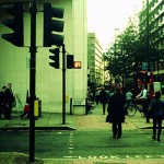
Besides maintaining thought of the common good, another important factor in helping smart cities to retain their “city-ness” is the concern of technological ubiquity. A city cannot be built only on smartphones, touchscreens, and Wi-Fi; it functions through human interactions. Tony Hiss[6], Guy Debord[7], and Henry Grabar[8] all speak to the place-driven, human quality of cities, especially through Hiss’s idea of “simultaneous perception” as one of the core qualities that makes a city a city. Almost as a modern day defense of Debord’s derive as a way of experiencing that quality of the city, Grabar points out, “The reverie of wandering, on foot or on wheels, can’t be calculated by an algorithm or prescribed by an app.”[9] However, technology can be used to enhance and facilitate human interactions and understandings of place, rather than make that understanding “unnecessary.” Hiss, Debord, and Grabar’s ideas are of great importance in the unique experience of being in a city, and it is possible to make them present in a smart city, as well. In terms of the WalkPortland app, keeping the app’s focus on getting people out of the shielded bubbles of their cars and out into the city is a way of using technology to promote and facilitate human interaction in the city.


Literature review

Andres Duany and Jeff Speck view “smart” not only as the utilization of new technology and design, but also as the return to some older forms of the same. Their book The Smart Growth Manual highlights “walkability” as a key feature of a smart city’s successful future. Unlike their parents’ generation, millennials (people born between approximately 1983 and 2000)[10] have tended not to buy their own cars, opting instead for a more walkable city life. And the “if you build it, they will come,” policy applies here: 64% of people first identify and move to a city they like, and then seek a job there.[11] Key to creating that desirable city image is “walkability.” Duany and Speck encourage planners to

“foster ‘walkable,’ close-knit neighborhoods: These places offer not just the opportunity to walk—sidewalks are a necessity—but something to walk to, whether it’s the corner store, the transit stop, or a school. A compact, walkable neighborhood contributes to peoples’ sense of community because neighbors get to know each other, not just each other’s cars”[12]

 This community is the place for a city’s life, culture, and social capital to be created, learned, and reproduced.

In keeping with Greenfield’s concept of urban and technological seamlessness, Duany and Speck also advocate for “[taking] advantage of existing community assets: from local parks to neighborhood schools to transit systems, public investments should focus on getting the most out of what we’ve already built.”[13] One method they cite for encouraging people to leave their cars and walk is to make that the most economical option by imposing higher parking fees. This method incentivizes people to use public transportation or walk.

However, this solution raises its own set of concerns about who then gets to benefit from walkability. As Sarah Marusek discusses at length in Parking Politics, higher municipal fees such as parking costs have disproportionate effects between socioeconomic classes, and in this way parking becomes yet another way of separating those who have the right to the city and those who have the means to the city.[14] Curbside parking, an equalizer in the world of private and pay-to-stay parking lots, can be restrictive in ways that make driving possible for some and impossible for others. Marusek also cites a case study in which parking rights are connected to whether or not people can call themselves “residents.” At Amherst College, “from September through May, city streets are strictly reserved for town residents who have a town-sanctioned parking permit. This restriction is in place to keep visitors, i.e. students, from claiming parking spaces and leaving no place for ‘rightful’ residents to park during the school year.”[15] While the students reside there most of the year, they are not eligible to be considered residents of the town.

The takeaway from both Duany and Speck’s work and Marusek’s work is that urban planning innovations— smart or otherwise— have fallout of many different forms, affecting different groups of people in predictable and unpredictable ways. They key role of government in these situations is to respond not only to problems in the city but to their solutions as well.

The purpose behind the WalkPortland app is twofold: to decrease car use and car presence in Downtown Portland, and to help people to enjoy the city on foot. The decrease in car traffic may already be underway. A November 2014 article from the Portland Press Herald reported that in Maine, the populations renouncing their cars include not just the millennials that Jeff Speck cites, but Maine’s aging population as well. “At both ends of the age spectrum, people increasingly want to live near restaurants, shops, and cultural amenities.” [16] A more pedestrian-friendly Portland and pedestrian-oriented technology to accompany it would benefit multiple populations.

However, the response to the city’s varying plans to show less privilege to cars and autos is not totally positive. Portland’s plan to consolidate and shrink the Franklin arterial, thereby “[reconnecting] side streets and [improving] pedestrian and bicycle access”[17] is seen by some as a danger to the city, one that “shuts down the life blood of commerce, transit and mobility… [because] if people can’t drive here, they’ll go somewhere else.”[18] This is a serious concern to the city of Portland, which is “the financial and commercial capital of Maine.”[19] If the attempt to take cars out of Portland comes too quickly or before people are ready for it, the effects could have serious consequences for Maine’s economy.

In his lecture “The Walkable City,” Jeff Speck cites not only the enormous health benefits of walkability, but its economic, environmental, safety, and citywide benefits as well. The “inactivity borne of landscape” has more effect on obesity in America than does diet.[20] There is a direct link between the prevalence of asthma and auto exhaust emissions in urban areas.[21] The benefits of walkability are not just individual; it also fosters community and drives people to shop and buy more locally, making their communities wealthier from the inside.

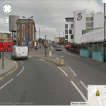
And yet, the car and parking problem in Downtown Portland remains, a strain on the environment (among other things), and a major inconvenience. Apps for increased urban convenience have a large and growing market, and WalkPortland would be one of many attempts to help people navigate a city in a specific manner. The online design and tech magazine Web Urbanist ran an article listing thirteen interactive city maps, which ranged from the frivolity of a smartphone-supported citywide Pacman game called MapAttack, to the everyday usefulness of the widely popular app ParkMe, which locates open parking spots. The goal, in general, is to make the city more conveniently and easily accessible so that people can get what they want from it, when they want it. “Apps for smartphones, tablets and other gadgets are making big urban centers feel smaller than ever, making it easy to catch a ride, find cheap eats, check out street art and make new friends.”[22]


Methods

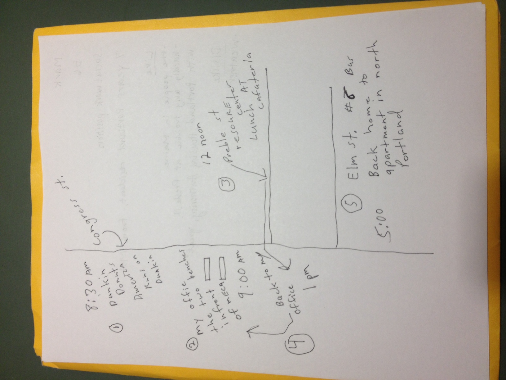
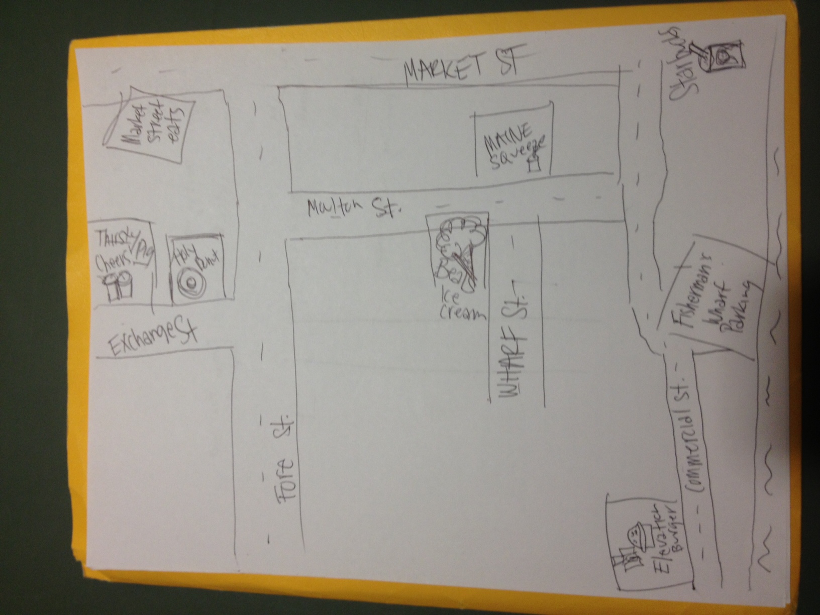
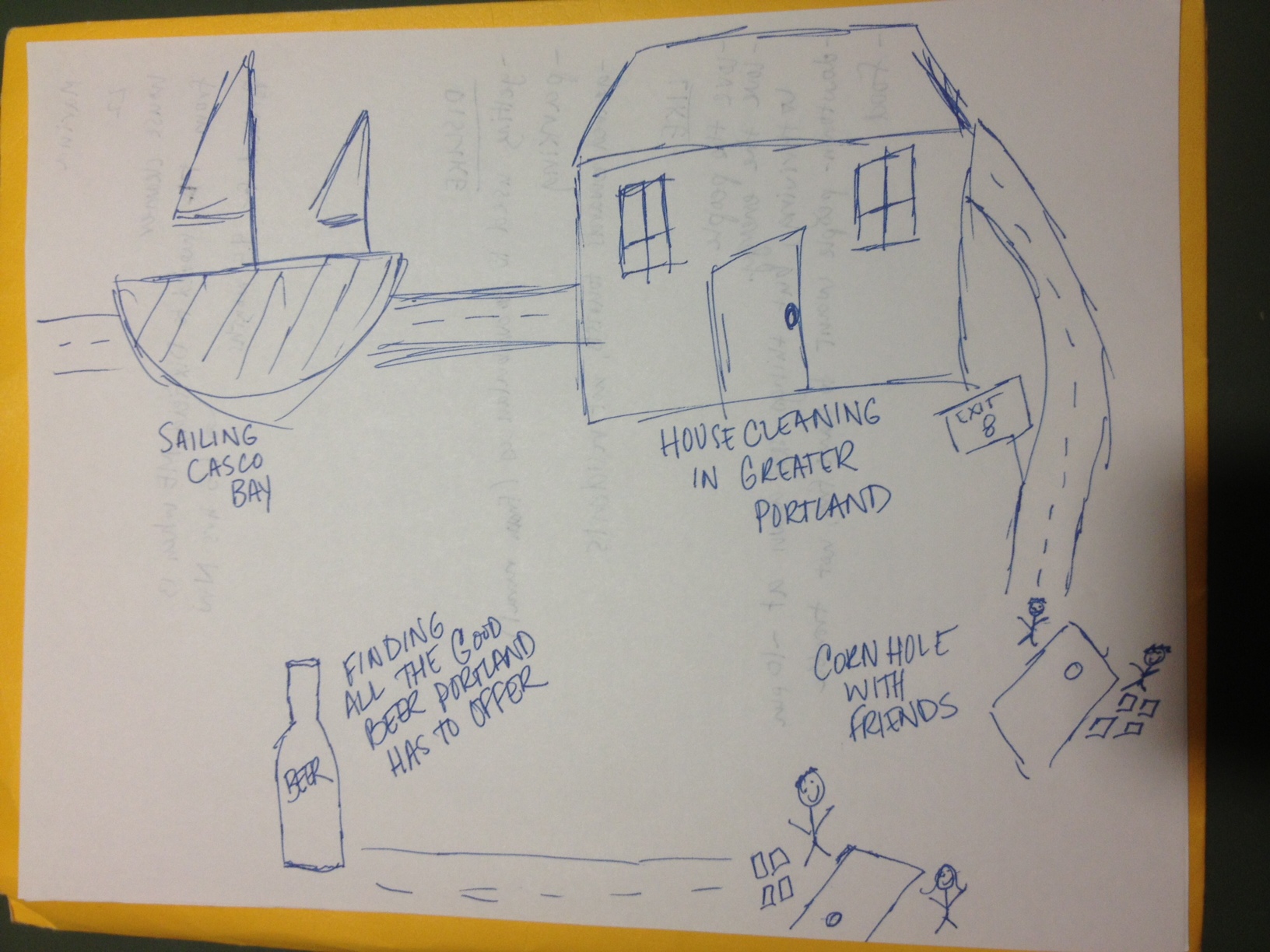
Input from actual Portland residents was immensely helpful in identifying parking as a major concern for the city, and in gauging people’s conception of the city’s size and walkability. I conducted interviews with 3 residents of Portland and 1 commuter into the city, keeping notes of how exactly they phrased their thoughts on the city. I also collected one mental map of the city from each participant. For my own perception of the city’s size and walkability, the time I spent interviewing and a transect walk to the West End were both helpful. I used QGIS to measure distances in Portland to gauge the perception of walkability against the actual distance.

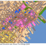
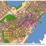
I created a simple base map of Portland, focusing on the Downtown area. I included data layers from the City of Portland that I thought would be helpful in creating a legible map for pedestrians, including of course major roads and sidewalks, but also building outlines (gray), open space (green), the boundaries of “Downtown,” (pink) historic landmarks (yellow and blue), and Metro bus routes (light blue lines). [Figure 1, Figure 2]

I concentrated on the scale of the map, and decided to keep my approach to a specific neighborhood of Portland, since my hope was to take Duany and Speck’s advice to “plan in increments of complete neighborhoods.”[23] Building outlines are an unusual inclusion in a city map, but at a pedestrian scale this seemed to make the map much more easily legible to its user. I wanted to create a map that was visually legible, appropriately scaled, and included more than just tourist attractions or sponsored locations and advertisements.

I also created a map showing the transportation network available around Portland (below). The components shown are the interstate (black), the Metro bus line (orange), the Portland Explorer tourist bus route (red), and railroad tracks (dotted black line). Once again, downtown is shown to help understand the relationship between Portland’s transportation network and its commercial center (pink). With a closer zoom, it becomes apparent that in fact Downtown is serviced more satisfactorily by Portland’s tourist bus (red) than by its city bus (orange). [Figure 3, Figure 4]


Findings

Of the four Portlanders I interviewed, three drove cars in the city. Each one of the three cited parking as source of major frustration in the city, calling it “awful,”[24] “a real difficulty” especially for those who work in Old Port,[25] and a source of dissatisfaction. Another complaint was that the city feels very much geared towards tourists, rather than residents.

Interviewees cited the small size of the city as a major upside, saying that is was “the perfect amount of city,”[26] that they enjoyed “the small town feel” and the fact that “people know you,”[27] and that the city has great, “thriving,” energy but tends to slow down by around 10 pm.[28] Each map depicted the neighborhood that the participant was most familiar with, as opposed to showing the whole peninsula or greater Portland area.

Using QGIS, I measured the length of Portland’s Downtown (as defined by the City of Portland), at .45 miles along the waterfront, and closer to .65 miles along Cumberland Avenue. The total area of the Downtown is about .25 square miles. These are all walkable distances for most adults.


Reflections / Discussion

My proposed solution is an app called WalkPortland. The app serves two main purposes. The more minor of the two is as an information source detailing where parking is available in the city. The second is as a pedestrian-oriented map application.

The parking feature of WalkPortland does not aim to make car usage and parking more convenient in Portland, or to function on a real-time basis like apps such as ParkMe[29]. While increased convenience may be a result of the app, the goal of the project is rather to have residents park their cars outside of Downtown Portland and walk to their destination, thereby reducing automobile congestion in the Downtown area (or other parts of the city) and making that a safer and more pleasant pedestrian and bicycle zone. Rather than functioning as a real-time update system for finding parking, which fosters a sense of competition and “I need to be as close as possible” that contribute to making car travel a problem in cities, the app would merely have an informational list and static map of pay lots, municipal parking and curbside parking available throughout the city. However, I anticipate that a ParkMe-like function would be highly requested.

The main focus of the app, aimed at reconnecting Portlanders’ conception of the city’s size to its actual size, is highlighted 5- and 10-minute walk radius bubbles. The goal of this feature is provide an accessible and understandable measure of Portland’s existing walkability by virtue of its scale. This will hopefully encourage people to consider walking as a viable means of transportation in the city, even across it. Using the standard average human walking speed of 3.1 miles per hour, simple calculations lead us to .25- and .5-mile radii, respectively.[30] In Portland, this translates to the entire length of the Downtown area that is walkable within 10 minutes.

Included on the app would be features important to pedestrians. Most map apps are created for car travelers and have features about traffic and toll-free routes, and leave out helpful and even crucial pedestrian information. The pedestrian map of WalkPortland would include leisure spots and amenities such as coffee shops, public restrooms, restaurants, playgrounds, grocery stores, and green space. It would also include layers that were of particular interest to pedestrian comfort and safety, such as sidewalks, street lighting,[31] public seating, bike lanes and paths, and indoor and outdoor public spaces.

To increase the accessibility of this resource so that it is not limited to those with a smartphone or an Internet connection, the maps can be made into site specific, physical, stationary maps. These maps would function the same as the app, but mapping 5- and 10- minute walk radii from their locations. These maps would serve as advertisement not only for the WalkPortland app, but also for the local businesses they would highlight. I anticipate that the primary audience for this app would be at first largely young, city-savvy smartphone users, and Portland tourists. My hope is that the app would be useful enough that anyone local might find want to have it to enhance their pedestrian experience of the city.

The WalkPortland app is an extension of existing ideas, values, and goals that the City of Portland has already set out. The app updates the technological realization of previously stated goals to help bring Portland closer to its aim of making the city more pedestrian friendly and the Downtown less congested with automobiles. Portland’s commitment to Complete Street practice and principles includes providing resources to make the pedestrian experience as pleasant and well-resourced as the driver’s.[32]


Conclusion

The WalkPortland app will help Portland drivers to get out of their cars, and it will help Portland pedestrians to get the most out of their walking experience of the city. This app will help people to think locally, and to consider walking the powerful tool that it can be in Portland. The benefits of walking are, especially in this context, manifold: to Duany and Speck this experience of the city is environmentally sustainable, community fortifying, and helpful to the literal health of the nation; to Debord, Hiss, and Grabar, the pedestrian experience of the city is of intense personal and cultural value to the city and its inhabitants; to the Portland City Council pedestrian traffic represents the alleviation of a serious congestion problem in the city’s commercial center; to Portland residents and commuters the pedestrian route is a powerful and less stressful way of understanding and moving about their city, while simultaneously helping them to engage more actively in its vibrant and thriving city life.


[1] City Council of the City of Portland ME, “Downtown Vision: A Celebration of Urban Living And A Plan For The Future of Portland – Maine’s Center for Commerce And Culture,” May 9, 1991. Accessed online December 14, 2014. http://www.portlandmaine.gov /DocumentCenter/Home/View/3376, 4.

[2] Ibid., 7.

[3] Ibid., 8.

[4] Adam Greenfield, Against the Smart City (Do projects, 2013), Kindle edition, chap. 1.

[5] Ibid.

[6] Tony Hiss, “Simultaneous Perception,” in The Experience of Place (New York: Vintage, 1991), 10.

[7] Guy Debord, “Theory of the Dérive and Definitions,” in The People, Place and Space Reader, edited by Jen Jack Gieseking, et al. (New York: Routledge, 2014), 65.

[8] Henry Grabar, “Smartphones and the Uncertain Future of ‘Spatial Thinking’,” CityLab from The Atlantic, September 9, 2014, accessed September 15, 2014, http://www.citylab.com/tech/2014/09/smartphones-and-the-uncertain-future-of-spatial-thinking/379796.

[9] Grabar, “Smartphones and the Uncertain Future.”

[10] Marina Schauffler, “Sea Change: Living without cars a good sign of the times,” Portland Press Herald, November 3, 2014, accessed December 15, 2014, http://www.pressherald.com/2014/11/03/sea-change-living-without-cars-a-good-sign-of-the-times.

[11] Andres Duany and Jeff Speck, The Smart Growth Manual (New York: McGraw-Hill, 2010), 168.

[12] Duany and Speck, The Smart Growth Manual, Appendix 1.

[13] Ibid.

[14] Sarah Marusek, Politics of Parking: Rights, Identity, and Property (Burlington: Ashgate Publishing Ltd, 2012), 30.

[15] Ibid., 32

[16] Schauffler, “Sea Change: Living without cars a good sign of the times.”

[17] Kelly Bouchard, “Opportunity, concern seen in Portland’s plan for Franklin Street,” Portland Press Herald, October 1, 2014, accessed December 15, 2014, http://www.pressherald.com/2014/10/01/opportunity-concern-are-seen-in-arterial-plans.

[18] Ibid.

[19] Ibid.

[20] Jeff Speck, “The Walkable City” (Ted Talk, TEDCity 2.0, September 2013) Accessed online December 14, 2014, http://www.ted.com/talks/jeff_speck_the_walkable_city?language=en, 7:35

[21] ibid., 12:41.

[22] Steph, “Urban Apps: 13 Interactive City Maps, Tools & Guides,” Web Urbanist, accessed December 15, 2014, http://weburbanist.com/2013/07/15/urban-apps-13-interactive-city-maps-tools-guides.

[23] Duany and Speck, The Smart Growth, Appendix 1.

[24] Josh (26, Portland resident), interview by Eva Sibinga, October 13, 2014.

[25] Brittney (23, Hollis, ME resident), interview by Eva Sibinga, October 13, 2014.

[26] Josh, interview.

[27] Brittney, interview.

[28] Marina, (22, Portland resident), interview by Eva Sibinga, October 13, 2014.

[29] www.parkme.com

[30] http://www.princeton.edu/~achaney/tmve/wiki100k/docs/Walking.html

[31] This idea came from Eileen Johnson, Lecturer in Environmental Studies at Bowdoin College.

[32] City of Portland. Council Order 125, “Complete Streets Policy,” December 17, 2012. Accessed online December 16, 2014. http://www.smartgrowthamerica.org/ documents/cs/policy/cs-me-portland-policy.pdf.


Bibliography


Bouchard, Kelly. “Opportunity, concern seen in Portland’s plan for Franklin Street.” Portland Press Herald, October 1, 2014. Accessed December 15, 2014. http://www.pressherald.com/2014/10/01/opportunity-concern-are-seen-in-arterial-plans.


City of Portland. Council Order 125. “Complete Streets Policy,” December 17, 2012. Accessed online December 16, 2014. http://www.smartgrowthamerica.org/ documents/cs/policy/cs-me-portland-policy.pdf.


Debord, Guy. “Theory of the Dérive and Definitions.” In The People, Place and Space Reader, edited by Jen Jack Gieseking, William Mangold, Cindi Katz, Setha Low and Susan Saegert, 65-69. New York: Routledge, 2014 [1958].


Duany, Andres, and Jeff Speck. The Smart Growth Manual. New York: McGraw-Hill, 2010.


Grabar, Henry. “Smartphones and the Uncertain Future of ‘Spatial Thinking.” CityLab from The Atlantic, September 9, 2014. Accessed September 15, 2014. http://www.citylab.com/tech/2014/09/smartphones-and-the-uncertain-future-of-spatial-thinking/379796.


Greenfield, Adam. Against the Smart City. 1.3 edition. Do projects, 2013. Kindle edition.


Hiss, Tony. “Simultaneous Perception.” In The Experience of Place. 3-26. New York: Vintage, 1991.


Marusek, Sarah. Politics of Parking: Rights, Identity, and Property. Burlington: Ashgate Publishing Ltd, 2012.


Shauffler, Marina. “Sea Change: Living without cars a good sign of the times.” Portland Press Herald, November 3, 2014. Accessed December 15, 2014. http://www.pressherald.com/2014/11/03/sea-change-living-without-cars-a-good-sign-of-the-times.


Speck, Jeff. “The Walkable City.” Ted Talk, TEDCity 2.0, Filmed September 2013. Accessed online December 14, 2014. http://www.ted.com/talks/jeff_speck_the _walkable_city?language=en.


Steph. “Urban Apps: 13 Interactive City Maps, Tools & Guides.” Web Urbanist. Accessed December 15, 2014. http://weburbanist.com/2013/07/15/urban-apps-13-interactive-city-maps-tools-guides.

Who Uses Portland’s Public Space?

The clear indication from my transect walk was that Portland’s smart city solutions must include some help for the homeless in Portland. I walked down Preble Street to the western section of East Bayside, and my walk I looked out for how people were interacting with public space. This included the various forms of use and disuse of public space, as well as use of unintended public space. I found that use of public space turned from casual to necessary use as I passed from the business and tourist district into a more depressed area of Portland. There was a very distinct change, approximately located along Congress Street as an edge. In terms of my smart city recommendations, I think they must incorporate solutions that provide housing, jobs, and support for the city’s homeless. How this factors into parking is something I am still pondering.

Each green link in this section will open to the map location in a new window. The walk was as follows: I began at the small public space at the intersection of Middle Street with Market and Exchange. Eight fairly rough looking people of a few different races were occupying most of the space, skateboarding and chatting with one another. They had two pit bull terriers with them. Across Exchange Street, right outside Bard Coffee, three people were using a smaller grassy area with benches as the backdrop for a photo shoot. A pair of young women and one lone young woman sat drinking coffee, on benches facing the street. At the corner of Middle Street and Temple Street, in the large plaza centered on The Lobsterman statue outside Nickelodeon Cinemas, three older-looking Caucasian men sat on three benches. One was looking at his phone, one was reading a book, and one watched the people and plaza around him.

Outside the Post Office on Temple Street, there was a large and abandoned plaza. It was filled with low walls to sit on, and contained a fair amount of greenery. This was an example of a possible public space that lay totally unutilized by anyone. On Congress Street near the corner of Congress and Temple, the small open garden of the First Parish Church was also unused. While this space is technically private, I included it, as there was a sign on the door inviting the public to respectfully use the space.

Walking down ­Elm Street, I saw several homeless-looking people using the overhang of the Public Library as a place to lounge comfortably in the shade. They may have been waiting for some form of transportation, as the building is right across from the bus depot. Further down and one street west, thirteen people were sitting on benches outside Preble Street Resource Center. Farther down Preble Street, a Caucasian man and a woman sat on the step outside the veteran housing building, speaking to each other. Another block down, two middle-aged men of color sat eating cake on the step at the entrance of a small green public-looking space.

At the corner of Elm and Somerset, nine people sat along the edge of a large, sort of grassy, vacant space. Behind them was the parking lot to Trader Joe’s and Walgreens. I walked around the large space towards the Walgreens, and passed a lone African American man sitting on a bench. He appeared homeless, and got up to sit in the Walgreens parking lot after I passed him.

At this point, I turned around and went back up the hill, up Alder Street. At the intersection of Alder and Oxford Street, I passed four young people standing around a streetlight at the corner of an empty lot. They were talking and laughing and I had the sense that they lived in the surrounding houses. For some reason (Apple Maps), my last two data points did not map correctly and I am not sure where they were geographically. The last things I passed were some unused benches, and then a nice bench on some cobblestones, where one man was sitting.

Reconsidering Smart City Suggestions: Portland Wants Parking

After speaking to Portland residents and commuters, one thing that became very clear to me is the popular demand for better parking in Portland. Of the four people I spoke to, three had cars. All three of them cited the parking as an undesirable aspect of Portland. However, none of the people I spoke to seemed to be aware of any place to park except by the waterfront.

One of my earlier ideas was to increase signage in the city. Originally this was intended to educate the public on smart changes that occurred around them, especially in relation to public space. I still feel that signage is important— that there is power in simply pointing out in words what you want people to know. If parking is a problem, it is possible to acknowledge and address that in part with signs. There might be a physical need for more parking space, but there may also be a distribution problem that could be helped by the distribution of information. The city is so small that there might be a trove of parking within a ten-minute walk, which would be useful if people knew where to find it. Easy to read maps and signage would help tourists and locals alike to locate parking nearby.

Ideally, the small degree of satellite parking would also help Portland to transition to a walking city. In turn, the increase of walking could benefit the numerous sidewalk businesses, and help public spaces to thrive more as places to rest or eat lunch before returning to one’s car.


Mark is a 56-year-old resident of Portland. He was a social worker, and now lives on disability payments. He is from Massachusetts, and has lived in Portland for 7 years. When asked what he likes about Portland, he cited the people in Maine, his good experience at Preble Street Resource Center, and his "great" experience with the Portland Housing Authority. He said he dislikes the weather.
Mark is a 56-year-old resident of Portland. He was a social worker, and now lives on disability payments. He is from Massachusetts, and has lived in Portland for 7 years. When asked what he likes about Portland, he cited the people in Maine, his good experience at Preble Street Resource Center, and his “great” experience with the Portland Housing Authority. He said he dislikes the weather.
Josh is a 26-year-old resident of Portland. He is originally from Woolwich, Maine, and has lived in Portland for one year. He works as a shop clerk in the business district of Portland. When asked what he likes about Portland, he called it “the perfect amount of city,” not too big or too small. He said he loves Portland’s culinary scene, and likes the people. He had trouble coming up with a clear source of dissatisfaction, except the “awful” parking around Old Port.
Brittney is a 23-year-old resident of Hollis, Maine, about 25 minutes south of Portland. She works at Beal’s ice cream parlor, where she has worked for eight years. She is now a student in Boston, but commutes to Maine for the weekend and continues to work at Beal’s. She has never lived in Portland, but said that she likes the small town feel, and the fact that “people know you.” She said that parking is a real difficulty, especially for people who work in Old Port as she does. She also said that the parking officials make parking especially difficult.
Marina is a 22-year-old resident of Portland. She is originally from Florida, and moved to Dixfield, Maine, about 10 years ago. She has lived in Portland for about a year, and works as a house cleaner in the greater Portland area. When asked what she likes about Portland, she said she loves the people, the food, and the energy of the city—especially that it feels “thriving” but things slow down by around 10 pm. In the downtown area, she says, people want to have fun but not make trouble. She cited the parking as a source of dissatisfaction, and said that, being from a rural area, she is still getting used to the city noise, especially the ambulances. She also said that the city is definitely geared toward tourists, not residents.


10:45

  • Two people sitting with to go coffees chatting by window (Jen and Mark)
  • Man behind me doing work with coffee to stay (Mr. Pince Nez, PN for short)
    • He has very small, “cool” glasses
    • Tweed jacket
    • mid 50s
    • cleft chin
    • I think I just distracted him
  • Woman in cool scarf and sweater walked out
  • Bearded man in self-aware Canadian tuxedo just walked in

10:55

  • Two women buying drinks (lime soda, coffee)
  • A few people have walked by outside, usually quite casually/ no hurry
  • One biker who looked like he was intently on his way somewhere
  • Jen and Mark have been chatting with no sign of stopping
    • I hope they will leave soon so that I can take one of their seats
  • PN making a phone call
  • Horse drawn city tour passing by (Stillbrook Acres, rides for all occasions)
  • The vibe in here is really nice except that I feel so self conscious about essentially spying on people
  • Florence + the Machine playing

11:05

  • Jen: white female ~30 yo, wearing workout clothes, minimal but careful makeup. OMG she is so into him she literally laughs at everything he says.
  • Mark: white male ~30 yo, wearing a very large watch
  • A meet-up just occurred in another corner of the shop… “so how do you know le-ann?”
    • White male, ~45, used the word “mate”
    • White female, ~45-50. Holding macbook air. Son’s name is “Hawk”
    • Both of them have sunglasses
    • Discussing business venture?
  • Woman runs past shop
  • Many people in here/around are in workout clothing
  • Somebody that I used to know
  • Arcade Fire Wake Up

11:15

  • Things seem to be picking up
  • Business meetup is for web design of this woman’s non-profit (she started it)
    • Hawk sat down right behind me
  • A bit of a rush now, more people who appear less outwardly “cool” and are also not in workout clthers
  • PN is leaving, looked at the WSJ on his way out
  • More car traffic outside
  • Lots of people come in and use the bathroom (at lease 5 while I’ve been here)
  • I think they might be playing “I want it That way” (Lol it’s actually Albert Hammond Jr. In Transit)
  • First kid came in, with dad (looks like he just needs to pee)
  • People hanging out outside (3 people standing around chatting, seem to have dog with them)
  • Jen and Mark have gotten comfy (damn, I want those chairs!)

11:25

  • Jen and Mark left. Mark: “Shall I escort you home so that your students don’t jump you?” (he sounds like an asshole but she really didn’t seem to mind)
  • I took their chairs (better view of the street)
  • 5 people sitting at tables and chairs outside, w 2 dogs
  • A lull in business, now
  • Not sure what the song is, same feeling as the rest
  • Have yet to see a person who doesn’t appear white—saw one black man outside

11:35

  • Two people who look South-Asian (?) just walked in
  • Many people here get coffee in to-go cups even if they end up sitting for a long time
  • OMG such a cute golden retriever outside
  • And a baby! Wow what cheeks
  • Australian guy just sat down, complaining about it being Columbus Day because he wanted to mail a package and it’s a federal holiday (he and his American buddy couldn’t figure out what the holiday was, though)
  • Cool old woman just walked in, did not hold door for young man coming in behind her
  • Young folks playing, someone whistling along very poorly

11:45

  • South Asian couple chatting at the counter, very friendly. She is in
  • Another lull
  • A different couple walked in, dressed very hip. She was on the phone. Wearing pink pointy flats and walking with a limp. Taking a long time and debating what to drink, chatting to barista and hugging while they choose

11:55

  • Even more of a lull now
  • Aussie and his friend Googled and figured out it was Columbus day
    • “What would you rather be, intelligent or creative?”
  • Business meet-up is still going on
  • African American boy ~11 went by on his bike
  • Two preppy white boys ~18 walked by
  • Guy w a large clipboard ~27 walked by looking for something
  • Car traffic consistent, probably ~1 car every 3-5 seconds at busy moments, with breaks in between
  • Fair amount of bicycle traffic, certainly fewer than cars though
  • Same music inside

12:05

  • 3 old women now buying coffee
  • Business meet-up is over, woman and her son still her
  • Aussie and his friend working steadily (…on Facebook)
  • Coffee grinding
  • Calming, no-lyric music playing now
  • Barista with bangs was totally unoccupied for like 5 minutes earlier, sat on her phone until people came in for coffee
  • Not much to report on outside—this street is pretty quiet in terms of pedestrian traffic

12:15

  • “I’m going to do… a coffee.” Odd phrasing in order by young woman now buying
  • Old couple just walked in. Man wanted bathroom
    • They appear to have a very unclear/confusing order
  • Aussie now playing arcade game on his computer
  • A lot of people use this space as a semi-public restroom
  • Music has gotten a little more “rockin’”

12:25

  • Several people/ groups in here ordering now
    • Blond young man and woman (heavily made up)
    • Slightly older (~25?) couple (man and woman) browsing coffee cups etc
    • Two young “trendy” women, and an older trendy woman
  • Very hot here now by window. I’ve already moved though so I’d feel a bit weird moving again. Wish they had some sort of shade or awning
  • Chilled out guitar music
  • Australian has switched computer games
    • Continued unawareness of visible buttcrack

12:35

  • Went up to get iced tea and almond croissant
    • The pastries are definitely not their strong point but the drinks are great
    • One of the baristas is gluten free
  • Fashionista in a purple trenchcoat just came in and out
  • Child (~10?) standing alone at counter… who is taking care of him?
    • Ordered a hot chocolate, took it outside and crossed the street by himself
  • Music has gotten more poppy, less acoustic

12:45

  • Young woman (~16/17?) and ~6 year old girl in here now (sisters?)
  • Large man (~40) ordering coffee
  • Young woman (~25) in line
  • Someone left a laptop on the counter
  • Young woman with golden retriever working outside on laptop still
  • 3 people browsing bagged coffee selection
  • This almond croissant is pretty shit but I’ll probably eat the whole thing anyway
  • Old woman in socks and sandals drinking tiny drink and writing on tiny notepad
  • Adam Tice artwork on walls—fairly uninspiring acrylic paintings of different pieces of food and some other things (block o meat, cup of coffee, pickle, etc.)

12:55

  • Tiny drink woman left
  • Two men at counter, one using bathroom
  • New longhauler is here, set up with her ipad near the counter. She has her own mug, it looks like
  • More conversations noise and less music, now
  • People still looking at coffee paraphernalia
  • Young guy with messenger bag just came in
  • Old woman on laptop in other corner
  • There is a whole other side of this shop that I am not very connected to— 2 differentiated seating areas mean noise is well dispersed
  • Woman walked by holding newly purchased broom—had walked to store
  • Guy sat down opportunistically to read abandoned WSJ

1:05

  • Used bathroom (key system to prevent surreptitious use)
    • Nice, small, pleasantly dim bathroom
    • Surprisingly, mirror has been defaced w/ word scratched into it: “EAIRZ” or similar, written in skinny graffiti script style
  • Another young couple
  • Another old man
  • Aussie still playing comp games
  • Music is more upbeat now

1:15

  • More of same
  • Two vaguely grungy high school girls came in to study the cooler of drinks
  • Woman debating pastry choice like no other
  • Flume bon iver

Human Infrastructure to Fill Out Physical Infrastructure

“People as infrastructure” is a concept at the core of any healthy and thriving city. People are the most important part of the city—without them there is no culture, no community, no innovation, and reason for innovation to exist. There is no city without people. In all cities, people function as cultural infrastructure, and in some cities as even more.

In New York City (and around the world), people absolutely function as the infrastructure of city image. While the specific purpose of the infrastructure varies—be it image, black market, street art, punk rock— cities are filled with networks of people without whom a factor of the city’s life would crumple. Networks of people are the infrastructure of culture; in Johannesburg they are the infrastructure of life, as well.

In Johannesburg and other African urban centers, people function as infrastructure in a more day-to-day way. Without this form of infrastructure residents might not have electricity, food, clothing. [1] In smaller communities, “people as infrastructure” can function as the lifeblood of cultural expression and organization. New Brunswick, New Jersey is home to a thriving punk rock scene that operates through semi-legal underground punk shows in residential basements. The location of each show is kept secret except through connection to the New Brunswick network of punk-rockers.

The problem is that you can’t just make people into infrastructural systems. In Johannesburg the human infrastructure developed out of need. Short of dire need for infrastructure, some form of guidance or policy is necessary to create a system in which “people as infrastructure” can form. Essentially, physical infrastructure may designed so that there is room for “people as infrastructure” to fill it out and make it operate to fuller potential. Once it is decided who should “give ground,” [2] those on the ground have the potential to make the system run as well as possible.

One of the best ways to make infrastructure work well, and traffic flow smoothly, is good communication between the moving parts. In London there are three different kinds of crosswalks: the zebra crossing where pedestrians always have the right of way, a smaller designated crossing where motorists always have the right of way, and a crossing controlled by traffic lights where the right of way is allotted to each. These crossings are not only well marked, they are well-conceived. They each fulfill a different and often site specific need in the city.

This crossing system, which relies on the knowledge and judgment of people, is a form of promoting “people as infrastructure.” People who know exactly how to use the city make it function better and more efficiently. This knowledge is helped along through government supported “people as infrastructure,” too. On the pavement at every busy crossing is written “Look Left” or “Look Right,” to keep disorientated pedestrians from being hit by cars. This kind of guidance helps modern city traffic to move as quickly as possible on roads that in some cases were originally built for Roman foot soldiers.

Portland is such a small city that it seems ridiculous not to privilege pedestrians in most infrastructure. Part of this might just be putting in infrastructure to make the city more pedestrian friendly. This includes well-marked, free public parking in useful places, so that people get out of their cars to walk. It includes enough public seating to make walking a realistic and attractive means of transportation. It includes considerations of sidewalk width and street crossings that help pedestrians to be comfortable.

Whatever the changes, a clearly marked system would be pretty necessary for success since so many of the Portland’s summer pedestrians are tourists. Everyone can benefit from a little more clarity in public directions, though.


[1] Simone, AbdulMaliq. 2014 [2004]. “People as Infrastructure: Intersecting Fragments in Johannesburg.” In The People, Place and Space Reader, edited by Jen Jack Gieseking, et al, 245. New York: Routledge.

[2] Sorkin, Michael. 2014 [1999]. “Traffic in Democracy.” In The People, Place and Space Reader, edited by Jen Jack Gieseking, et al, 411. New York: Routledge, 2014.

[3] Britton, Ian. Pedestrian Crossing. Digital image. Freefoto.com. N.p., 2 June 2007. Web. 8 Oct. 2014.

[4] Screenshot from Google Maps, from post code W10 in London, UK. Coordinates for Google Maps [51.525564,-0.214748]

[5] London Crosswalk Countdowns. Digital image. Jocabola.com. N.p., n.d. Web. 8 Oct. 2014. <http://www.jocabola.com/archives/blog/london-crosswalk-countdowns/>.


The Holistic View: Keep People from Being Locked out of Housing

One thing Desiree Fields and Sabine Uffer make abundantly clear: treating housing as a liquefied asset with no conception of it as a place where people live is sure to lead to trouble. Common welfare is quickly left by the wayside, people are forced out of their homes, housing and neighborhoods become socioeconomically stratified. Housing is intimately tied to people’s lives and livelihoods, and the two cannot be separated. However, ignoring the broader market in which housing can be a form of capital is not a viable solution. [1]

In terms of promoting the common good, we have not only to consider the prosperity and diversity of a neighborhood, but also its history. Neil Smith says that the new pioneers of gentrification “seek to scrub the city clean of its working-class geography and history,” and in doing so erase and edit parts of the city’s social history. [2] This is not to say that dilapidated buildings must be carefully upheld in their state of deterioration, but that as the city changes it respects and acknowledges what is being left behind temporally. Both Fields and Smith call for a more holistic view to urban housing developments. All parties must be accounted for.

It is in the “holistic view” concept that I begin to doubt the realistic execution of David Crowley’s vision of the smart city. A space that “maximizes the requirements of the users” is not one destined for 100% success in any public setting. [3] The holistic view includes those who do not believe that people’s actions have a measurable effect on climate change. These people have significantly less incentive to change their behavior and act as sensors in smart buildings. Realistically, it seems that if the system relies on maximum participation, it should be paired with a system of incentive or penalty to stimulate usage.

Control of housing should come at a state level, and not be left open enough for profiteers to have access to existing communities. In Portland, the holistic view means taking into account not only the tourist industry that helps the city to thrive in the summer months, but the city’s year round residents. The holistic view means working actively to provide housing to people who come to Portland seeking it— even if they really don’t look like “Mainers.”


[1] Fields, Desiree, and Sabina Uffer. 2014. “The Financialisation of Rental Housing: A Comparative Analysis of New York City and Berlin.” Urban Studies, July.

[2] Smith, Neil. 2014 [1996]. “‘Class Struggle on Avenue B’: The Lower East Side as the Wild Wild West.” In The People, Place and Space Reader, edited by Jen Jack Gieseking, et al, 318. New York: Routledge, 2014.

[3] Crowley, David N., Edward Curry, and John G. Breslin. 2014. “Leveraging Social Media and IoT to Bootstrap Smart Environments.” In Big Data and Internet of Things: A Roadmap for Smart Environments, edited by Nik Bessis and Ciprian Dobre, 379. Springer. http://link.springer.com/chapter/10.1007/978-3-319-05029-4_16.

Park by the Public: using citizen sensing to improve public space

Matthew Arnold said, “without order there can be no society; and without society there can be no human perfection” [1], and used that as justification for the repression and “reigning in” of those who challenged order and therefore society. I do not actually disagree with his statement that a well-ordered society brings us closer to “human perfection” than does a society filled with chaos. However, for those in power to alone decide what constitutes acceptable chaos is a setup for large-scale injustice, inequality, and apathy. To achieve “order” Arnold advocated employing techniques of repression and tighter control of public space, to control the public from above by limiting their capacity to damage society.

What if the public had some established power in ordering society? Crowley et al define the term citizen sensing as “opportunistic sensing where people report on issue or events in their surroundings and this information is then analyzed to try to create insights into these events” [2]. Programs and apps for doing just this exist already in many cities, with varying rates of efficacy. After 9/11 New York City began a citizen reporting-based program called “If you see something, say something.” In 2012 New York Magazine published a short and dismissive article on the program, essentially summarizing Harvey Molotch’s book Against Security. According to Molotch, the program has acted much more effectively as a citywide lost and found than as an antiterrorism program [3]. We can see this as a failure of the city’s antiterrorism program, but also as the beginnings of a successful citywide lost and found program.

Instead of trying to enlist regular civilians to stop acts of terrorism, enlist them to report on regular civilian issues. This includes the lost and found, and countless existing apps for small municipal repairs, and it could also apply to usage of public space. Mitchell and Setha Low both write about fear as a major enemy of public space. Fear is the justification from policymakers for tighter control of public space, and the reason that city residents consent to give up freedoms of space usage [4]. If, as Mitchell says, “public space engenders fears… that derive from the sense of public space as uncontrolled space” [1], a solution could be to give people some measure, or at least feeling, of control over their public space. Empowering the public to call directly for changes or improvements to public space would not only generate increased usage of those spaces, it would tell those in power what should be done to improve the space.

This empowerment could take the form of an app, for streamlined smart city technology. Since public space should be available to as much of the public as possible, and not just those who have smart phones, there could be a fixed or paper version of the technology as well. The app could be designed essentially as a survey. This form of crowdsourcing could be especially helpful for a place like Portland, which is low on urban design resources. With a smart technology survey system on public spaces, the city’s urban design team (of one) could crowd-source one of the most difficult questions in designing public space (what would make people want to utilize this public space?) to the city’s most appropriate population (the people.) A scannable barcode in the public space, linked to a site-specific survey, could enable people to report about their experience of the space.

Public parks and plazas are the communal lifeblood of a city. This is where social reproduction within the city can occur on its most diverse level, as long as different kinds of people feel not only welcome, but inclined, to utilize public space. Promoting the comfortable and positive use of parks and plazas is a means for supporting cultural and community growth within Portland.


[1] Mitchell, Don. 2014 [2003]. “To Go Again to Hyde Park: Public Space, Rights and Social Justice.” In The People, Place and Space Reader, edited by Jen Jack Gieseking, et al, 194. New York: Routledge, 2014.


[2] Crowley, David N., Edward Curry, and John G. Breslin. 2014. “Leveraging Social Media and IoT to Bootstrap Smart Environments.” In Big Data and Internet of Things: A Roadmap for Smart Environments, edited by Nik Bessis and Ciprian Dobre, 385. Springer. http://link.springer.com/chapter/10.1007/978-3-319-05029-4_16.


[3] Gunn, Dwyer. “Does “See Something, Say Something” Do Nothing?” NYMag.com. New York Media LLC, 21 Sept. 2012. Web. 01 Oct. 2014.


[4] Low, Setha M. 2002. “Spaces of Reflection, Recovery, and Resistance: Reimagining the Postindustrial Plaza.” In After the World Trade Center: Rethinking New York City, edited by Michael Sorkin and Sharon Zukin, 164. New York: Routledge.

Public Signage: educate the public to make Portland smarter!

  1. Less decrepit parks
    • Lighting, park maintenance (sidewalks, plant health)
    • Playground in the park (with seating nearby!)
    • Give people other reasons to linger in the park a little while— public Wi-Fi, a plaque or sign to read about the city’s history or the kind of trees that grow there (for example)
  2. Encourage informal use of public spaces for dining (this goes with #1)
    • Put in seating, water fountains, even tables
    • This idea from the Portland City Council Meeting Agenda
  3. Public Wi-Fi in public spaces
  4. Signage for a smart city movement, with barcodes, too
  5. More greenery


To me, #4 is the possibility most worth explaining further. What I mean by signage for the smart city is that smart city works that are put into play should be documented and displayed in some way for the public to understand and appreciate. It would not be possible for every development, but a sign denoting Public Wi-Fi would not only promote use, it would raise awareness of the presence and possibility of the smart city project for Portland, and present a good opportunity for educating interested citizens. I think public signage for a smart city is totally within the range of possibility for the city of Portland, and also to the great benefit of the general public. Scannable barcodes make this a project that would connect Portland to its populous virtually and locally.

In Against the Smart City, Adam Greenfield implies the menace that ubiquitous technology seems to pose to the city. While his sense of menace may over-privilege the fear and uncertainty that accompanies any such rapid development in human history, Greenfield is not wrong to speak of the depth of the change. He writes, “Our encounter with this extended technical armature has begun to alter the fundamental terms city life has been founded on, in many cases for centuries.” The world’s cities do not exist in the same world (technological or otherwise) that they did a century ago, or even much more recently. Less than a decade ago, there was not a single city in the U.S. that offered free citywide Wi-Fi. (Sunnyvale, CA was the first in 2005.) Now, over 75 cities in the U.S. offer free municipal Wi-Fi to part or all of their cities, each with the ultimate goal of making Internet access a universal service. Many other cities have the same goal and projects in process. Changes to today’s cities are big, they are fast, and for many they are tinged with the gut-wrenching sense that the world that is progressing faster than is actually comfortable.

Keep the people in the loop. Town agendas are inaccessible and unlikely to be read. Put barcodes on smart city update signs so that people can learn more about the smart city changes. It is their city—let them know, day to day, what is happening to it, especially if those changes are smart changes. The most incredible thing about the Internet, and the advent of smart technology, is the agency it gives any person in the world who can use it. Pointing out the well-sewn seams of a technological movement aimed at “seamlessness” (Greenfield) can do a lot of good not only for popular support of the smart city and for creating educated “smart citizens”, but for people’s pride in their city and its further development. Pointing out the changes overtly also helps to hold the right people accountable, thereby helping to keep the smart city movement one that is rooted in the best interests of the city’s people.


Greenfield, Adam. 2013. Against the Smart City. 1.3 edition. Do projects.

*** I read this on the Kindle app for iPhone, which only told me that this quote (“Our encounter…”) was 3% of the way through the text. I have not been able to find a page number. The passage on “seamlessness” is 29% of the way through the text… Oh, the irony.


Portland City Council Agenda for a Regular City Council Meeting, Sept. 15, 2014. Order 58-14/15 under Consent Items

Public Space (the feeling of a place): requirements for effective creation and use?

Public space. What makes a public space successful? Unsuccessful? What defines or counts as “successful use” of a public space? What are the major dangers to public space? The minor or subtle dangers? What makes a public space pleasant to occupy? Since there is not a specific monetary value assigned to public space every time someone enters it, its value seems much quieter and more amorphous than the value that people assign to spaces that have been advertised or sold to them. Often, people do not even seem aware of the presence or absence of public space (unless it has just appeared or disappeared), but of the general feeling— liveliness, community, ugliness, or inhospitality— that lingers in that space.

Townsend’s point about the invisible infrastructure of cities (telecommunications networks) often being overlooked got me thinking about other aspects of a city that get overlooked. I think public space is certainly one aspect of urban life that requires people to speak specifically for it, rather than speaking for itself. Hayden assigns public space a very important role for a city’s people, claiming that it is the site for “the reproduction of social relations” in a city (Hayden 19). I had never thought about this before, but undoubtedly, the things and people you see occupying the public space in your city will have a profound effect on the way you view your city and its population. Your experience of your city could involve walking home through a public park scattered with piles of litter but nobody sitting around chatting. Or it could include walking home through a quiet park where people have spread blankets and sit in the sun, or chosen to eat lunch in the park rather than in their offices. The difference between those two things might just be adequate trashcans and comfortable benches, and maybe an initiative for public art in the park. Public space is one way for people not only to live out their hopes for a community, but for them to share that vision with the other people who have access to that space as well.

Today in Portland, I was intrigued by the story of the small park below the Westland Hotel. I have always thought of a public space as requiring a large-scale public works committee to improve it— I think I have tended to think in terms of National Parks or the whole New York City Highline, in that regard. To hear that that the use and future of that small park could be influenced by such small steps was amazing to me. In retrospect, thought, I have certainly had the experience of walking down the Highline and distinctly recognizing one small aspect of its construction or function that has been calculated to improve user experience. (Someone has put a bench right across from this lovely view; someone has arranged these tables and chairs in specific groups of 2 – 5 under this covered section; someone has taken the time to design and plant a variety of beautiful and interesting plants that I haven’t seen growing elsewhere in Chelsea.) On the Highline, that may have been part of a much larger planning project, but I think public space does not always have to be so top-down. It can be influenced, formally and informally, by the people who use it, and want it, and notice it.