Vivian Yang
December 12, 2014
Digital Image of the City
Final Paper, Transportation
Transporting Portland to a Better City
RESEARCH QUESTION
In the past few decades, Portland, Maine has experienced a drastic population increase resulting in high occupancy and increasing horizontal sprawl. Most noticeably, the population growth has encouraged gentrification of certain neighborhoods in and around Portland. This neighborhood specific gentrification is creating a stark divide between the socioeconomic classes of the residents. Neighborhoods like Old Port and Munjoy Hill continue to experience economic and social prosperity, while areas such as Preble Street struggle to manage and aid homelessness and low social and economic growth. These neighborhoods do not have many interactions, or even a means for residents to try. Most cities have an extremely thorough transportation system that incorporates alternative forms of transportation, such as metro lines, bus routes, or bike share programs. Portland, however, only has a very scarce and underused Metro bus system. Given the significance of a transportation system as a means of connecting Portland residents, I would suggest that Portland expand and rejuvenate its public bus system. The new system should be more accessible, efficient, and reliable in order to encourage public transportation. My project is aimed to increase the flow of all people within Portland and between the surrounding towns. Furthermore, given the increasing sustainability awareness and concerns, I believe it is necessary for the new system to incorporate an environmentally friendly approach.
MOTIVATION
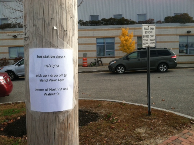
Based on my interactions with Portland and its residents, there seems to be a general consensus that the public transportation system is lacking. Three of my four mental map interviewees had recommendations pertaining to various public transportation aspects. The first map interviewee, a 28-year-old male from Munjoy Hill, suggested increasing bicycle lanes to encourage alternative forms of transportation. The next two women both suggested better public transportation overall and one of them more specifically suggested a better public transportation for the elderly population. Many classmates also found that Portland residents recommended and wanted a more extensive and accessible bus system. Within my infrastructure group, over a quarter of the suggestions concerned a component of transportation. Furthermore, my transect walk indicated that there were very few active bus stops, busses, and bus riders in at least the Munjoy Hill area. Most noticeably, on a two-mile walk there were no people waiting at any of the bus stops. The one noticeable bus stop that had benches and an overhang was closed the Sunday of my transect walk and in over two hours, I was only able to find a single running bus. Though a relatively small city, Portland still lacks some of the fundamental transportation aspects of many other cities. Even small items that encourage public transportation such as SmartCards or apps for bus times do not exist. These applications make public transportation more efficient and in turn, more accessible for residents as the system becomes more reliable. Therefore, the transportation infrastructure will ultimately be pivotal to Portland’s growth as a city and should be addressed and reformed.
I am hoping to also discuss transportation as a means for encouraging social equality and growth as my fourth mental map interviewee suggested that Portland should be more welcoming to residents of all socioeconomic backgrounds. I believe that an extensive transportation system could help bridge the gap between the Portland neighborhoods. In collaboration with more city events, the Metro bus system will act as the mode for which neighborhoods will interact. Festivals, concerts, and improved public spaces in Portland will only be effective in stimulating economic and social growth if residents have a means to visit these different parts. Therefore, I believe the first step to bridging the socioeconomic gap is to create the transportation infrastructure that will allow such interactions.
APPROACH TO THE SMART CITY
As a part of the “smart city” initiative, an improved public transportation should incorporate many of the efficient and environmental ideas of “smart.” Especially in a relatively small city such as Portland, it is necessary to create the foundations for transportation infrastructure that will still be relevant and applicable in the far future. Therefore, Portland should design the system with sustainability in mind using route analysis that will maximize ridership and minimize travel time.
Gabry’s article “Programming Environments: Environmentality and Citizen Sensing in the Smart City” suggests that as urban centers focus on economic growth, there is also an expectation of “greener” and sustainable in the efficiency[1]. As Portland’s population continues to grow, the use of public transportation becomes more necessary for traffic efficiency and as a way to curb greenhouse gas emissions. Alternative forms of transportation aid in decreasing the necessity for parking as well as reduce traffic congestion and gas emissions. As environmental concerns become increasingly prevalent in current news, cities need to ensure that their transportation systems encourage sustainable ideas and designs. Furthermore, Jimenez’s idea of “right to infrastructure” examines how open source technology exists in a city[2]. He argues that open source is becoming a necessity for urban politics and social theory. As cities, such as Portland, grow physically, there should also be a growth of open source infrastructure as a means to balance the city and make the city accessible for all residents.
Michael Sorkin’s “Travel in Democracy,” analyzes the urban planning of traffic and the idea of maximizing flow in the constantly growing environment of cities[3]. He suggests that modern urban transportation planning is based on conflict avoidance between the various modes of transportation. As cities grow it is necessary to consider how interactions between vehicles and pedestrians will change, especially in such a walkable city as Portland that is also experiencing higher levels of vehicular traffic. Sorkin argues that with such varying hierarchies of transportation, the physical and social aspects of transit must be taken into account. Thus, a core aspect of urban planning in Portland will be ensuring efficiency for all modes of transportation. The expansion of the bus system will ideally increase traffic flow without emphasizing the use of individual cars. Reduced travel congestion will be beneficial for pedestrians and bicyclists and open the city to all alternative forms of transportation.
LITERATURE REVIEW
There is a two-step process for rejuvenating Portland’s public transportation system. Physically, the service area should be larger and more accessible through bus stops and bus routes that optimize utilization. Currently, the Greater Portland Transit District Metro has not been generating sufficient profits and in 2010, bus fares were raised 20% in an attempt to close the deficit[4]. While expanding the system may seem counterintuitive, it is likely that the bus system is underutilized because of planning and efficiency issues. In order to generate higher revenue it will be necessary to reorganize the transit routes. As Portland’s largest form of public transportation, it is necessary that the Greater Portland Transit District Metro is available for residents at an affordable cost.
First, the Metro system needs to be physically accessible for its residents. Alan Murray’s “A Coverage Model for Improving Public Transit System Accessibility and Expanding Access,” analyzes how to design a public transportation system aimed at accessibility and efficiency with emphasis on increasing sustainability and decreasing urban overcrowding[5]. Murray references research suggesting that in the late 1990s, public transportation was severely underutilized. Assuming that public transportation is still underutilized, especially in urban hubs, there is much potential for economic growth and environmental awareness. The study is based on the belief that expanding transportation services will increase ridership and utilization. In 2012, the Washington Post released an article stating that public transportation tended to increase in times of high gas prices, but ridership did not necessarily change to falls in gas prices[6]. The idea is that public transportation is habit-based. However, the article argues that since many public transit services are not equipped to handle large influxes of commuters and creates overcrowding on these lines. However, for a bus system that does not seem to be at risk for overcrowding in the near future, the idea that public transportation is habit forming is particularly useful for encouraging and sustaining higher rates of ridership.
Secondly, public transit should incorporate a “smart” aspect for its transit system. Many large cities currently have apps and online sites dedicated to tracking wait times and travel times so that travelers can have up to date information on transit times. This smart approach affects accessibility and efficiency of the entire bus system, which then encourages more use by residents and visitors. Jan Frick’s 2014 article, “Improving Transport and Accessibility through New Communications Technologies,” discusses how technology can improve the “utilization and usability” of a large-scale public transportation system[7]. The project is looking to use satellites and integrated network sensors to increase accessibility and environmentally friendly transit systems in the North Sea Region. Though still in the relatively early stages, the Improving Transport and Accessibility through new Communications Technologies (ITRACT) project has been remarkably successful. ITRACT is creating transit improvements based on the needs of regions individually. While urban centers may work on decreasing rush-hour traffic, rural areas will focus on maximizing public transportation that is not heavily used. Given the dynamic of the city of Portland compared to the rural outskirts of areas like Cumberland County, ITRACT provides insightful technological ideas to support the vastly different regional environments near Portland.
More specific planning is discussed in Peter Furth and Adam Rahbee analysis of bus stop spacing in their 2007 study, “Optimal Bus Stop Spacing Dynamic Programming Geographic Modeling,” which modeled the effects of changing bus-stop spacing for bus routes and measuring the changing demand[8]. Furth and Rahbee determined that the optimal distance for bus stops is roughly ¼ of a mile. Further distances result in the exponential decrease of ridership and closer distances cause unnecessarily longer travel times. A quarter of a mile is generally agreed upon to be the optimal walking distance for a bus stop although there are studies to suggest that in high-density city blocks, 1/8 of a mile is optimal.
Thankfully, Portland’s city council is making an effort to encourage use of the METRO bus system. On September 10, 2014, the council discussed the effectiveness of bus stop placement. Metro staff concluded that many bus stops were not appropriately placed. Stops were either too close together, which made travel times unnecessarily slow, or needed to be relocated to better adhere to the Transportation, Sustainability, and Energy’s (TSE) bus stop placement standards. These developing criterion include access, proximity to sidewalks, lighting, safety, ADA accessibility, proximity to major origins/destinations, potential for bus stop amenities, connections, far-side preference, and spacing. While the city council and the TSE acknowledge that all bus stops can meet all the criteria, the standard acts as a strong foundation for deciding where to create, relocate, or remove bus stops.
Even more recently, the Portland Press Herald reported that the Metro and Greater Portland Transit District plans to discuss expanding the Metro bus service from Portland to Yarmouth and Freeport[9]. Though federal funding has not been secured, Metro officials are hopeful in the project and plan to start service by next summer. These transit routes will hopefully encourage travel to neighboring towns, but more importantly, provide working commuters to Portland with an alternative mode of transportation, which is more cost effective and environmentally friendly.
DATA AND METHODS
My data was taken from the Maine Office of GIS and the Bowdoin College GIS data. Using the Maine Office of GIS census data, I was able to find the population and size for each block in the greater Portland area and thus was able to calculate the population density. I overlaid the official city outline of Portland as well as Portland’s current bus routes to see which areas are actually accessible by the bus system. I then added a buffer zone around the bus lines, which is about a quarter of a mile based on previous studies, to estimate the distance that people would be willing to walk to a bus stop. I was unable to find a layer with only the bus stops, which would be more accurate in determining the accessibility of the transit line. However, given that these line buffers would be an overestimate of people that have access to the bus lines, rather than underestimate, it is still a good proxy for determining which areas are unable to access Portland’s bus system.
The second analysis was slightly more complicated and thus I used ArcGIS in order to access more involved ArcGIS geoprocessing tools. Using the population density of each census block I was able to perform a hot spot analysis that identified the statistically significant “hot spots” and “cold spots.” These spots reveal areas that would likely benefit the most from having bus routes, based on the population density. Initially I planned on incorporating the aforementioned Portland’s city council bus stop standards into my analysis, but there were no data sets on many of the criteria, such as lighting or ADA accessibility. However, should these data sets become available, I would use a location-allocation network analysis. A location-allocation network analysis is able to choose points that have the highest “demand” based on a set of criteria. Therefore, using the METRO bus stop standards, it would be possible to determine exactly where new stops could be placed to adhere to as many parameters as possible.
However, population density and count are not thoroughly representative of which areas need more accessibility to the Metro bus system. Isaac May’s project is researching the possibility of incorporating smart bus cards, which would increase efficiency and save paper, but also create a substantial data set on the most used bus routes. Based on the pure population density map, many of the bus routes reach areas of low density such as Falmouth. However, it is possible that a larger population of residents is actually using this route to commute to Portland. Therefore, the collaboration of data sets would more accurately indicate where additional routes would be most useful and which routes may be obsolete. Though my analysis provides a foundation for expanding the bus routes, a thorough analysis would need to include many additional data sets.
FINDINGS
The following is a map of Portland and the neighboring towns, Falmouth, Westbrook, and South Portland. It maps the population density of each census block in these areas. Most noticeable are the bus routes that reach areas of Falmouth and Westbrook despite exceptionally low population densities. Additionally, despite high population densities in the Portland boundaries, bus stops are still rather sparse.

The next map is a different analysis of the transit system using ArcGIS’s hot spot analysis. The population density acts as a set of weighted features that can be converted into hot spots and cold spots based on statistically significant z-scores. Z-scores are a measure of standard deviation and thus hot spots and cold spots can be determined based on population density deviations from the mean. Interestingly, the area in northeast Portland that is not particularly high in density is considered a hot spot at a 90% confidence interval.

DISCUSSION
Though expanding the bus network will definitely be a costly endeavor, it will ultimately help build the Portland community and stimulate the city’s economy and social scene. These two map analyses suggest that additional bus stops would be relatively close to the already existing routes, especially in downtown Portland. Therefore, it would be a matter of efficiently and optimally placing stops along these routes to maximize accessibility for the residents. As Plumer’s Washington Post article suggested, public transportation is habit based. Therefore, encouraging residents to use public transportation will perpetuate a cycle of increasing ridership. Higher utilization of the bus network will then in turn contribute to a more environmentally conscious city that reaps the economic and social benefits of less traffic and efficient transportation. Though my map analyses are incomplete, they create a foundation for modeling a new bus system that considers a wide range of parameters.
Though these maps analyze the physical dimension of a more efficient bus system, there is still a “smart” dimension that needs to be considered. For the expanded Metro system to work, busses need to be consistent and reliable. Residents will only use a transportation system that can be accounted for and trusted to arrive and depart on time. Though accidents and delays are often unavoidable, riders should still be informed so that they can plan accordingly. The current scarce, and often unreliable bus schedule, forces potential riders to drive rather than risk depending on an inconsistent system. Therefore, the implementation of apps for smart phones and up to date online wait times and travel times will allow residents to plan with the public transportation system. Many cities already have this technological facet for their transportation system. Washington DC’s Metro and Metrobus system incorporates both apps and online programs to determine exact wait and transit times. Especially when busses are infrequent and the weather is cold, knowing exact times are valuable in creating rider loyalty and support for public transportation. Ultimately, users will be able to easily access information that greatly increases their transit efficiency.
Increasing physical accessibility and reliability will hopefully encourage more ridership for the Metro bus, especially given the parking predicament in Portland. Limited parking spots in downtown Portland suggest that some part of the city will require changing. Rather than trying to build more parking lots in an almost full occupancy city, the transportation investment is a much more environmentally friendly and socially beneficial plan.
Assuming that both stages of this expansive project are fulfilled and successful, I am hoping that the Metro bus will become a gateway for neighborhood connectedness and diverse interactions. The city of Portland is constantly looking to continue its rich culture as an arts district, a working port, or an esteemed food hub. But many neighborhoods are deprived of these events, as there are currently no means for commuting. With the implementation of this transportation plan, inter-neighborhood connections would be much easier to navigate. Even with the rapid gentrification of certain neighborhoods, a means for the city to connect on a physical level will hopefully help bridge the socio-economic divides.
CONCLUSIONS
The discussion that the infrastructure of a city should support all residents resonates with the unequal distribution of wealth on a socio-economic scale in Portland. Though a smart bus system will not solve the socio-economic disparity present in Portland, it can be a means for increased interactions between the Portland neighborhoods. Designing an efficient and environmental transportation system will encourage residents in Portland to use public transportation, especially in the midst of a growing economic and social setting. In collaboration with many other Portland projects that our class has suggested, the transportation system will be a means for all residents to participate in the growing Portland culture. Ultimately, I am hoping that the city of Portland can use the transportation system as the gateway to stimulate economic, environmental, and social awareness and activity.
[1] Gabrys, Jennifer. 2014. “Programming Environments: Environmentality and Citizen Sensing in the Smart City.” Environment and Planning D: Society and Space 32 (1): 30–48.
[2] Jiménez, Alberto Corsín. 2014. “The Right to Infrastructure: a Prototype for Open Source Urbanism.” Environment and Planning D: Society and Space 32 (2): 342–62.
[3] Sorkin, Michael. 2014 [1999]. “Traffic in Democracy.” In The People, Place and Space Reader, edited by Jen Jack Gieseking, et al, 411-415. New York: Routledge, 2014.
[4] Bell, Tom. “METRO raises bus fares.” Portland Press Herald. 24 February 2010. Web. 15 December 2014.
[5] Murray, Alan T. “A coverage model for improving public transit system accessibility and expanding access.” Annals of Operations Research 123.1-4 (2003): 143-156.
[6] Plumer, Brad. “Public Transportation is habit-forming – and that’s a problem!.” The Washington Post. 18 May 2012. Web 15 December 2014.
[7] Frick, Jan. “Improving Transport and Accessibility through New Communication Technologies.” Advances in Production Management Systems. Innovative and Knowledge-Based Production Management in a Global-Local World. Springer Berlin Heidelberg, 2014. 572-578.
[8] Furth, Peter G., Rahbee, Adam B. “Optimal Bus Stop Spacing Dynamic Programming Geographic Modeling.” Transportation Research Record: Journal of the Tranportation Research Board. 1731: 15-22. Electronic.
[9] “METRO to hold public meetings on new bus routes in north suburbs.” The Portland Press Herald. 7 November 2014. Web. 14 December 2014.