Category Archives: Infrastructure

Separation as Increased Access: “Smarter” Flow in Traffic Infrastructure

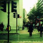
Both in-class discussions and readings regarding infrastructure involve debate about the “right to infrastructure,” and most prominently is the constant tension between pedestrians and cars— which should be prioritized in urban infrastructure planning. In his essay, “Traffic in Democracy,” Sorkin talks about how the city “organizes its prejudices and privileges physically,” specifically exemplifying how New York physically prioritized motor vehicles in its closing down of 50th Street pedestrian crossings. [1] Many have questioned New York’s decision, stating that such measures does not create equal access to the City.

First and foremost, the “equal” in “equal access to the city” needs to be qualified. “Equal” should be within relatively similar contexts. Surely, a Manhattan resident has more access to Midtown than a Long Islander. At this point, one may argue that even within Manhattan, motorists and pedestrians do not receive equal access to the roads. The equality here deserves qualifying, too. “Equal access” should mean that motorists receive equal access to the motor lanes, and all pedestrians should receive equal access to the walking lanes. Cross-comparing motorists and pedestrians is meaningless, as I will argue in the next paragraph.

Before I discuss the hierarchy between motorists and non-motorists, I would like to highlight that these two groups are not mutually exclusive— a person decides which transportation method he will use based on his specific situation. For example, if I travelled from far away, or if I am in hurry to reach my destination, I may choose to drive. If I intend to get more exercise, or I simply am not in a hurry, I may choose to walk. The decision of being a motorist or not is more dependent on which gives the person more utility. Surely a person in a hurry should not be waiting for a person that is not.

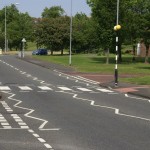
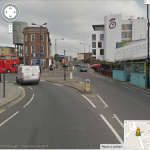
So how to promote smarter infrastructure and city experience for all if the road is not meant to be divided equally between cars and pedestrians? My suggestion is to have dedicated passageways for each. Motorists travel from further distances and prioritize saving time, so a couple major roads and thruways can be dedicated for their usage, with big parking lots accessible near the thruways. At the same time, other roads should be converted to exclusive pedestrian usage. Separating different forms of traffic based on their different speeds and needs will improve the flow and efficiency of the city, while also minimizing congestion. Sorkin describes the “flow” in New York, and how that resulted in slower moving bodies deferring to faster ones. [1] However, if we separate them, no group would have to specifically defer to another. And this is definitely something Portland can implement with its current roads system.

[1] Michael Sorkin, “Traffic in Democracy,” in The People and Space Reader, ed. Jen Jack Gieseking, et al (New York: Routledge), 2014, 411-415.


Human Infrastructure to Fill Out Physical Infrastructure

“People as infrastructure” is a concept at the core of any healthy and thriving city. People are the most important part of the city—without them there is no culture, no community, no innovation, and reason for innovation to exist. There is no city without people. In all cities, people function as cultural infrastructure, and in some cities as even more.

In New York City (and around the world), people absolutely function as the infrastructure of city image. While the specific purpose of the infrastructure varies—be it image, black market, street art, punk rock— cities are filled with networks of people without whom a factor of the city’s life would crumple. Networks of people are the infrastructure of culture; in Johannesburg they are the infrastructure of life, as well.

In Johannesburg and other African urban centers, people function as infrastructure in a more day-to-day way. Without this form of infrastructure residents might not have electricity, food, clothing. [1] In smaller communities, “people as infrastructure” can function as the lifeblood of cultural expression and organization. New Brunswick, New Jersey is home to a thriving punk rock scene that operates through semi-legal underground punk shows in residential basements. The location of each show is kept secret except through connection to the New Brunswick network of punk-rockers.

The problem is that you can’t just make people into infrastructural systems. In Johannesburg the human infrastructure developed out of need. Short of dire need for infrastructure, some form of guidance or policy is necessary to create a system in which “people as infrastructure” can form. Essentially, physical infrastructure may designed so that there is room for “people as infrastructure” to fill it out and make it operate to fuller potential. Once it is decided who should “give ground,” [2] those on the ground have the potential to make the system run as well as possible.

One of the best ways to make infrastructure work well, and traffic flow smoothly, is good communication between the moving parts. In London there are three different kinds of crosswalks: the zebra crossing where pedestrians always have the right of way, a smaller designated crossing where motorists always have the right of way, and a crossing controlled by traffic lights where the right of way is allotted to each. These crossings are not only well marked, they are well-conceived. They each fulfill a different and often site specific need in the city.

This crossing system, which relies on the knowledge and judgment of people, is a form of promoting “people as infrastructure.” People who know exactly how to use the city make it function better and more efficiently. This knowledge is helped along through government supported “people as infrastructure,” too. On the pavement at every busy crossing is written “Look Left” or “Look Right,” to keep disorientated pedestrians from being hit by cars. This kind of guidance helps modern city traffic to move as quickly as possible on roads that in some cases were originally built for Roman foot soldiers.

Portland is such a small city that it seems ridiculous not to privilege pedestrians in most infrastructure. Part of this might just be putting in infrastructure to make the city more pedestrian friendly. This includes well-marked, free public parking in useful places, so that people get out of their cars to walk. It includes enough public seating to make walking a realistic and attractive means of transportation. It includes considerations of sidewalk width and street crossings that help pedestrians to be comfortable.

Whatever the changes, a clearly marked system would be pretty necessary for success since so many of the Portland’s summer pedestrians are tourists. Everyone can benefit from a little more clarity in public directions, though.


[1] Simone, AbdulMaliq. 2014 [2004]. “People as Infrastructure: Intersecting Fragments in Johannesburg.” In The People, Place and Space Reader, edited by Jen Jack Gieseking, et al, 245. New York: Routledge.

[2] Sorkin, Michael. 2014 [1999]. “Traffic in Democracy.” In The People, Place and Space Reader, edited by Jen Jack Gieseking, et al, 411. New York: Routledge, 2014.

[3] Britton, Ian. Pedestrian Crossing. Digital image. Freefoto.com. N.p., 2 June 2007. Web. 8 Oct. 2014.

[4] Screenshot from Google Maps, from post code W10 in London, UK. Coordinates for Google Maps [51.525564,-0.214748]

[5] London Crosswalk Countdowns. Digital image. Jocabola.com. N.p., n.d. Web. 8 Oct. 2014. <http://www.jocabola.com/archives/blog/london-crosswalk-countdowns/>.


Interconnected Infrastructures

There are many elements of a city. Of course, there are the three overarching subjects that we as a class are focusing on: housing, public space, and infrastructure. Housing is necessary because without it there would be no people inhabiting the city. Public spaces are also vital because they can be used by everyone and make possible encounters and events that would not occur in private areas like workplaces and homes. Unlike housing and public space, infrastructure quite literally makes a city a city. Roads and bridges – edges – connect isolated locations – nodes – to form a greater place known as the city. There are numerous forms of infrastructure, each of which is suited to a different type of city or environment. Areas with a large number of people and businesses might benefit from roads and highways, for example. In a less busy area, sidewalks might be more appropriate than massive freeways. As with anything, determining which types of infrastructure are the best requires context.

There are myriad types of infrastructure useful in the smart city. One of the most promising and relatively new areas of infrastructure is that of digital technology. In the so-called “Silicon Age” we live in, computers seem to have limitless potential for the ways in which they can improve our lives. While public Wi-Fi, Ethernet, and fiber optic networks are of course practical in any modern city, infrastructure does not need to be limited to the physical realm: websites and apps can be just as useful as any physical network. To use an example of which I’m sure most Bowdoin students are aware, the Bowdoin dining app makes those difficult-to-make decisions regarding where to eat that much easier. These applications do not need to be limited to a single developer: the NYC subway application contest we discussed in class is a fantastic example of how the public can be brought together to create something that benefits everyone. [1] The MTA App Quest Challenge is a perfect example of one of the main ideas discussed by Alberto Corsín Jiménez in his paper “The Right to Infrastructure”: “in beta” infrastructure. [2] Furthermore, the crowdsourced nature of the MTA App Quest Challenge takes advantage of the talents of everyone in the community who wants to contribute. This is much like what Jiménez refers to as the “open source” model. [2] This model does not only apply to smart cities, however; it also has tremendous implications for any society.

What is so great about the open source model of creating infrastructure is that anyone and everyone can contribute to a project to make it better. Jiménez gives many examples, such as the El Campo in Madrid and the Inteligencias Colectivas initiative. [2] As El Campo shows, open infrastructural projects may have nothing to do with digital technology. Whether they are physical or digital instances of infrastructure, open source projects have the potential to help and empower communities in ways unlike any other. Again going back to the example of El Campo, the forum of people governing the space – known as La Mesa – met with Madrid’s City Hall less than two years after its creation. As Jiménez states, “This move challenged almost thirty years of urban politics in Madrid, where City Hall had long ignored all citizen claims that were not channelled through local Neighborhood Associations.” [2] Open source projects have the potential to give people a voice who otherwise would have none. Surely this is a promising model of infrastructure for promoting the common good. By giving everyone a voice and the ability to directly impact the city, infrastructure can best serve everyone.

This open source model is already starting to have an impact on Portland. Below is a user-created map of bike paths in the city: [3]

Portland bike map

As we can see from this map, there are several, but not lots of bike paths in Portland. One way Portland could improve would be to have more transportation options for people trying to get around the city. Currently, there are limited public transportation options and few other ways of getting around the city other than walking and driving. Although Portland is a very walkable city, it would be nice for people without cars to have faster ways of getting around. Taking inspiration from our class discussion about bicycle lanes in Berlin, I think a greater abundance of bike lanes in Portland would certainly benefit those who want to quickly get across the city without having to drive. Currently, bicyclists have to choose between riding on the sidewalk or riding on the road, neither of which were designed for bicycles. As Michael Sorkin puts it, “Modern city planning is structured around [. . .] conflict avoidance. Elevated highways, pedestrian skyways, subway systems, and other movement technologies clarify relations between classes of vehicles for the sake of efficient flow.” [4] While it might be a stretch to say Portland needs to be reworked to incorporate subway systems and pedestrian skyways, having bike lanes would make traveling much easier for cyclists.


[1] “Home,” MTA App Quest, accessed October 8, 2014, http://2013mtaappquest.challengepost.com/.

[2] Alberto Corsín Jiménez, “The Right to Infrastructure: A Prototype for Open Source Urbanism,” Environment and Planning D: Society and Space, volume 32 (2014): 342–362.

[3] Gordon Harris, “Bicycle Routes in Portland Maine,” Cycling Routes in New England (blog), March 2011, http://cyclingnewengland.blogspot.com/2011/03/bicycle-routes-in-portland-maine.html.

[4] Michael Sorkin, “Traffic in Democracy,” in The People, Place and Space Reader, ed. Jen Jack Gieseking et al. (New York, Routledge), 411–415.

Infrastructure: Top Down and Bottom Up

Admittedly, when first thinking about infrastructure, only roads, transportation, public space, and schools came to my mind. I did not consider even much of how data and information, let alone social cues too make up infrastructure. But as we have read and discussed in class, infrastructure is the physical, technological, and social materials undergirding everyday social life. Social infrastructure is perhaps the most significant because it is the least tangible and thus intertwined in our everyday lives in complex and enigmatic ways. Simone describes how she found that social infrastructure in Johannesburg notably consisted of economic collaboration among marginalized residents. [1] This kind of infrastructure is also noteworthy in the way that it was created from the bottom up. That is, this “conjunction of heterogeneous activities, modes of production, and institutional forms” [1] grew out of both cultural practice and the existing physical infrastructure in the area implying development beginning from within the culture itself. This infrastructural progress could be vastly different than those suggested by the smart city because much smart technology is usually begun from city management then down to the people. I argue that infrastructure of physical and technological kind must be appropriately implemented so as to consider the underlying culture in order to ensure the most successful installment into cities. Social infrastructure, like laws and regulations which already have underlying cultural reason behind them usually, is inherently cultural and so it will in most cases begin from the bottom up and compliment the beliefs of the people.

However, there have been many cases in the past where a top down approach was used to develop infrastructure in cities. One of the first times that such an approach was used on the city of New York was in 1811 when the Jeffersonian grid was implemented for northern Manhattan. The approach was successful at the time because there simply were very few settlers (except maybe Native Americans, but U.S. history marginalizes them anyway) north of the area around the old Dutch colony and thus the implementation of the grid structure had little impact on current people. Conversely, despite the millions of people that then lived in New York a century and a half later, Robert Moses led nearly countless infrastructural projects in the mid-twentieth century that drastically changed the structure of the city. He famously described how to complete these projects that in some ways literally tore up the city, he had to hack his way with a meat ax. Yet, Berman reflects that “Moses was destroying our world, yet he seemed to be work in the name of values that we ourselves embraced” [2] which were principles like progress and modernity. The power invested in him as the city planner allowed him to have such control over the development of the city. Finally, a recent example of the top down approach was described in Sorkin’s article about the shutting down of crosswalks at 50th and 5th by Mayor Guiliani in 1999. [3] In this mindset, pedestrians were an inconvenience to cars and not the other way around. This approach, however, was against the social infrastructure that had developed in the area (which in this case was actually more of a free for all constructed by the movements of tourists). Although the “car is the main means for activating the landscape” [3] in the eyes of Guiliani and Moses, this was not always the case for the way that social structure had developed upon that landscape. In fact, years later, NYC city planners would realize this and begin to shutdown roads to cars in places like Times Square. Thus, though a top down approach can be a successful approach at city planning, it does generally need to consider the preexisting social infrastructure of a city in its implementation.

The other approach to be considered is a bottom up approach in city planning. By bottom up, I mean, that the potential for more physical (or even legal) infrastructure beginning with the already developed social infrastructure of the people. The Johannesburg example described by Simone is a good example because it highlights how “residents experience new forms of solidarity through their participation in makeshift, ephemeral ways of being social.” [1] This illustrates one of the many ways that this infrastructure contributes to the common good. An outsider could certainly view the less technological ways commerce in the city is organized and simply dismiss it as rudimentary, but the interactions are certainly complex in their own way and allow for more personal interaction. Jimenez also describes how open source urbanism is a great way for smart technology to be implemented in a bottom up approach. Developing the term “right to infrastructure” (following from Lefebvre’s “right to the city”), Jimenez focuses on the importance of the ascent of free and open source software [4]. This sort of approach is also novel because it simultaneously gathers and juggles media systems, interfaces, and social relations together to product a produce an infrastructure that also has the right to produce any existing infrastructure and us. [4] When we discussed in class how social infrastructure can be just as durable, apparent, and reinforcing as physical infrastructure, I recalled reading an article about Nathan Pyle’s book of NYC Basic Tips and Etiquette. [5] His book includes many tips about how to navigate city and also describes many of the rules of behavior that is often expected, but not usually policed. And since this book is simply written and created by a New Yorker, it demonstrates a bottom up approach in developing social infrastructure. The article is here and I will try to post some of the images below (in .gif form so click on them to see the movement!):

BI_140501etiquette12

BI_140501_survive nyc 3

Ultimately, city planners need to be as culturally relativistic as possible when considering an implementation of new physical and technological infrastructure. For instance, IBM and Amazon developing lobster drones to deliver goods around the city of Portland may not be the most practical idea because residents of the city may have strong negative feelings about the idea (although they admittedly could be positive – I do not think any research has been done on the matter). There are advantages and disadvantages to both kinds of approaches of infrastructure development, and Portland needs to consider how balancing them both. Free and open source software seems like a right to city development and perhaps it is only practical to allow people to do some of the development work. Of course, city government can always hold the final say, so it simply makes sense that city councils could reach out to exactly the people they are trying to please (the people who live in the city).

References

[1] Simone, AbdouMaliq. “People as Infrastructure.” In The People, Place, and Space Reader, edited by Jen Jack Gieseking, et al, New York: Routledge, 2014. 241-246.

[2] Berman, Marshall. “All that is Solid Melts Into Air: The Experience of Modernity, Verso.” 1983. 287-348

[3] Sorkin, Michael. “Introduction: Traffic in Democracy.” In The People, Place and Space Reader, edited by Jen Jack Gieseking, et al, New York: Routledge, 2014. 411-415.

[4] Jiménez, Alberto Corsí­n. “The right to infrastructure: a prototype for open source urbanism.” Environment and Planning: Society and Space 32 (2014): 342-362.

[5] Pyle, Nathan. “NYC Basic Tips and Etiquette”. 2014.

Smart Technology in Housing and Gentrification

Housing cannot be discussed without gentrification and that is exactly the issue that looms over the advent of the smart city. Gentrification as a term was first coined by Ruth Glass in 1964 to describe the process of middle class residents moving into lower class neighborhoods and subsequently driving up property values. The causes for gentrification vary by case, but real estate investment is certainly an important factor. Further, private equity real estate investment is exactly what Fields and Uffer identify as an important factor that causes financialization, which ultimately leads to “higher inequalities in housing affordability and stability and rearranged spaces of abandonment and gentrification.” [1] Therefore, we can expect that the investment needed to build the smart city should have similar results to the effects of financializtion in Berlin in New York described by Fields and Uffer. As global financial integration transformed the political economy of housing in both cities, it either furthered gentrification or deterioration depending on the area. In New York, private equity firms “repurposed informality as a leverage to evict ‘illegal subletters’” [1] forcing out lower-income residents who could not afford legal representation in court. In Berlin, a similar process occurred as well, which was that in neighborhoods where housing investors tried to minimize costs and did not focus in housing maintenance, people would often abandon the deteriorating housing: “Households with the resources to secure better housing often left, concentrating low-income households without other options.” [1] I fear that it is likely that smart technology will be only installed in the areas of the city that investors would deem “appropriate” for the technology and thus this would further marginalize or gentrify certain areas.

The technology necessary to making housing smarter also has its pro and cons as well. A smart city requires housing that is integrated community-wide, or at least all updated with current technology. And Greenfield criticizes the smart city in the way that “it pretends to be an objectivity, a unity and a perfect knowledge that are nowhere achievable, even in principle.” [2] This is certainly the case for smart technology that requires citizen actuation, as it may not always be correctly sensing an issue in the grid and requires anthropogenic maintenance. This kind of intermediate technology, though certainly not objective, does seem to be the most affordable and easy to install. Crowley demonstrated how such technology could reduce energy usage in an office building by up to 26% by notifying workers via twitter of items using energy that were not being used by anyone. [3] Further, this technology may be of minimal cost and this easy to implement in a variety of public and private buildings. Thus, use of smaller scale and less expensive technologies could lessen the probability that energy and technology companies would first begin this program in higher income homes and organizations, subsequently expanding differences between income classes. Therefore, this kind of smart city may actually be very useful in promoting the common good in the way that it uses simple measure to reduce energy costs in buildings.

The reason why we must very strongly consider how investment in smart technology in housing could gentrify areas and exacerbate class differences is because this has proven to be a significant issue in the past. Smith highlights how the transformation of the lower east side into the “East Village” is a perfect example of how gentrification created class conflict. Hundreds of homeless people were evicted from Tompkins Square Park in the dead of winter in December 1989 following riots in August the year before as many were angered about the rampant gentrification of the area. [4] This site and area became a symbol of new urbanism being categorized as the urban “frontier”. [4] It would appear that the American tradiation with manifest destiny continued as “real-estate cowboys” sought to take control of the “uncivil” working class and take over this “new” territory from marginalized communities in a romantic, yet dangerous way. [4] It is very easy to see how this could similarly happen in the future as smart city technology becomes increasingly available. “Software Cowboys” could bring forth sensor technology to “civilize” the lack of smart technology in marginalized neighborhoods.

Overall, Portland will need to both take ideas from the smart city and preexisting housing institutions and structures currently available. Use of human actuation systems in building energy use over the high cost of actuation systems can both easily reduce energy usage and thus costs and also help to develop more of a sense of community in these building through the human actuation process. Therefore, implementation of such housing technology seems pragmatic for the community of Portland (especially for a city that spends much money on the heating of buildings during the cold winter). However, these technologies should be implemented in a cautious manner as to not allow already privileged communities develop more advantages and cause oppressed communities to be more at a disadvantage. Specifically, perhaps it would be wise to install such technology in a non-profit like Preble Street that is already looking for easy ways to reduce energy cost.

Ultimately, as smart technology is likely more frequently used in cities around the world, we must carefully consider how these implementations may worsen preexisting social inequalities. If we look at what real estate investment has done to many communities in the past, we need to carefully consider what smart technology may do to these same and similar communities in the future.

References

[1] Fields, Desiree, and Sabina Uffer. “The financialisation of rental housing: A comparative analysis of New York City and Berlin.” Urban Studies July (2014): 1-17.

[2] Greenfield, A. Against the Smart City. 2013.

[3] Crowley, David N., Edward Curry, and John G. Breslin. “Leveraging Social Media and IoT to Bootstrap Smart Environments.” In Big Data and Internet of Things: A Roadmap for Smart Environments. Switzerland: Spring International Publishing, 2014. 379-399.

[4] Smith, Neil. “Class Struggle on Avenue B: The Lower East Side as Wild Wild West.” In The People, Place, and Space Reader, edited by Jen Jack Gieseking, et al, New York: Routledge, 2014. 314-319.

Responsibility and Representation in Public Space

Considering the readings and our discussion in class, it is evident that public space, and the public sphere in general, is at odds with the largely pervasive private sector of capitalistic America. I found that a point in the Mitchell reading when he references Jeremy Waldron (1991) highlights this point: “In a society where all property is private, those who own none…simply cannot be, because they would have no place to be.” [194]1 This emphasizes the importance of owning property as a significant attribute to being an American citizen and how it marginalizes those who do not possess any property. Public space, thus, can provide a space that allows an opportunity for representation for those unable to be represented by simply the private sector and is illustrated when Mitchell writes “In a world defined by private property, then, public space (as the space for representation) takes on exceptional importance.” [194]1 However, admittedly, it may not be the public space that allows for this representation, but rather it is the representation that “both demands space and creates space.” [195]1 Regardless, there is inherent need and importance surrounding public space as it, in many ways, is a vehicle for many basic spatial rights like access, freedom of action, and changes. [17]2 Despite the fact that public spaces are meant to fulfill many key spatial rights, we still found, through our walk through Portland and examples in class, that these spaces may not be indeed used as often as we would think for something that is so necessary by definition.

Thus, considering this foundation, it is evident that in the smart city, public spaces will continue to be at odds with the private worlds that surround them. Whether or not this distinction puts public spaces in a place of power or is oppressed by the private sector, it would certainly be wise for the public (e.g. the City of Portland) to partner up with useful smart city technology providers (e.g. IBM). Such partnerships can certainly be much smaller and still help to make public spaces much more effective. The Bryant Park Corporation is the group we focused on in class because of the way this privatization of a public space has been widely successful. It would seem highly likely that if corporations, especially those near a public space, are allowed some stake in the public space that they would feel somewhat of a responsibility to take care of it because of the investment made. This is certainly something that Portland and other potential smart cities should keep in mind.

Another factor that smart cities and Portland should consider in developing public space is its utility and how people interact in these spaces. I found an interesting article describing how Keith Hampton is building on the findings of William Whyte decades later in understanding how technology is changing the use of public space. [3] This article mentions the Whyte videos we watched in class that concluded that seating is one of the most important factors in developing useful public spaces. Many of the spaces filmed were near Bryant Park and Hampton did some recent filming to compare with those of the past. Hampton found that social interactions, the number of people, and the number of women has increased in public spaces since Whyte’s filming. This was unexpected as many assume that technology (i.e. use of mobile phones) would actually cause use of public space to decrease. Although he mostly considers technology in the article, certainly the Bryant Park Corporation had some to do with the findings.

It still should be noted that by making public spaces private in some ways, we are preventing them from delivering their original purpose: to allow for a space that has the potential to represent anyone. Although partnerships between the public and private can certainly improve public spaces, does this allow for the representation that is theoretically expected of a public space and benefit the common good? Certainly partnerships may seem to move away from an idea for the common good due to their nature, but they do seem to improve the life experiences of so many people in an efficient manner. When considering the World Trade Center Memorial like in Low’s article, I am not sure we would want an important place of remembrance for all Americans to be in any way controlled by a private company. We would allow, however, for some type of public control (e.g. security), while perhaps still granting many rights to spaces like freedom of action. [4] Both the suggestions by the grade schoolers in Low’s article and the actual result (One World Trade Center and the 9/11 memorial) are certainly a mixture of both public and private as 1WTC is partially owned by a real-estate company and many of the grade schoolers suggested options that varied between the two sectors.


References

1. Mitchell, Don. 2014 [2003]. “To Go Again to Hyde Park: Public Space, Rights, and Social Justice.” In The People, Place and Space Reader, edited by Jen Jack Gieseking, et al, 192-196. New York: Routledge, 2014.

2. Low, Setha M. 2002. “Spaces of Reflection, Recovery, and Resistance: Reimagining the Postindustrial Plaza.” In After the World Trade Center: Rethinking New York City, edited by Micheal Sorkin and Sharon Zukin, 163-72. New York: Routledge, 2014

3. http://www.pps.org/blog/technology-brings-people-together-in-public-spaces-after-all/

4. http://abcnews.go.com/US/selfie-911-memorial-teens-story/story?id=24676819

5 Ideas For a Better Smart City

Rapid technological progress over the past 20-30 years has made us  very dependent on the computers that are in our backpacks, pockets and even wrists. As humans got more used to using technology in everyday life, some of the humans came up with the idea of a Smart Cities that are built upon technologies that we love so much. But, what exactly is a smart city and what role do humans play in it, if any at all.

There are couple of Smart City projects around the world: Masdar City in the oil-rich United Arab Emirates or the Korean New Songdo. Adam Greenfield, in his book “Against the Smart City” describes the developers of these cities in a following way: It’s that their developers appear to lack any feel for the ways in which cities actually generate value for the people who live in them[1]. And it is hard to disagree with Greenfield. I came across this video featuring Masdar City – an empty city populated solely by robots.

After watching this video, I asked myself a question: Would I want to live in a city like Masdar? where everything is automated and there is nothing for humans to do except for enjoy the ultimate lifestyle and work experience[2]. Cities like Masdar or New Songdo will probably not be populated by anyone who is alive today, because such a drastic change of lifestyle is hard. However, there are ways in which technology can be applied to existing cities without sucking sole out of them and converting them to dense settlements[3], where only robots can hear you scream.

1. Buses That Arrive On Time
Portland, ME Bus Stop

Availability, reliability and performance of public transportation is crucial to the city and its performance.

2. More & Better Parks
Lincoln Park

During a two hour walk in Portland, I only noticed 3 or 4 parks and most of them were decrepit, had benches in awkward places and grass was not cut evenly. This creates a very uninviting and repelling atmosphere. Location of the park also matters;

3. Maps, Schedules, Everything – Digital & Easily Accessible

Tbilisi Bus Stop

This a photo of a smart bus stop in Tbilisi, Georgia. The screen displays bus ETA, air temperature and time in Georgian and English which really makes it easier for tourists to get around. The screen also acts as a wifi hotspot. As there are bus stops all around the city, it automatically became covered by a publicly available wifi network. Portland could also implement this kind of system; an app that provides access to schedules and city maps could also be developed.

4. More, Easily Available Public Spaces

Anything from stairs in front of the building to the communal tennis court can count as a public space, so there is no photo for this one. It is extremely important for city dwellers to have places to take a break from the rhythm of the city. Developing such areas will create basis for a happier and healthier population.

5. Data Collection For A Good Cause
Power of Crowdsourcing
Data collection does not necessarily involve CCTV cameras and sensors that feed data to a closed, centralized system. Data collection can be a process open to the public. In fact, Open Data is even better because it creates opportunities for innovation and entrepreneurship. I think Portland could really benefit from an open-source crowdsourced data collection platform, where citizens could upload photos and geolocations of places that need fixing or renovation.


Some of the ideas above have to seem no connection with each other; however, there is one thing uniting them: all of them can be implemented using the same technology that powers smart cities like Masdar or New Songdo without devaluing humans in the city ecosystem.

The best thing about these ideas is that implementing any one of them will spark the development of the other by rising public demand. A more reliable public transportation system will encourage people to leave their cars at home and go for walks (knowing they will not have to walk all the way back – they will be able to take a bus!). More people going for walks will encourage development and growth of public spaces which will create opportunities for outdoor performances and street artists.

However, implementing a crowdsourced open data collection platform excites me the most. This data could be used to figure out where to place parks and where to put bus lines; tracking the location of people in parks would enable planners to place benches in relevant places. The openness of this data, would enable 3rd party developers to create even better apps to power the city life through applications that could be targeted at people living in specific locations or of a specific demographic.

Opportunities are limitless, we just need to implement technology without removing life from the city.

————————————————————————————-

Citations

1. Greenfield, Adam (2013-12-20). Against the smart city (The city is here for you to use) (Kindle Locations 306-307). Do projects. Kindle Edition.

2. Greenfield, Adam (2013-12-20). Against the smart city (The city is here for you to use) (Kindle Location 86). Do projects. Kindle Edition.

3. Greenfield, Adam (2013-12-20). Against the smart city (The city is here for you to use) (Kindle Location 47). Do projects. Kindle Edition.

Improving Public Transportation and Access

5 Recommendations for the City of Portland relevant to infrastructure:

1. The parking situation in downtown Portland is not great, especially during the winter when snow removal blocks off portions of streets. Could we come up with a way to improve upon parking?

2. The public transportation system stinks; the buses run sporadically and there is little to no signage or mention of how the system works.

3. Can we create some kind of infrastructure (combined with tourist attractions) that will make tourism in winter more accessible?

4. There seems to be a large divide between the local suburbs (or even just more residential areas of the actual city of Portland) and the downtown area. Can we adjust the transportation system between these areas to help link them to downtown Portland?

5. Maps placed around Portland would be very helpful to orient tourists (and even residents) to Portland geography. There are very few maps around the downtown area and the ones that exist are specifically in Old Port; maps placed in areas of Portland would be beneficial to people navigating the city by foot or bike who do not have GPS access.

When I walked around downtown Portland last Sunday for the field trip, the most surprising lack of infrastructure to me was the absence of a practical public transportation system. We walked around Portland for approximately 3 hours and saw so few buses pass by that we did not realize there was a public transportation system. Professor Gieseking even gave us an example of how spotty the bus service is in Portland; she explained how the bus is supposed to run every 30 minutes to the airport, but often is late or does not show up at all. While I do believe that Portland is quite a walkable city, the lack of a functional public transportation system makes it difficult for residents and visitors to access different parts of the city. I also believe that a better transportation system in downtown Portland as well as the greater Portland area would, to a certain degree, alleviate issues with seasonal access to Portland.

If Portland were more accessible to people without cars, I believe it would become a larger tourism hub in New England. I realized this from my experiences in Portland as a Bowdoin student last year; I found it difficult to go to Portland without using Bowdoin’s shuttle/taxi agreement because I did not have a car on campus. The Amtrak Downeaster and the Concord Coach Lines bus do not stop in downtown Portland, making it very difficult for people to access the city without either having a car or spending exorbitant amounts of money on taxis. I believe that if there were more ways for people to access the downtown area from neighboring suburbs or even from farther away, Portland would have less of an issue with seasonal tourism.

What I find very interesting about public transportation in Portland is that it is not an issue discussed in City Council meetings. I have browsed all of the minutes and agendas from meetings in the last three months, and none has mentioned public transportation. The July meetings mentioned the “Portland Area Transportation System,” but on closer look, the discussions in this category were only about funding for road repair and traffic lights {1}. It seems slightly ridiculous to me that representatives in Portland can be unhappy about things like the lack of winter tourism when they have not figured out ways to make the city more accessible at all times of the year. I do not think Portland is necessarily ready to become a “smart” city along the lines of cities discussed in Adam Greenfield’s “Against the smart city” because it not only lacks the financial support to overhaul its technology but it also has a certain New England charm that could and most likely would be compromised by large-scale changes. While Portland could probably use a transportation app and a new bus map (see below) to help residents and tourists with transportation around Portland, I am not sure if Portland could benefit from a major change in transportation infrastructure, as a major change could potentially reshape the city and people’s perceptions of Portland. This made me think about how even though I am in support of certain aspects of smart infrastructure, I do agree with some of Greenfield’s points. Greenfield discusses how implementing smart technology in cities is often assuming that “there is one and only one universal and transcendently correct solution to each identified individual or collective human need” {2}. Humans are not perfect and cannot live in an entirely regulated world. I believe that drastically changing something like the public transportation system in Portland into a specific, technologically smart system would be trying to achieve a robotic, futuristic perfection that does not exist in the culture of Portland. However, I do think that creating tangible change through a transportation app and a phased-in reworking of the transportation system would be highly beneficial to residents and visitors of Portland.

While from the map it seems that Portland has a wide-reaching bus system, maps are nowhere to be found around downtown Portland and buses are rarely seen passing by {3}.

{1} Portland City Council. “Regular City Council Meeting Agenda.” Portland City Agenda Center. http://portlandmaine.gov/AgendaCenter/ViewFile/Agenda/07212014-479?html=true (accessed September 24, 2014).

{2} Greenfield, Adam. Against the smart city. New York City: Do projects, 2013. Kindle loc. 432.

{3} “Main Map.” Greater Portland Transit District. http://gpmetrobus.net/index.php/main-map (accessed September 24, 2014).

Smart Solutions for Infrastructure in Portland

Smart City Innovations (In regards to Infrastructure)

  1. Free Wifi Hot spots
  2. Smart devices/sensors spread throughout the city that acquire real time data, alerts and information processing
  3. App and online applications that tracking information such as: energy, parking meters, amount of parking spaces available
  4. Within 2 miles of a home there should be access to public transportation
  5. Public maps that are accessible online and in print

After reading portions from Adam Greenfield’s book and our field trip to Portland, I feel as if I learned a great deal about the city that I did not know before. Portland has so much potential and I agree with Greenfield on many aspects of the evolution into smart cities. Firstly, as a society we need to think beyond the norm. If we continue to structure a smart city with the current definition of what “smart” means, Portland will not become “smart”. We need to be looking to the future and try to be one step ahead of the evolution of technology. Looking at a smart city in a standardized way also helps to promote the connotation of the city, in the case Portland, becoming stagnated, and unoriginal and lacking character. However, in building a smart city creativity and digital intelligence advancement go hand in hand.

As someone who has not been to many places in Portland (excluding a select few restaurants), it was awesome to learn so much about Portland’s history and how the city became what it is today. Being that it is only about 3 miles long, I felt like I quickly gained a sense of the vibe of Portland. As the city continues to improve, it still manages to keep a very laid back, small New England feel, which I think is very important. The infrastructure I am proposing to add to the city of Portland should not disrupt its current happenings. Rather, it should exist in a way that it begins to become a major presence but in an intrusive way.

Smart devices, which would be placed throughout the city of Portland, would be a “smart” investment. This system would be made up of sensors that send back real time results of data, alerts, and information that city workers could instantly receive. Additionally, the presence of these devices would greatly improve efficiency and help intelligently run the community. Participants that are involved in bettering  the city would now have the opportunity to minimize or maximize certain factors in that city that used to not be in their control. This form of Information Technology, would be become the foundation for the running of society.

Greenfield, Adam. 2013. Selections from Against the Smart City. 1.3 edition. Do projects.

Peers for Portland Piers: Public Parks, Palatable Provisions, and Private Pads

  1. Traffic schedule amendments (More bus pickups)
  2. Waterfront access (Pier parks)
  3. Traffic schedule amendments (More public parking/vertical garages)
  4. Public  drinking water/restrooms
  5. Utilization of piers

While I believe public restrooms and drinking water would be beneficial to Old Port (I don’t believe they are necessary in less-touristy neighborhoods), I think retooling traffic assignments and increasing pleasurable waterfront access are more important to the City of Portland. Looking at these changes in terms of excitement factor (because, let’s be honest, who doesn’t get giddy about traffic schedule amendments) I would argue that utilization of the piers by the development of public recreation areas (similar to a park, but with outdoor exercise equipment, physical challenges, etc), private housing (similar to the condos already present on the piers), and  restaurants/entertainment venues (similar to DiMillos) would have the most direct impact on the city, specifically the Old Port. I am imagining transforming one, or preferably several, of the run-down, seemingly abandoned piers into a greenspace intended to allow access to the waterfront, provide pleasurable public space for visitors and citizens, and enhance the value of surrounding buildings. This project has already been tested in small scale in Portland at Moontide Park, beside the new Ocean Gateway Pier near Hancock and Thames Streets. I experienced this park this summer at the Shipyard Half-Marathon after-party, where there was a concert, beer garden, and other great activities in the pleasant greenspace. A second, larger scale example is Race Street Pier in Philadephia, PA. (http://www.visitphilly.com/museums-attractions/philadelphia/race-street-pier/)

Race Street Pier

Doesn’t that look like an inviting greenspace?! Now, imagine adding outdoor exercise equipment, in an effort similar to one from Ben Butterworth Parkway in my hometown of Moline, Illinois. Check out: http://www.genesishealth.com/healthinfo/healthbeat/ , the hospital system sponsoring the exercise program in my town.

Upon investigating the City Council’s minutes, I have found nothing discussing the development of the seemingly abandoned piers we walked through on our field trip. I did find an interesting change to the Traffic Schedule that amended a “Bus Zone” and “No Parking” zone to a “Two Hour Metered Parking” and “Bus Zone”.¹ I suppose that translates into additional parking spots for the city, but there was probably a reason the no parking zone was necessary (reasons aren’t mentioned in the document). Not surprisingly, the motion was passed unanimously, as most of the topics in the City Council meeting are.² (It seems the only divisive topics are protection of existing parks and the school system. Perhaps the development of new parks may also be highly contested?)

In the beginning of Against the Smart City, Greenfield directly states that the way “city dwellers collectively understand, approach and use the environment around us” is rapidly changing.³ Why don’t we embrace this sentiment and advocate for the redevelopment of the piers? Even though there have been issues in the past with new condos on the water, we now know the allure and value of those properties. Following the examples of Race Street Pier, Moon Tide park, and Ben Butterworth Parkway, we know the project is feasible. Next, we should investigate the legal, financial, and governmental blockades. Ultimately, I believe it is worthwhile to investigate the development of the piers as public greenspaces, as well as food, entertainment, and housing options.


¹http://me-portland.civicplus.com/AgendaCenter/ViewFile/Item/647?fileID=2766

²http://portlandmaine.gov/AgendaCenter/ViewFile/Minutes/06162014-438

³Greenfield, Adam. 2013. Selections from Against the Smart City. 1.3 edition. Do projects.