Category Archives: Post #7: Individual Analysis of Transect Walk

Sustainable Aspects (and Parks) of Portland

The data I collected during my transect walks reflects the sustainable aspects of Munjoy Hill and Deering Oaks Park. I paid attention to gardens, composting bins, recycle bins, trash bins, and solar panels (along with some other observations). Though, it was interesting to see that a few buildings actually did have solar panels, overall there were not many “green” indicators throughout Munjoy Hill. In fact, I did not see one recycle bin anywhere in Portland!

When I interviewed for mental maps, the barista at Coffee By Design mentioned Portland’s composting system and while I was visiting a bakery, there was publicity for the composting system as well. However, it was challenging to note which houses actually recycled or composted since I walked around on a Sunday and both are collected on Tuesdays. It would be interesting to see how many people actually compost since my data does not accurately reflect the people.

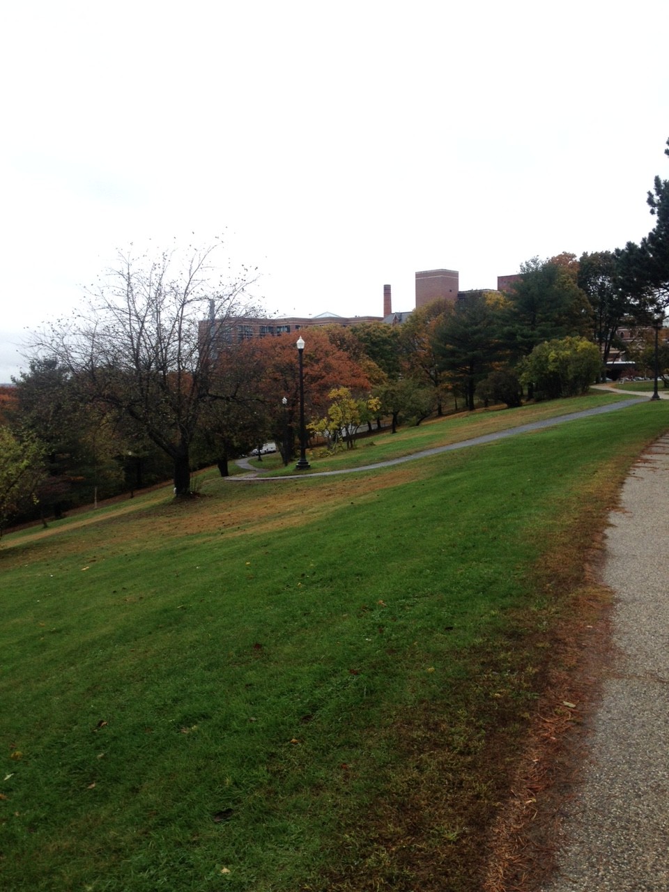
While walking, I passed one park (Fort Sumner Park), which was overgrown and not particularly cared for. It was hidden in a residential area, but had a GREAT view of the city (see picture below)! The bottom half of the park did not have much, but once walking up the staircase, there were four benches overlooking the city. Another noteworthy green space I saw was the East Promenade, which is one large park along the shore of the eastern side of Portland. It did a good job of providing enough seats for visitors, the history of the area (such as at the Fort Allen Rehabilitation Park ), and attractions that appeal to a wide range of people. There was a playground, a baseball field, picnic tables and benches, and spaces to walk along near the shoreline.

Image and video hosting by TinyPic

Fort Sumner Park on Sheridan (Taken by Jenny Ibsen)

Image and video hosting by TinyPic

The View from Fort Sumner Park (Taken by Jenny Ibsen)

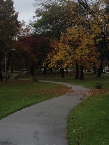
When I walked around on my second visit, I went to Deering Oaks Park, which had an interesting use of space because there was a large central fountain and pond, yet there was no seating around it.

Screen Shot 2014-10-22 at 7.12.01 PM

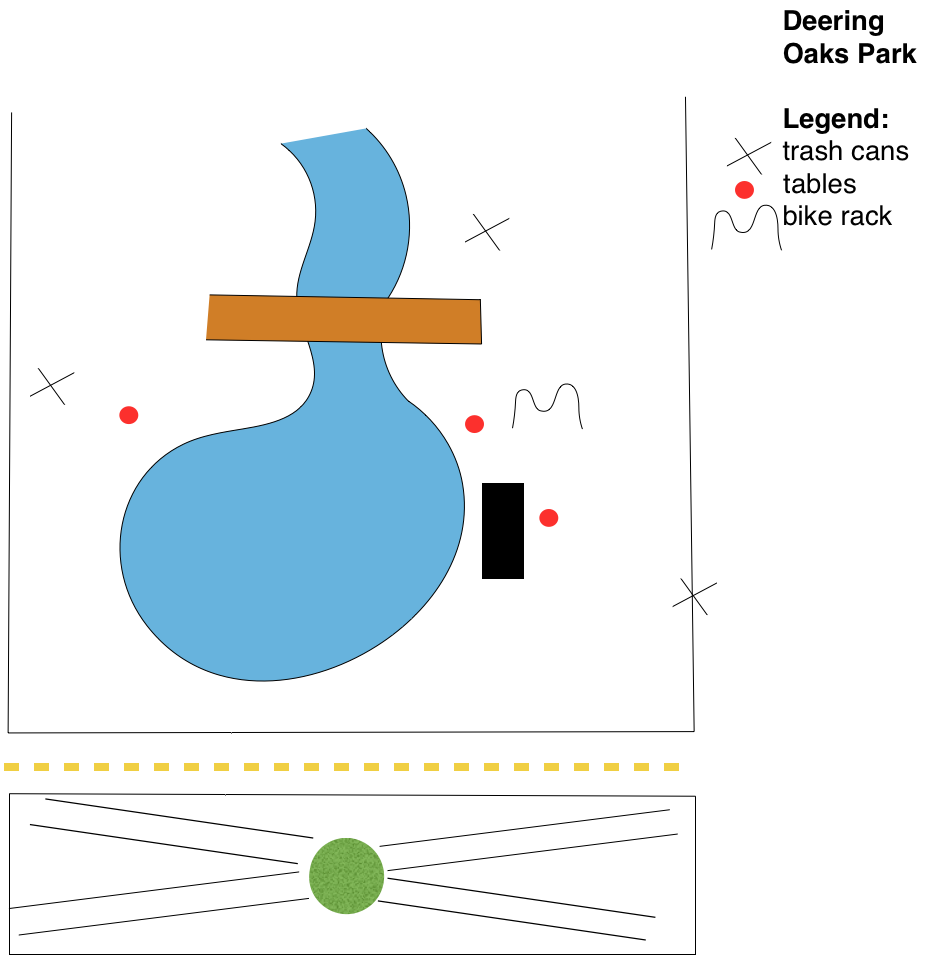
Deering Oaks Park Map (Drawn by Jenny Ibsen) – My extremely rough sketch of the park, including all the trash cans and picnic tables that I saw during my 30 minutes there. The black rectangle is a stage and the green circle is a plot of plants.

The park had several awkwardly spaced benches in an abundance of purposely uncared for grass. There was a sign posted nearby stating, “Sections are purposely left unmowed in order to return to a more natural and healthy woodland.” This was extremely interesting because though naturally maintained gardens are more sustainable, I have never actually seen this in practice. This could be more effective in the park if there were more attractive aspects to the park. There were not enough seating options to attract a large amount of people, and aside from the stage, there were not many other reasons for people to visit the park in general. This, in addition to the uncared for grass, gave the park an overall average feel (though, it did look nicer than other parks in Portland).

Overall, Portland has a few impressive aspects of green technology, but could use some work for the basic framework of the city. There were solar panels a few buildings and there were plans for them on a newly constructed building. I was also surprised by the abundance of Hybrid cars, mopeds, and Partial Zero Emission Vehicles (PZEV). Yet, the city definitely needs to work on its public green spaces and frequency of recycling bins.

Transect Walk
Started: Eastern Promenade                (10/19/14)

  • Lots of plants at houses
  • Garden (corner of E. Promenade and Turner)
  • Hybrid car—236 E. Prom, corner of Quebec and E. Prom, 304 E. Prom, corner of Melbourne and E. Prom
    • I don’t know why I kept track of this—they just seemed really abundant
  • Solar compacting trash – 288 Eastern Promenade

Walked to Walnut, then Willis

  • Hybrid—23 Willis

Montreal St

  • Corner of Willis and Montreal—first graffiti sign
  • Garden: 41 Montreal, 46 Montreal

North St

  • Newly developed houses
  • Multiple family buildings (condos)
  • School located at 129 North St

Walnut, Sheridan

  • Green Clean building (local company?) —179 Sheridan
    • Organic waste container (curb to garden program)
    • Hybrid car
  • Area feels empty
  • Developing? House under construction across the street
    • Solar panels on picture
  • Graffiti and overgrown garden
  • Fort Sumner Park (hidden view of Portland)
  • 107 Sheridan – laundry line in backyard
  • 106 Sheridan – recycling bin outside house
  • 99 Sheridan – Moped

Cumberland

  • 62 Cumberland – solar panels on roof

Sheridan, Congress

  • 159 Congress – garden
  • 127 Congress – partial 0 emission Subaru

St. Lawrence, Monument

  • many front yard gardens
  • 53 Monument – garden

Waterville, Sherbrook, St. Lawrence

  • garden – 70 Waterville
  • recycling bin – 72 St. Lawrence
  • Moped – 61, 52 St. Lawrence

Fore St, Eastern Promenade

  • Many decks on first and second floors of houses
  • Large windows

O’Brien

  • 4 O’Brien – organic waste, kWh usage outside house, recycle bin

Eastern Promenade

  • 64 E. Promenade –recycle bin
  • Fort Allen Rehabilitation Project
    • Bollard lighting (instead of over head street lamps)
    • Solar compacting trash (no recycling)
      • 64, 84 (around corner) E. Promenade
    • empty green space
  • recycling bin—168 E. Promenade
  • roads close to shore, green grass, randomly placed benches facing water
  • few trash cans, but no litter??
  • Solar compacting trash
    • corner of E. Promenade and Congress, Turner and E. Promenade
  • First water fountain!! (corner of E. Promenade and Congress)
  • Playground (few trash bins where expected (around edges of playground area)
  • Many houses have roof windows or natural lighting
    • Corner of Congress and E. Promenade
  • 222 E. Promenade – garden

Other places (drive back to 295)

  • Solar panels — Washington and Cumberland
  • School and Solar panels, community garden (North St)
  • Pick up to 295 – solar powered signs

Deering Oaks Park                  (10/21/14)

  • No seating near fountain/pond
  • Benches along paths and borders
  • Only saw 3 trash cans
  • Some lampposts located near paths
  • Trees near bridges are abundant
  • Grass is naturally kept
  • What is under the bridge?? Looks like it should be the pond but actually dried up… L
  • Stairs leading down to the pond on northern side of bridge
  • Park continues across street…no benches, no trash
  • Outside park: some houses, commercial, industrial area, near highway


**Added November 3, 2014:

Transect Walk

Transect Walk: Above is a map of my transect walk (the red point mark indicates my start and stop location).

Searching for Public Seating in the West End – Emma Chow

I conducted a transect walk through the West End with fellow Public Space group members, Libby and Jackie. We decided to focus on public seating and learn from the William Whyte video to observe the state of usable public seating in Portland’s West End. Our observations indicate a need for more public seating facilities, but perhaps more importantly, better maintenance of current seating facilities. There is great potential for the two parks we visited to be improved; I would recommend the City dedicate their funds to first improving the Western Promenade and Deering Oaks park before setting plans to install any new parks. I also would recommend that public art installations be shaped around seating – either making the art the seat itself or creating art near pre-existing seating to make it more inviting.

Our walk began at Pine St. and State St. and we headed west to the Western Promenade. We could not find any public seating on our way to the Promenade, which was quite surprising to us since we perceived ourselves to be in one of Portland’s most wealthy residential neighborhoods. We spotted a tree stump early in our walk and given the lack of traditional seating (benches, ledges, etc.), we proclaimed that if they had cut the tree a little higher then the stump would be a wonderful seat! We thought about the potential for having a series of stumps that could be carved by local artists and then lacquered for longer wear.

IMG_0977

The tree stump that inspired our “nature” seating idea.

We spent quite some time exploring the Promenade, which had exactly six benches, all of which were very run-down and not aesthetically pleasing. The placement of the benches was rather unusual – they were awkwardly spaced and faced out toward some trees and shrubbery (some of which had been cut down) overlooking the water. A water view sounds appealing, however, the inlet is surrounded by industrial buildings, large storage tanks, and the airport – not exactly what I would like to look at for a long period of time. We struggled to understand why the park designers had placed the benches in such a manner. Would it not be more pleasing to have the benches turned the opposite way facing the lawn? And perhaps fill the lawn with some gardens and more trees? Or level a section of it out and make it a soccer field, play ground, or recreation area? We saw three people while we were at the Promenade, all had dogs. Why not make part of it into a dog park? They could easily install a dog tap for water along with some doggie bags, a physically fenced in area is not necessary. The paths did not make much sense to us either – three different materials were used and the path which housed all the benches was very broken and poses a safety risk to anyone walking or running along it. The lighting fixtures in the park were inconsistent, as well. The area mostly left us feeling confused, wondering who would come here and what they would do.

IMG_1007


The winding paths on the northern end of the park which were very confusing to us. They were very narrow and at a steep incline which would make it difficult for older residents to use.

IMG_0998


A view of the industrial area below.

IMG_0990

One of the three types of paths at the Western Promenade, looking old and grown in. 

IMG_0985

All of the benches looked like this one. Old, moldy, and not very comfortable looking (no arm rests even!). 

We headed North from the Promenade past Maine Medical Center. There was some seating outside the hospital entrance, however, it faced the side of the building rather than the street. The height of the seating was ideal, but it was rusting and old. It also did not appear as though it was very well-cared for.

IMG_1009

The blue rusted seating facing a brick wall.

IMG_1012

Here is our first example of some usable public seating outside the hospital. The ledge is a good height and depth, it is facing the street, and the flower bed can be planted with aesthetically-pleasing arrangements to attract people. 

IMG_1015

Across the street from the hospital is a parking lot with a stone wall that has so much potential for seating, but the railing is stuck right in the middle so seating is not even a possibility. It is such a shame that patients and hospital employees lack opportunities to sit outside for lunch or an afternoon break. 

IMG_1018

A seating area at the corner of Deering St. and Congress Ave. where two of the three benches sit side-by-side with a garbage bin – not exactly the most inviting space for people to want to sit for an extended period of time. The third bench (not pictured) is looking away from the others, isolated all on its own. 

IMG_1021

We made our way north to Deering Oaks park, which was definitely the most encouraging public space we visited, particularly for seating. There was a string of benches bordering one of the winding paths. We did spotted one lone picnic bench; however, it was placed in a random location. We noticed the lighting fixtures were, like the Western Promenade, inconsistent – some were black lanterns while others were grey and ugly. The pond is a great feature, but there are no paths built along it and no seating nearby. How are people supposed to be able to enjoy the fountain and watch the ducks if there is limited access and no facilities to sit? Furthermore, the park needs a physical or psychological barrier to separate it from the traffic driving by. I know I would be much more likely to want to spend time there if the visual and audio effect of the cars did not disrupt the peace of being immersed in nature.

Coordinates:

Low stone pillars: 43o39’02.15″N; 70o16’09.10″W
Promenade bench 1: 43o38’58.52″N; 70o16’34.65″W
bench 2: 43o38’57.33″N; 70o16’34.62″W
bench 3: 43o38’56.53″N; 70o16’34.73″W
bench 5 (think we’re missing one): 43o38’54.50″N; 70o16’34.15″W
bench 6: 43o39’04.52″N; 70o16’34.98″W
Blue hospital benches: 43o39’07.83″N; 70o16’31.52″W
Stone hospital benches: 43o39’08.62″N; 70o16’29.70″W
Hospital bus stop: 43o39’08.95″N; 70o16’30.14″W
Congress St bench 1: 43o39’14.78″N; 70o16’21.44″W
Congress St bench 2: 43o39’14.44″N; 70o16’21.02″W
Congress St bench 3: 43o39’15.00″N; 70o16’21.27″W
Deering Oaks Park bench 1: 43o39’25.03″N; 70o16’20.17″W
DOP 2: 43o39’25.32″N; 70o16’19.84″W
DOP 4: 43o39’26.10″N; 70o16’15.64″W
DOP 5: 43o39’26.22″N; 70o16’14.57″W
DOP 6: 43p39’26.48″N; 70o16’12.78″W
DOP 7: 43o39’26.84″N; 70o16’11.52″W
DOP 8: 43o39’27.22″N; 70o16’10.67″W

Where are the playgrounds?

For my transect walk, I decided to walk around East Bayside/Munjoy Hill and look at the kinds of educational infrastructure in place around the neighborhoods. Before leaving on my walk, I made sure to look on Google Maps and see where there were schools, as I wanted to check areas around schools to see what I could find in terms of playgrounds and playspace for children and what I noticed about where children were playing. These were my findings:

  1. East End Community School (43.670622, -70.253396): The East End Community School has a gated playground area and sports fields. I’m curious to know whether this is for the school only, or whether the public has access at certain times, but I didn’t see any informative signs.
  2. Eastern Prom Location 1 (43.670853, -70.253569): The upper portion of the Eastern Prom has a few tennis courts and a baseball field, but no playspace for younger children.
  3. Eastern Prom Location 2 (43.670853, -70.253569 à close enough to Loc. 1 that coordinates are coming up as the same): The middle portion of the Eastern Prom has a dilapidated playground and a baseball field. The playground does not look like it as been renovated in many, many years.
  4. Emerson School (43.668339, -70.244983): The Emerson School had absolutely no playground infrastructure.
  5. Shailer School (43.667031, -70.250599): The Shailer School had no playground, but an open grassy park area next to the school. In front of the park was a sign about opening and closing times for the park and playground, but I could not see any playground. I drove around the school’s driveway to try and see if there was a hidden playground, but found nothing.

Many locations where I anticipated seeing some kind of school were just residential. It seems like the schools were converted into housing recently. On Google Maps, there were at least 3 schools with addresses that I passed that just did not exist.

I was greatly under-impressed with the amount of playgrounds and easily accessible playspaces for students after school. I saw no students walking outside, though this might have been I took my transect walk on a rainy day. I was not able to get to Portland in time for school dismissal, which I believe is much earlier than our general end of classes, but overall there were almost no public playgrounds that were accessible to kids. Even the playspaces on Eastern Prom are hard for students to access, as to get to the playgrounds, kids need to cross large streets with fast moving cars (and their parents may not let them do this by themselves).

As for the neighborhoods of Munjoy Hill and East Bayside, they are definitely more “gritty” neighborhoods as Sharon Zukin would say in “How Brooklyn Became Cool.”{1} It is hard to tell which areas are impoverished, as all the buildings are built in a similar New England brownstone-equivalent style, but some are less well-kept than others. Because of the weather, there were very few people out on the streets. It was not an uncomfortable experience to walk around, but I felt like it was not what I saw that was impressive in relation to school and playground infrastructure, but what I did not see. There is an incredible lack of playgrounds and open playspace for students in the Munjoy Hill/East Bayside area. The only relatively young people I saw seemed to be about late high school/college age and were smoking in front of a house in East Bayside.

I originally was looking more into transportation in Portland, but decided that I thought infrastructure as it relates to education would be more interesting. I think that from what I saw in Munjoy Hill and East Bayside, Portland definitely needs to improve on its education infrastructure. While I do not know what educational infrastructure exists in other neighborhoods of Portland, I was greatly disappointed by the lack of playgrounds and playspace for students. When I did my café ethnography, I was surrounded in the café by parents and their young children. To see such a vibrant community of young parents and their children was very exciting to me, but educational infrastructure in the city should be improved to support those children’s needs.

{1} Zukin, Sharon. “How Brooklyn Became Cool.” In Naked City: The Death and Life of Authentic Urban Places. Oxford: Oxford University Press, 2010. 35-62.


Blog Post #7 & Comment #3: Transect Walk Data Sharing

Blog Post #7 – October 27th

Place the details from your transect walk into your post with exact notes of addresses or latitude and longitude. At the top of the post, reflect on what this data tells you about your research area, and how this data repeats or diverges what you found in your ethnography and mental maps. Are you swayed to consider different smart city recommendations to improve the quality of life and economic sustainability of Portland? Or have you different ideas in mind?

Comments #3 on Blog Post #7 – November 3rd

Continuing our work to produce knowledge as a group, look at each of Blog Post #7 for your research group. In a paragraph (or two maximum), respond to your colleague’s ideas and describe how this may or may not shift the ideas you have been thinking about. What else should your colleague consider? Draw on evidence from any of the class readings in October to back up your ideas.