
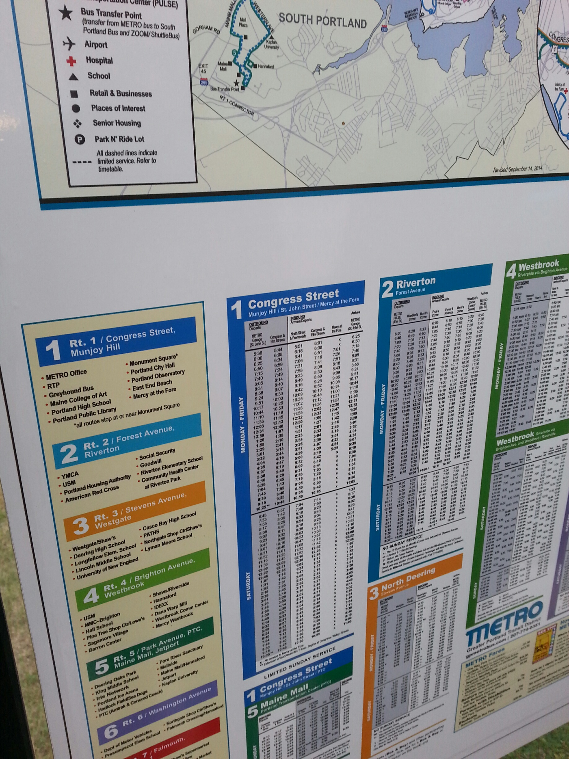
The data that I collected on the transect walk complimented the most beneficial smart city recommendation of a Transportation App that I found from the café ethnography and the 4 mental maps. Throughout the entire walk along the Route #1 Bus Line in Portland, Alex, Karl, and I only saw 2 route #1 busses. This suggests to me that the busses do not stick to schedule particularly well and that there is no simple or quick way to tell whether a bus will show up or not. In addition, the bus stops are just small yellow signs and it was particularly hard to tell where they were sometimes. Furthermore, when looking at the Portland Bus Routes map, there is no information about where the stops actually are, so unless the passenger already knows where the stops are near their desired location, it is kind of a guessing game that makes using public transportation particularly hard for visiting tourists. Oddly enough, Google Maps contains the information about bus route stops but the public maps in Portland do not. That being said, I think that it would be incredibly beneficial for Portland to firstly create more obvious bus stops and provide more information about where they are located. Secondly, I think that Portland should provide more information about the scheduling and wait times for the buses on each route, as they are often unreliable and late. As discussed in some previous posts, this information could all be incorporated into a public transportation application that residents could check on their computers or phones to see as to what the bus schedules are, how long the delays are for, and where the specific stops are.
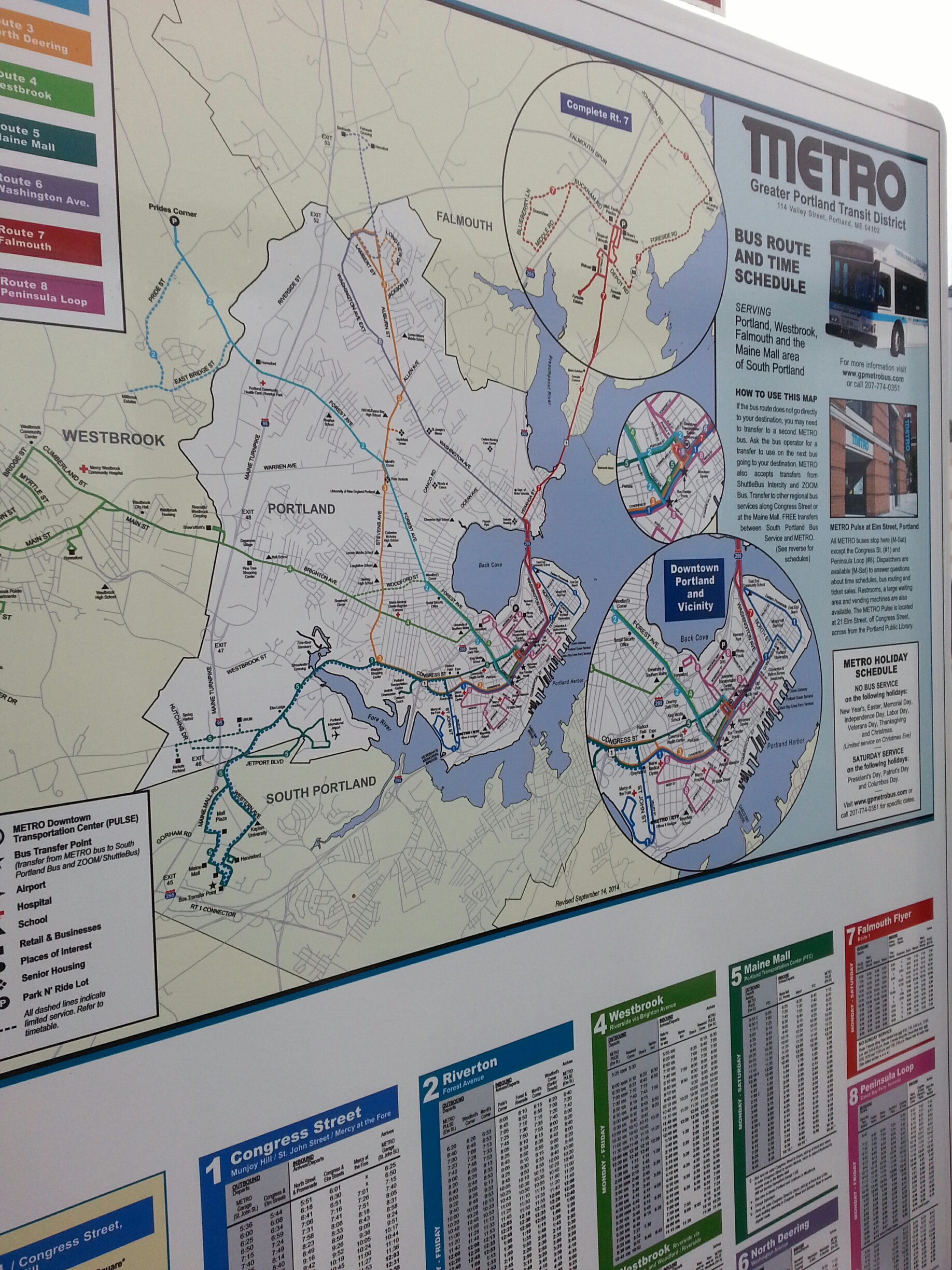
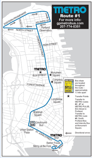
Portland City Metro Map of Bus Route #1
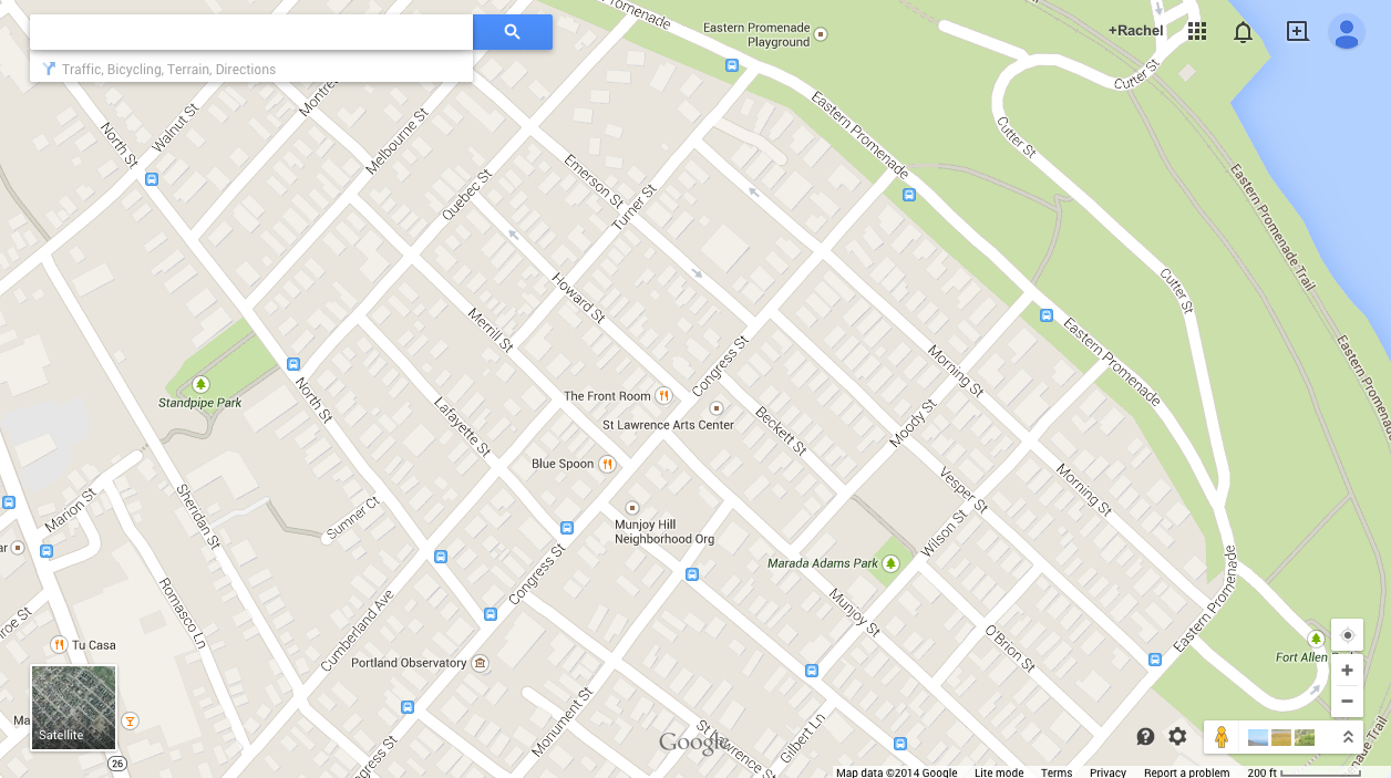
Google Map of Portland City Bus Route #1 – does not show exact route but shows where the stops are (if you hover your mouse over the bus stop symbols then a window pops up describing which Metro Routes stop there)
Transect Walk along public bus Route #1 – took account of the locations of all bus stops and Route #1 busses that we saw
- 206 Congress Street
- Congress & Kellog
- Congress & North
- Congress & Lafayette
- Atlantic and Monument
- 27 on Atlantic Street
- Vesper & Eastern Promenade
- 126 Eastern Promenade
- 182 Eastern Promenade
- Turner & Eastern Promenade
- 304 Eastern Promenade
- East End Community School & North Street
- 143 North Street
- North Street & Quebec Street
- Cumberland & North Street
The issue that you raise in your blogpost is very important. Good public transportation is a necessity for a modern city, because it makes life easier for tourists while reducing the use of private cars, thus contributing to reduced carbon emissions.
I think it is crucial for Portland to start revamping its public transportation system. Portland is a central tourist destination in Maine, and it is very important for tourists to be able to get around comfortably and without confusion. I totally agree with all of your suggestions for creating a more efficient public transportation system in Portland.
It’s clear from what you observed during your transect walk that the bus system in Portland needs to be overhauled. I know we’ve been primarily thinking about “smart” projects to improve Portland, but I think that there are more fundamental issues with the public transportation system that must be addressed before a transportation app is developed. Most striking to me is that the bus stops along your walk were so difficult to recognize and find. Perhaps the first step to improving the public transportation system should be to make bus stops easier to find, perhaps with better signage. You also mention how Portland’s maps contain less information about bus stops that Google Maps does. This suggests to me that Portland’s public maps should also be updated. I feel that this might be an important step to take before developing a transportation schedule app. After all, what use is there in knowing the bus schedule if it is so difficult to find the bus in the first place?
I did my transect walk on the bus stops and lines in Portland as well. I definitely agree with everything you mentioned in your post. The signs were hard to see and the times seemed very unreliable based on my time in Portland. Having apps to see bus stops and wait times would be a great way of incorporating smart city ideas into Portland. I think the biggest issue would be that the people who are more likely to use the bus system would be less likely to have individual smart devices. However, maybe at bigger stops there could be electronic signs that have the times and routes like the signs at metro stations.
Do you think that certain routes were differently profitable? I wonder if the problem with the public transportation is that it is too spread out. Routes go to Falmouth many miles from the city center of Portland. If we could reroute those lines around the denser parts of the city, it is possible to make those lines more reliable and more profitable. If we could boost ridership in one section, it would be easier to expand the route if there are already dedicated riders than trying to improve the expansive and unreliable system that exists already. This would also help to reduce the amount of confusing signage.
Its quite curious that you chose to follow the bus stop routes as the basis of your transect walk. Taking the bus is very much an urban activity, and defines transportation for many cities. Portland is not one of those cities. People who live in Maine, in general, are automatically geared toward their personal vehicles that public transportation is so rarely considered a realistic commuting option. I would be interested what your experience of the route would have been if you took the bus instead. The scenery moves faster, and the stops are dictated by where people specifically get on and off; thus you would see the street from a different pace and viewpoint.